


North and Central Texas
Friday and Friday night
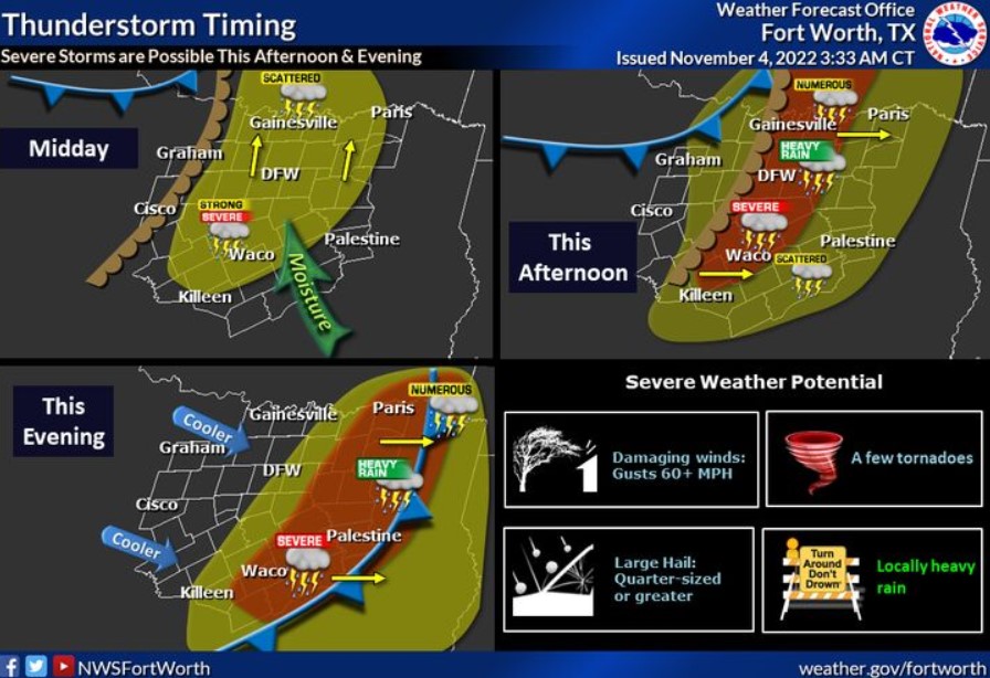
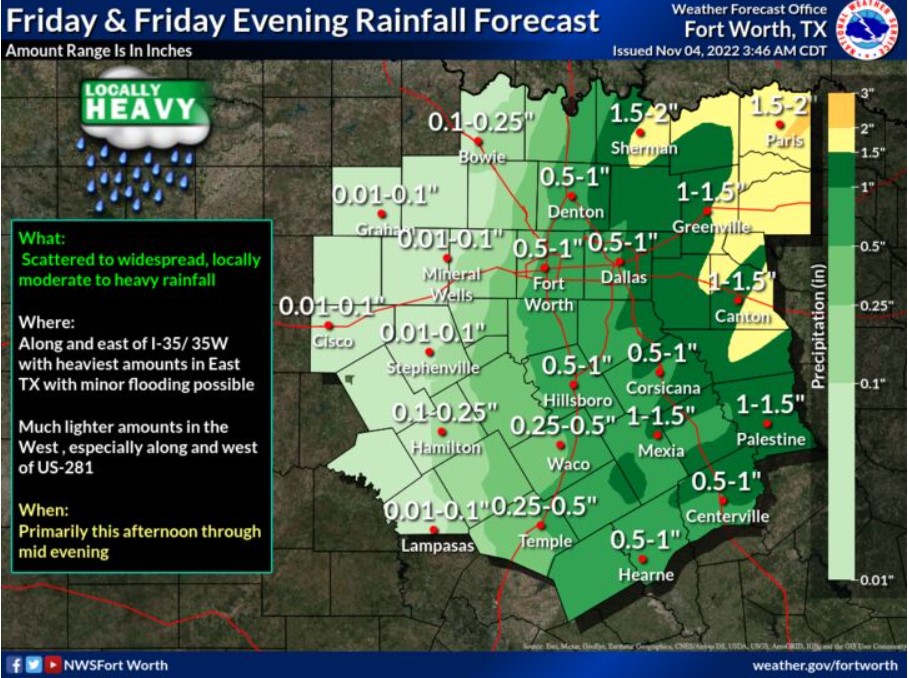
Scattered to widespread thunderstorms are expected across much of the region this afternoon and evening. Some storms may become severe, with large hail, damaging winds, and a few tornadoes. The best chances for thunderstorms and the highest severe weather threat will be along and east of the Interstate 35 corridor. Heavy rain may also occur at times and could cause localized flooding issues.
Saturday through Thursday
There is a slight chance of storms on Monday and Thursday, but severe weather appears unlikely.
SPOTTER INFORMATION STATEMENT
Spotter activation is likely this afternoon, primarily for locations
along and east of the Interstate 35 corridor.
Northeast Texas
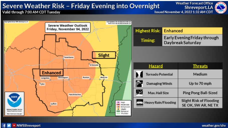
There will be a significant risk for the Four State Area to see severe thunderstorms beginning late Friday afternoon and continuing into the early overnight hours. The main threats will be damaging winds, large hail, and some tornadoes. Also, heavy rainfall will be possible.
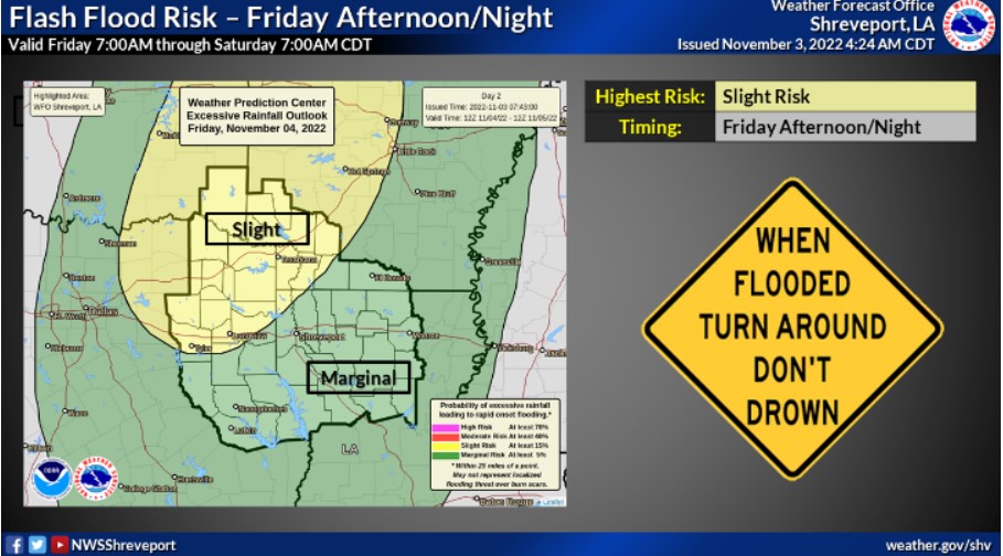
Overall, many locations will see this upper-level storm event bring anywhere from an inch to as much as more than three inches of needed rainfall. A Slight Risk for Flash Flooding extends across the I-30 corridor, where Thunderstorms may train before forming into a faster-moving squall line during the late evening & overnight hours. Turn around, don’t drown.