


North and Central Texas
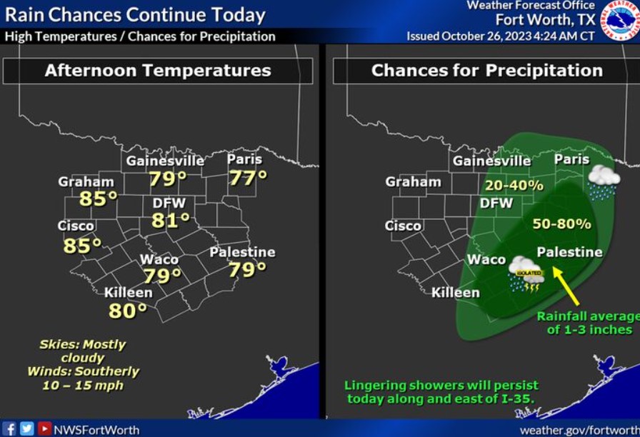
The bulk of the rain will be shifting into East Texas today. However, lingering showers as far west as the I-35 corridor will be possible. Average rainfall amounts will amount to about 1-3 inches. Expect afternoon high temperatures to climb into the upper 70s to mid 80s.
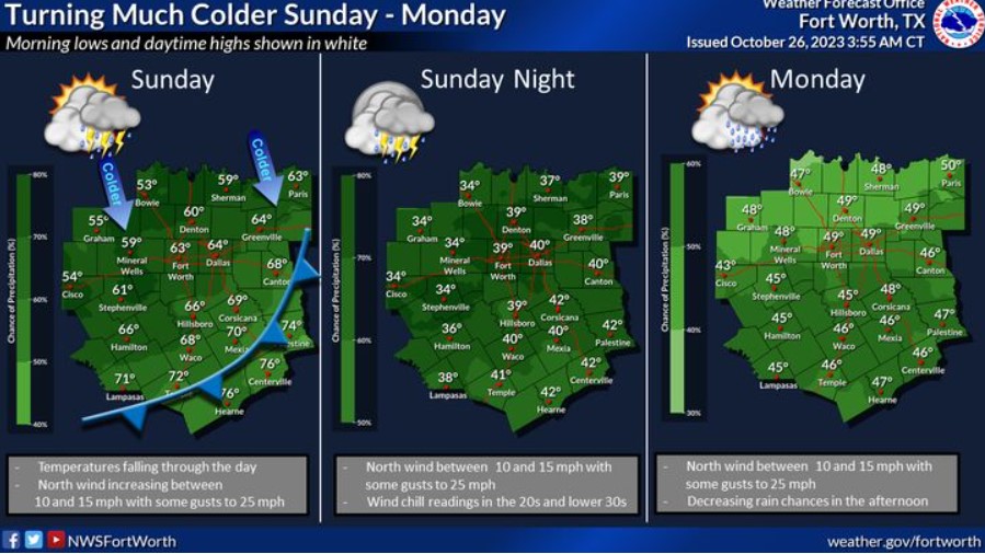
A strong cold front will move through early Sunday, with falling temperatures occurring during the day. Temperatures will be in the 30s and 40s for lows Sunday night, with highs struggling to reach 50 on Monday. Adding to the chill will be a chance of rain, a few storms behind the front on Sunday and Monday, and breezy north winds.
Today and Tonight
Scattered to numerous showers and thunderstorms are possible today, with the best chances east of the I-35 corridor. Heavy rainfall may result in localized flooding. A few intense storms are also possible with gusty winds.
In addition, some lingering flooding issues are likely along and west of the I-35 corridor due to heavy rainfall Wednesday night and this morning. Rivers, creeks, and some roads may remain flooded until later today.
Friday through Wednesday
Isolated to scattered showers and thunderstorms are possible across the region Friday through Monday. Additional rainfall over already saturated ground could result in some localized flooding issues. The severe weather threat is low, but a few intense storms with small hail and gusty winds are possible.
SPOTTER INFORMATION STATEMENT
Do not expect spotter activation at this time.
South Central and Southwest Arkansas, North Central and Northwest Louisiana, Southeast Oklahoma, and East and Northeast Texas
Rain chances will begin to increase tonight across Southeast Oklahoma and the western sections of East Texas ahead of an approaching upper-level disturbance.