


North and Central Texas
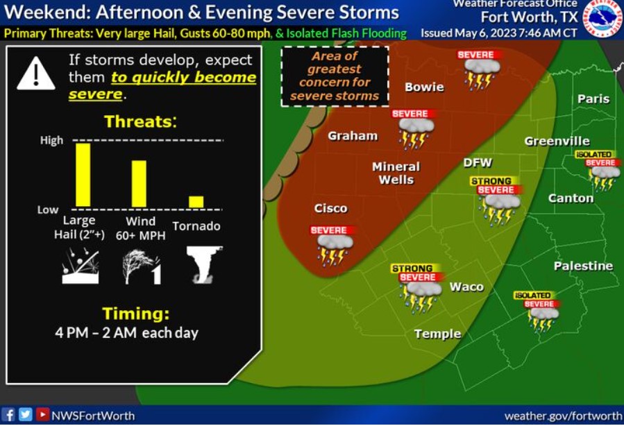
Warm, breezy, and humid conditions continue this weekend with scattered, late-day strong to severe storms containing locally heavy rainfall expected from mid-afternoon through the evening hours each day. Thunderstorms may start isolated and discrete with colossal hail, damaging winds, and possibly a brief tornado. Storms will then evolve into storm clusters or a storm complex after nightfall and during the evening hours. Large hail, damage to destructive winds, and isolated instances of flooding or flash flooding would become the primary hazards. The primary window for strong to severe storms will be between 3:00 pm and 11:00 pm each day.
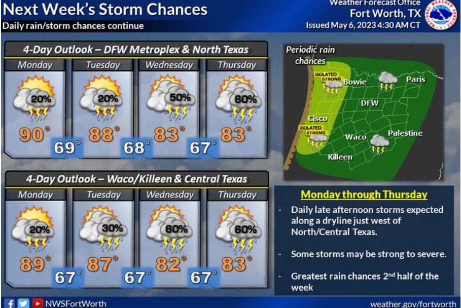
The unsettled weather pattern will continue with daily storm chances across North and Central Texas next week. Rain chances will increase in the latter half of the week as another storm system approaches North and Central Texas.
Today and Tonight
Severe storms will be possible this afternoon and evening, mainly along and west of the I-35 corridor. The main threats will be large hail over 2″ and damaging wind gusts between 60 and 80 mph. Isolated flash flooding may occur if training storms develop. You can not rule out a tornado or two.
Sunday through Friday
The severe weather threat continues on Sunday. The unsettled weather pattern will lead to additional strong to severe storms each day, mainly in the afternoon and evening. You could see large to colossal hail, damaging winds, and a tornado. The flash flooding threat will increase in the latter half of next week.
SPOTTER INFORMATION STATEMENT
Expect limited spotter activation this afternoon, mainly along
and west of I-35.
South Central and Southwest Arkansas, North Central and Northwest Louisiana, Southeast Oklahoma, and East and Northeast Texas
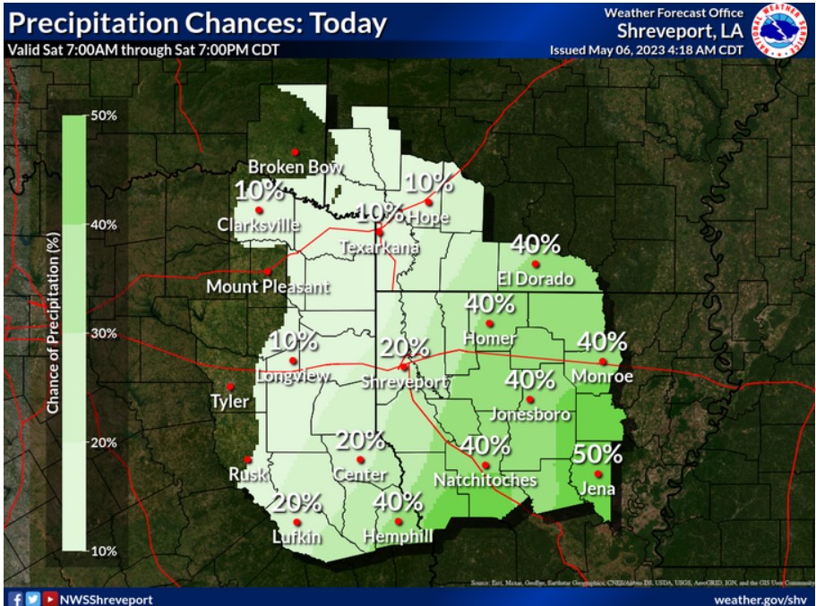
Rain chances will return to the area today. The best opportunities will be across most of our Louisiana Parishes and portions of South-Central Arkansas.
Today and tonight
Isolated to widely scattered thunderstorms will be possible throughout the region today through tonight. A few storms may be intense to marginally severe, mainly along and north of the I-30 corridor, with damaging winds and large hail as the primary threats.
Sunday through Friday
The overall threat of severe weather remains low. Periods of scattered thunderstorms will continue through late this weekend and into next week. Still, you can not rule out the potential for some isolated severe thunderstorms and locally heavy rainfall during this period. Damaging winds and large hail will be the primary threats to severe storms.
SPOTTER INFORMATION STATEMENT
Spotter activation may be needed through tonight, mainly along and
North of the I-30 corridor.