


North and Central Texas
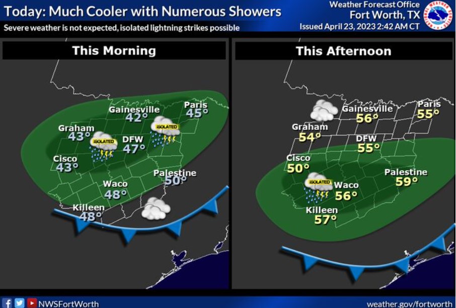
Expect widespread rain with embedded storms and much cooler temperatures today without severe weather, and the main concern will be intermittent lightning strikes. Otherwise, morning temperature will range in the 40s and 50s, and afternoon temperatures in the 50s.
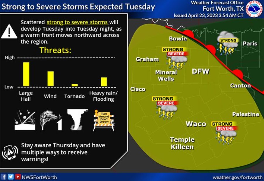
A solid upper-level impulse will approach from the northwest, helping to draw a warm surface front northward. Though the day will start very cool in the 50s and showery, afternoon temperatures will warm into the 60s and 70s in the wake of the warm front, as lift increases later in the day into Tuesday night with gusty southeast winds 15-20 mph. Instability will be on the increase with the increasing threat of large hail. Localized damaging winds may also pose a danger late for areas mainly south of the I-20/30 corridors. Continue to monitor future revised forecasts regarding the possible severe weather on Tuesday.
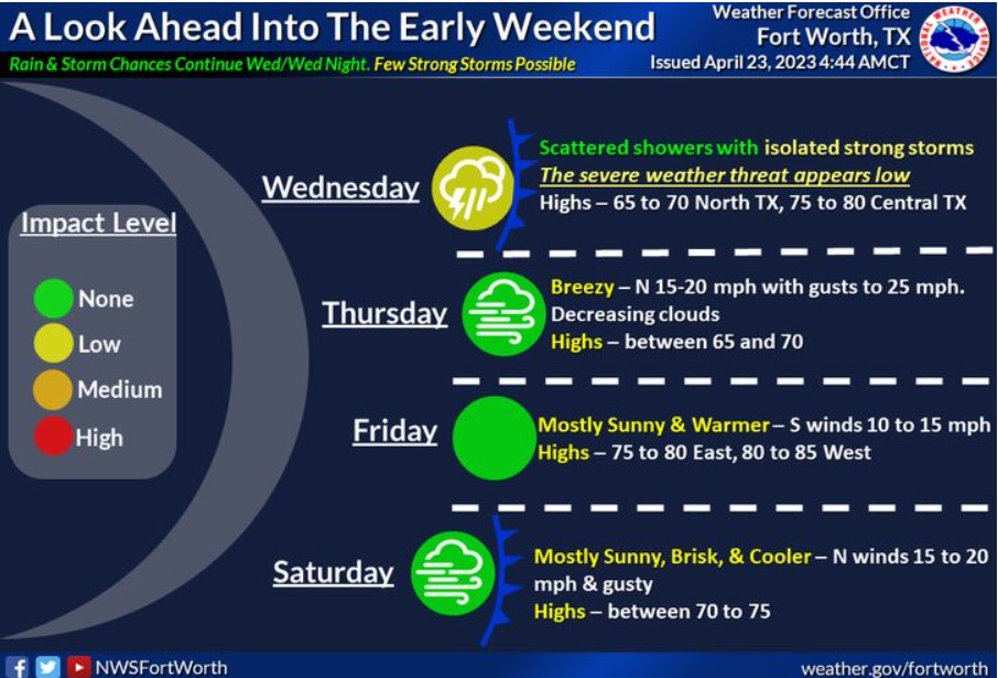
Showers with scattered thunderstorms will continue Wednesday and Wednesday night as the primary upper disturbance passes east across the region. A few intense storms may occur before the next cold front arrives late Wednesday and Wednesday evening. Rain ends from west to east on Thursday with brisk and cooler temperatures. South winds and warmer temperatures return Friday before another cold front Friday night/early Saturday cools things off again. Primarily dry weather is expected Thursday through Saturday.
Today and Tonight
Isolated thunderstorms are possible, mainly southwest of a Breckenridge, Hillsboro, to Fairfield line through early this evening. Occasional lighting strikes are the primary hazard.
Monday through Saturday
Isolated to scattered thunderstorms are expected region-wide Monday night through Wednesday before ending from west to east by early Thursday. Strong thunderstorms containing small hail will be possible, with more powerful storms throughout this period.
However, there will be a window for a few severe storms containing primarily large hail beginning late Monday night and continuing through Tuesday night, as a strong disturbance aloft approaches from the northwest. Isolated instances of damaging winds could occur as well, primarily west of I-35, but confidence remains low at this time.
SPOTTER INFORMATION STATEMENT
Do not expect spotter activation at this time.
South Central and Southwest Arkansas, North Central and Northwest Louisiana, Southeast Oklahoma, and East and Northeast Texas
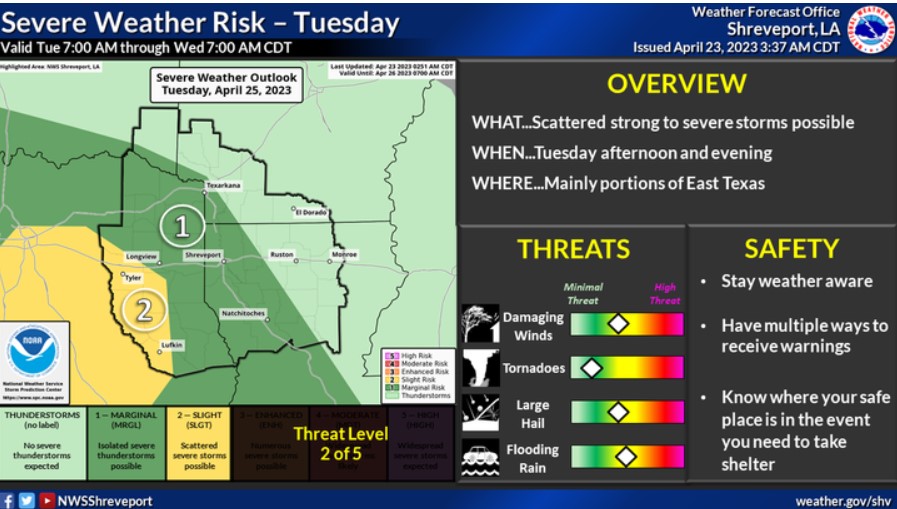
There is a risk for severe weather on Tuesday across portions of Southeast Oklahoma, Southwest Arkansas, Western Louisiana, and East Texas. Damaging winds and large hail will be the primary threats. In addition, locally heavy rainfall could result in isolated flash flooding.
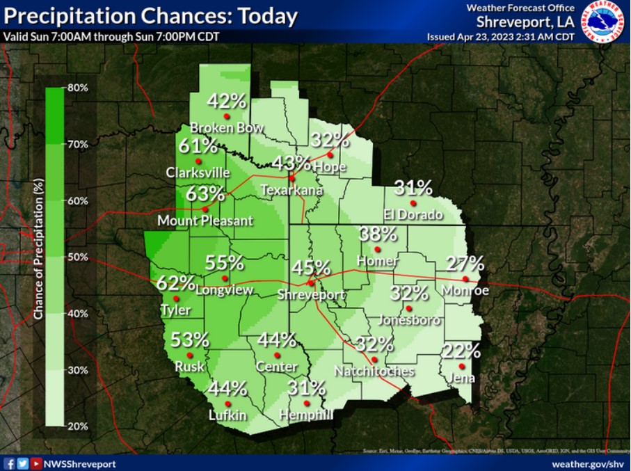
Rain chances will expand eastward across the area today as an upper-level disturbance passes overhead. The highest rain chances should be across much of East Texas.
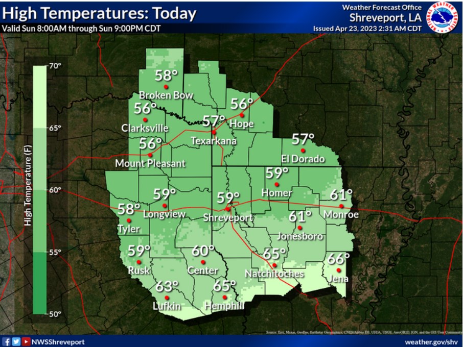
With rain and cloud cover across the area, expect below-normal temperatures, with highs ranging from the upper 50s to mid-60s.