


North and Central Texas
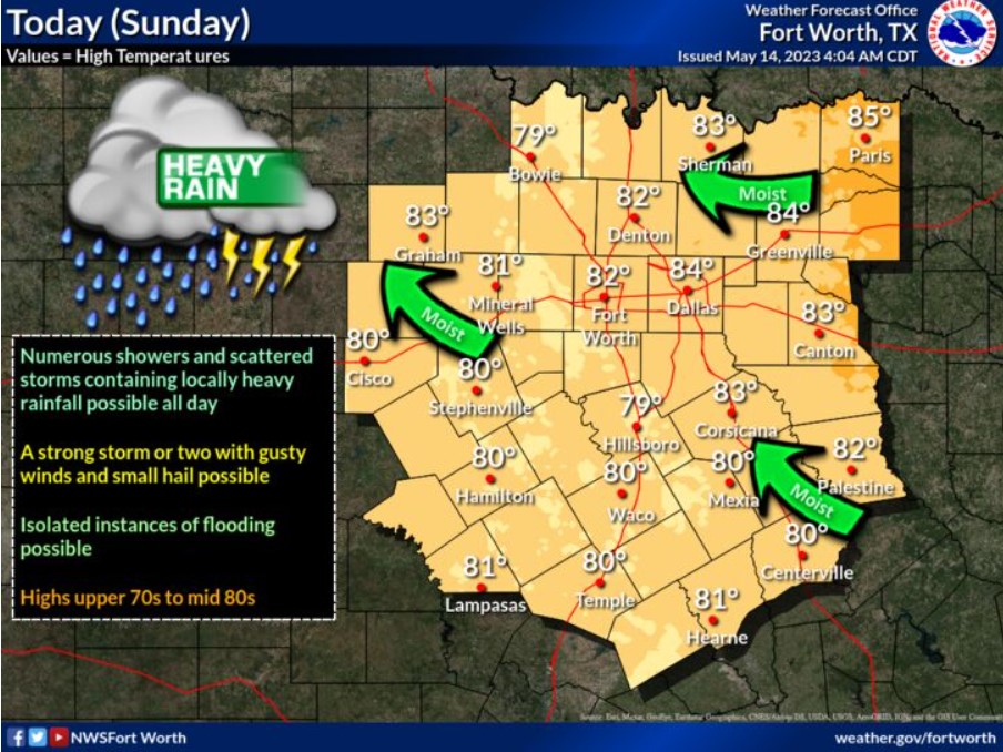
Considerable cloudiness is expected today, along with warm and humid conditions. Periodic showers with embedded, scattered storms are possible this morning, mostly west of I-35/35E this afternoon. Brief torrential rainfall may cause some flooding problems. A few intense storms could produce gusty winds and small hail as well. Highs will range from the upper 70s to mid-80s this afternoon with southerly winds ten mph or less.
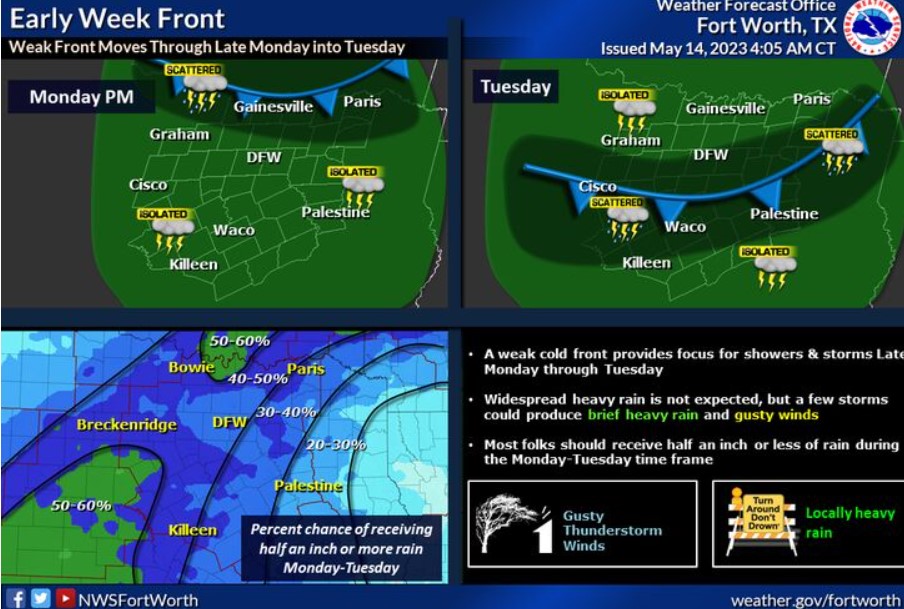
A weak cold front will bring a chance of showers and storms as it pushes through the area during the Monday-Tuesday time frame. Expect widespread heavy rain, brief heavy rain, and gusty winds in a few storms.
Today and Tonight
There is a chance of thunderstorms through tonight across much of the region. Severe weather is unlikely, but locally heavy rain may occur.
Monday through Saturday
Expect occasional chances for storms through much of the week. The severe weather threat is low, but intense storms with small hail, gusty winds, and heavy rain are possible.
SPOTTER INFORMATION STATEMENT
Do not expect spotter activation at this time.
South Central and Southwest Arkansas, North Central and Northwest Louisiana, Southeast Oklahoma, and East and Northeast Texas
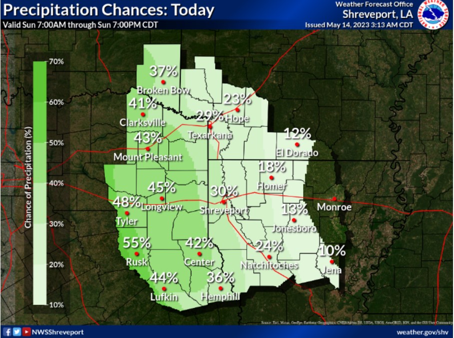
Isolated to scattered showers and thunderstorms will begin across the westernmost zones of east Texas this morning, with more storms developing and spreading east during the afternoon and early evening.
Today and tonight
Expect scattered showers and thunderstorms to increase this afternoon over East Texas and spread north northeast into portions of Northwest Louisiana, Southwest Arkansas, and Southeast Oklahoma. Isolated strong to severe storms can not be ruled out, with damaging winds and hail possible, before the storms diminish by mid to late evening.
Monday through Saturday
Isolated to scattered showers and thunderstorms will be possible Monday through Saturday, becoming most enhanced Tuesday and Wednesday, with a slow-moving weak cold front through the region. Isolated intense storms can not be ruled out each afternoon and evening, with locally gusty winds, hail, and brief heavy rainfall possible.
SPOTTER INFORMATION STATEMENT
Spotter activation may be needed this afternoon and evening for any
storms.