


North and Central Texas
Today and Tonight
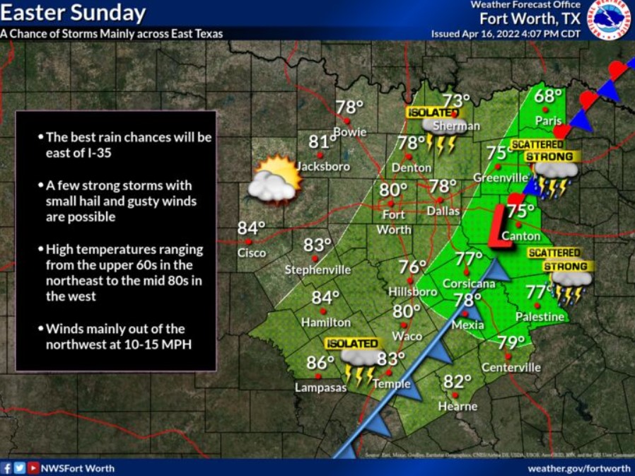
There is a chance of showers and storms on Easter Sunday, mainly across the eastern third of the forecast area. A storm or two may become strong with small hail and gusty winds, and an isolated severe storm is not totally out of the question. However, if rain occurs, it probably won’t last very long, and most of the day should turn out pretty nice. Isolated to scattered thunderstorms are possible with the best chances east of I-35. There is some uncertainty regarding the strength of the cap aloft from the Interstate 35 corridor and locations further west.
Any thunderstorms that develop will potentially become strong or even marginally severe, with hail up to quarter size being the primary threat.
Monday through Saturday
Thunderstorm chances will return next week, Tuesday through Thursday, and then again Friday night through Saturday. However, the severe weather threat is low at this time.
SPOTTER INFORMATION STATEMENT
Do not expect spotter activation at this time.
South Central and Southwest Arkansas, North Central and Northwest Louisiana, Southeast Oklahoma, and East and Northeast Texas
Sunday through Friday
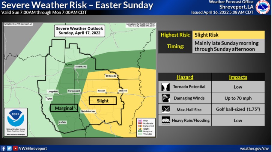
Scattered to numerous showers and thunderstorms should develop and move into the region during the day Sunday across the main portions of South Central Arkansas and all of Northern Louisiana. Any severe thunderstorms across the region on Sunday will pose mainly large hail and damaging thunderstorm wind gust threats. An an isolated tornado cannot be ruled out on Sunday as well.
After a break early this week, thunderstorms return to the forecast Wednesday into Thursday. A few of the storms may become strong to severe.
SPOTTER INFORMATION STATEMENT
Activation of emergency management personnel, amateur radio operators, and storm spotters may be needed this evening. Please relay any information about observed severe weather to the NWS.