


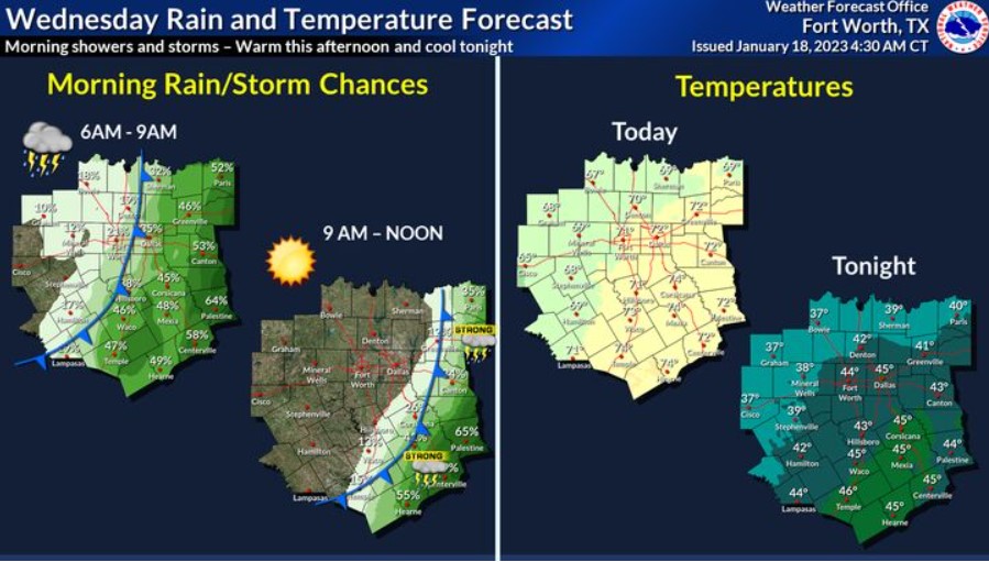
A cold front will move through this morning, bringing scattered showers and some storms with the best chances east of I-35. Intense storms containing small hail and gusty winds may develop, but the NWS does not expect severe weather. Highs will climb into the upper 60s to middle 70s with breezy winds behind the front. Lows tonight will fall into the 30s across the north and west, with 40s elsewhere.
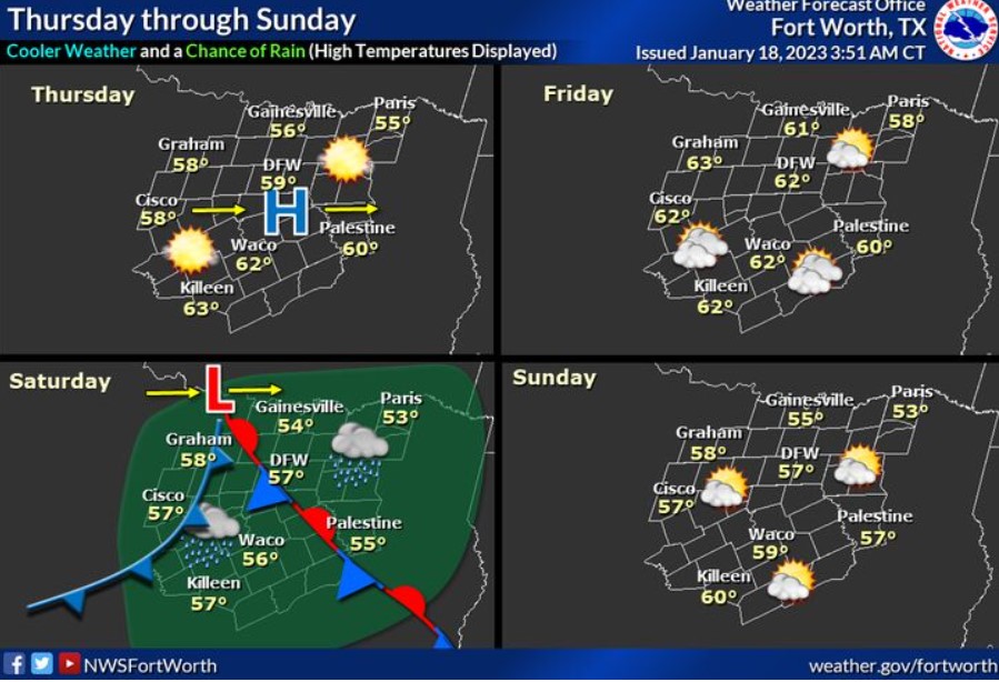
Cooler, more seasonable temperatures are expected Thursday through the weekend, with afternoon highs in the 50s and 60s. Conditions will be particularly cool and damp on Saturday as an upper low and a frontal system moves through the region. As a result, rainfall totals should remain light or less than a quarter of an inch.
North and North Central Texas
Today and Tonight
Critical fire weather conditions will develop this afternoon, mainly for areas west of the I-35 corridor. Avoid activities that may lead
to the development of wildfires.
Before the critical fire threat, there will be a threat of storms along and east of I-35. A thunderstorm or two may be strong, but that threat is low overall.
Thursday through Tuesday
Expect no hazardous weather at this time.
SPOTTER INFORMATION STATEMENT
The NWS does not expect spotter activation.

Storms will be in two waves. First, they start as isolated early in the morning before becoming a line of thunderstorms in the afternoon and evening. Above is the breakdown of the timing of both waves.
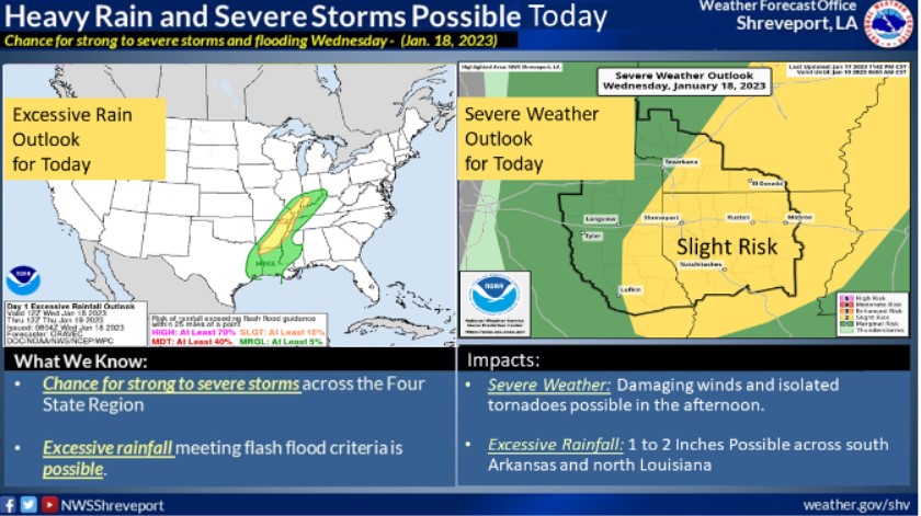
The NWS is monitoring the chance for strong to severe storms across the Four State Region on Wednesday. Heavy rain and thunderstorms, some powerful, may be possible.