


This Hazardous Weather Outlook is for North and Central Texas.
Today and Tonight.
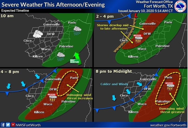
Severe thunderstorms will be capable of producing large hail, damaging wind and tornadoes this afternoon into the late evening. Anywhere from Gainesville to Mineral Wells to Comanche and eastward into East Texas will have the potential of hazardous weather conditions. It includes the DFW Metroplex, I-35 corridor, and Waco/Temple/Killeen areas.
Flash flooding will also be possible mainly from the Metroplex northeast into the Paris/Bonham areas.
Snow will be possible from I-20 north Saturday morning with some light accumulations mainly north of US-380. It should not produce any significant travel hazards given any snow that does fall will likely melt on contact or blow off the roads given the windy conditions.
Saturday through Thursday.
There is a low chance for thunderstorms mainly along and east of I-35 Wednesday into early Thursday. Lightning would be the main threat.
.SPOTTER INFORMATION STATEMENT…
Spotter activation is likely this afternoon and evening across North and Central Texas.
