


North and Central Texas
Today and Tonight
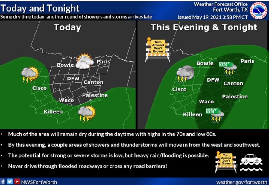
Isolated thunderstorms are expected today across North and Central
Texas but are expected to increase in coverage tonight, mainly along and east of I-35. Flash flooding will remain a threat through this time.
Thursday through Tuesday
Thunderstorm chances will continue through the weekend. Additional rounds of heavy rainfall may cause further flooding issues and significant rises on area rivers through Saturday. Additionally, a few severe thunderstorms may be possible.
SPOTTER INFORMATION STATEMENT
NWS does not expect spotter activation.
Southwest Arkansas, North Central and Northwest Louisiana, Southeast Oklahoma, East and Northeast Texas
Today and Tonight
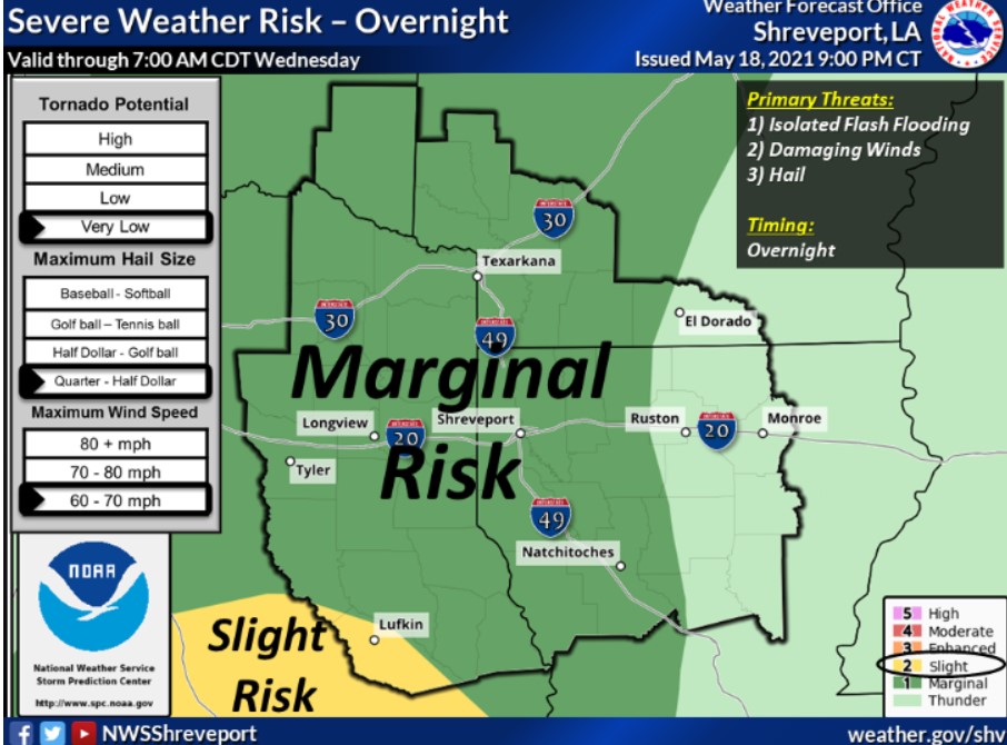
Showers and a few thunderstorms will persist this morning across portions of Southeast Oklahoma, East Texas, and North Louisiana before gradually diminishing. Additional shower and thunderstorm redevelopment are possible this afternoon and tonight across the region, with the potential for isolated intense storms containing locally gusty winds and brief heavy rainfall. Given the saturated grounds, you can not rule out localized flooding. Thus, a Flash Flood Watch remains in effect through Thursday morning for all of East Texas, McCurtain County, Oklahoma, much of Southwest Arkansas, and North Louisiana.
Thursday through Tuesday
Periods of showers and thunderstorms will continue across the region Thursday and Friday, with the threat for locally heavy rainfall and flash flooding persisting. Additional rainfall amounts of one to two inches, with isolated higher amounts over three inches, will be possible through Friday across the area. Isolated strong thunderstorms will be possible through Friday as well, with locally gusty winds the primary threat. Expect showers and thunderstorms to become more isolated to widely scattered Saturday over East Texas and Southeast Oklahoma before dry conditions finally return to the region Sunday through early next week as an upper-level ridge of high pressure builds west into the area.
SPOTTER INFORMATION STATEMENT
The NWS could activate emergency management personnel, amateur radio operators, and storm spotters may be needed this afternoon and tonight for isolated strong thunderstorms and potential flood reports.