


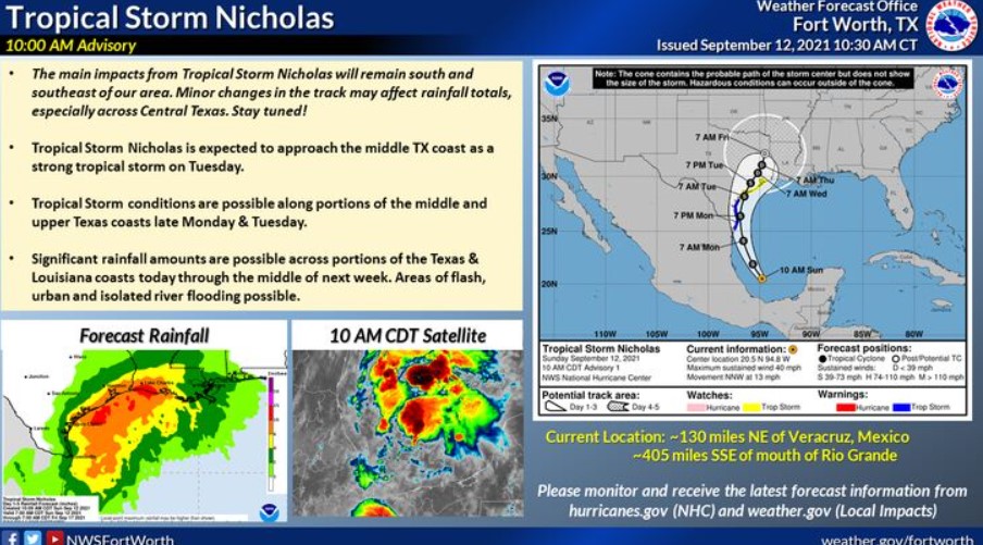
Tropical Storm Nicholas has developed in the Gulf of Mexico, about 130 miles NE of Veracruz, MX. This tropical storm will continue moving N/NW in the next 24-48 hours before landfall in the middle TX coast. Significant rainfall along the Gulf coast will lead to flash, urban and isolated river flooding. However, the NWS expects no significant impacts across North or Central TX at this time.
Hazardous Weather Outlook
This Hazardous Weather Outlook is for portions of South-Central and Southwest Arkansas, North-Central, Northwest Louisiana, Southeast Oklahoma, East, and Northeast Texas.
The NWS expects no hazardous weather through Sunday night.
Monday through Saturday
By Tuesday, a tropical system in the Gulf of Mexico may bring widespread heavy rain to the Four-States region. Depending on the storm track and intensity, flooding and flash flooding may be possible until next weekend.
SPOTTER INFORMATION STATEMENT
There is no need for the activation of emergency management personnel, amateur radio operators, and storm spotters through Sunday night.