


North and Central Texas.
Today and Tonight
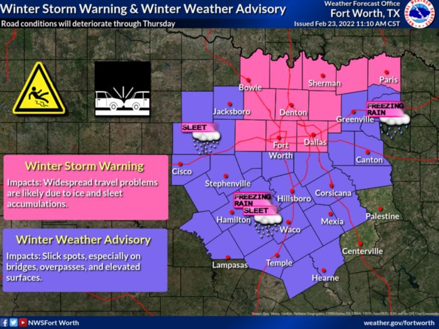
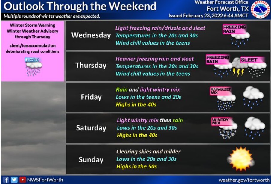
Sleet thunderstorms and freezing rain will impact areas north of the I-20 corridor this morning. Expect initial accumulation confined to bridges and overpasses, but some icing of the main road surface may also occur. A wintry mix of lighter precipitation will be possible elsewhere, with some ice accumulation on elevated surfaces. By late afternoon, the potential for frozen precipitation will reach areas as far southeast as Temple, Killeen, Mexia, and Athens. In addition to the wintry precipitation, wind chill values will occasionally dip into the single digits and teens.
Heavier freezing rain and sleet are expected tonight, with more significant impacts to travel. Thunderstorms will accompany the activity. The most important concern will be from the Dallas/Fort Worth Metroplex northward to the Red River.
Thursday through Tuesday
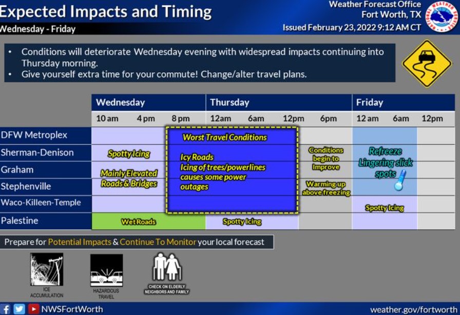
Road conditions will continue to deteriorate Thursday morning, with additional freezing rain and sleet, primarily along and northwest of a line from Temple, Killeen, Terrell to Paris. Thunderstorms will be possible regionwide on Thursday with wind chills dropping into the single digits and teens.
On Friday, additional freezing rain and sleet will be possible, with one final round of wintry weather Saturday morning. However, don’t expect these subsequent rounds to result in significant accumulation.
SPOTTER INFORMATION STATEMENT
The NWS does not expect the activation of spotters.
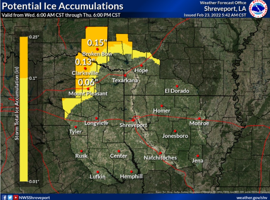
South Central and Southwest Arkansas, North Central and Northwest Louisiana, Southeast Oklahoma, and East and Northeast Texas
Today and Tonight
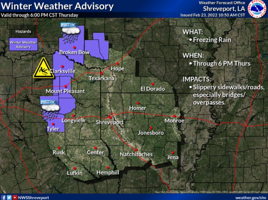
Scattered showers are possible today and tonight across much of East Texas, North Louisiana, and Southwest Arkansas. These showers will increase this afternoon and tonight across portions of Northeast Texas, Southwest Arkansas, but don’t expect any hazardous weather.
Thursday through Tuesday
Scattered to numerous showers and a few isolated thunderstorms are expected Thursday across portions of Northeast Texas and Southwest Arkansas, which will gradually spread into North Louisiana Thursday night. This rain should end before temperatures fall to or below freezing, and thus, no wintry mix or impacts. Expect areas of precipitation to increase across the region during the day Saturday before gradually diminishing Saturday night. The forecast does not call for any hazardous weather.
SPOTTER INFORMATION STATEMENT
The NWS will not need to activate emergency management personnel, amateur radio operators and storm spotters through tonight.