


North and Central Texas

Expect numerous showers and thunderstorms to develop this morning through this afternoon, primarily along/east of the I-35 corridor. There is a low chance for a few more muscular storm cells capable of producing hail up to 1″ in diameter. The potential for isolated tornadoes and damaging wind gusts will be confined to the Brazos Valley late this morning through this afternoon. Stay weather-aware today!

Expect mostly sunny and slightly cooler weather on Friday, with highs from the upper 50s in the north to the mid-60s in the south. Lows Friday night will be in the 40s under a partly cloudy sky. A northwest wind between 5 and 10 mph will prevail during the day, with winds becoming east to southeast during the night at speeds around five mph.
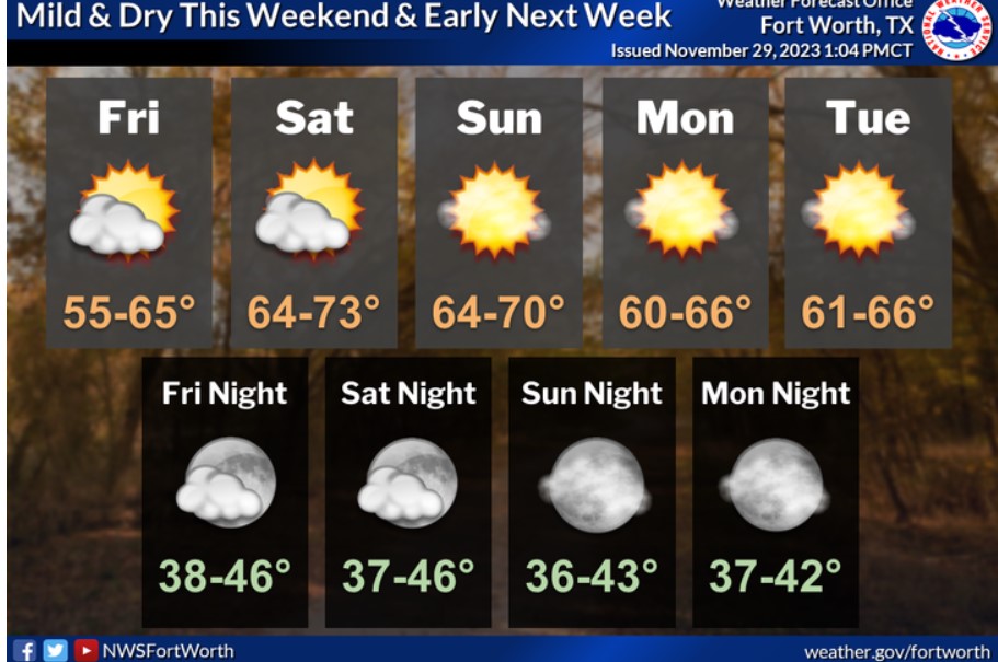
The weekend through early next week will be dry and seasonably cool, with highs mainly in the 60s and lows from the upper 30s to the mid-40s. A few locations will warm into the lower 70s on Saturday and Sunday.
Today and Tonight
Thunderstorms are possible today across all of North and Central Texas. Some storms may contain marginally severe hail. There is also a low chance for damaging winds and isolated tornadoes across eastern Central Texas and Brazos Valley, mainly this afternoon. Storms will exit the region this evening.
Friday through Wednesday
Do not expect any hazardous weather at this time.
SPOTTER INFORMATION STATEMENT
Do not expect spotter activation at this time.
South Central and Southwest Arkansas, North Central and Northwest Louisiana, Southeast Oklahoma, and East and Northeast Texas

The risk of a few severe storms will return to southern parts of the region today as a solid upper-level disturbance advances eastward across Texas. Expect any severe storms in lower East Texas, across Toledo Bend country, and into the adjacent areas of Northwest/Central Louisiana. However, a northward shift with the warm front is possible.

Showers and storms will begin to return to portions of deep east Texas after midnight, becoming more widespread as daybreak approaches.

Under stiff south winds, highs today will climb back into the 60s almost area-wide.
Today and tonight
Showers and thunderstorms will return to the region today and continue through tonight. There may also be periods of moderate to heavy rainfall during this period, but widespread flooding does not appear likely at this time. In addition, a marginal severe weather risk is in place, with hail being the primary threat.
Friday through Wednesday
Rain may continue across portions of Deep East Texas and Central and Northeast Louisiana through early Saturday morning. However, dry conditions will likely return by Sunday and continue through the first half of next week.
SPOTTER INFORMATION STATEMENT
Spotter activation may be needed.