


North and Central Texas
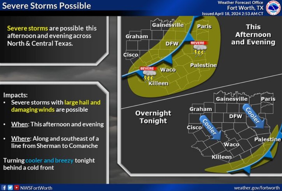
A cold front will arrive this afternoon, bringing thunderstorm chances back to the region late afternoon through this evening. A few severe storms with large hail and damaging winds are possible. Cooler air will enter tonight behind the cold front.
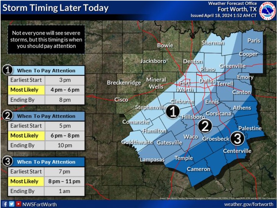
The graphic depicts the latest thinking regarding the timing of thunderstorms associated with a cold front this afternoon and evening. Some storms may become severe, with large hail and damaging winds. Remember to check back for updated forecast information throughout the day, and have multiple ways of receiving severe weather warnings.
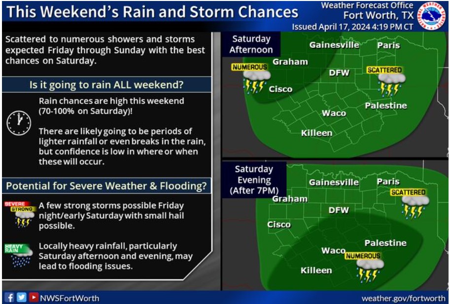
Moisture lifting over a cold front will produce scattered to numerous showers and thunderstorms Friday through Sunday, with the best storm chances on Saturday. There will likely be periods of light rain or breaks in the rain, but confidence is low in where or when these will occur. Do not expect severe storms, but a few intense storms are possible late Friday night into early Saturday. Additionally, locally heavy rainfall may lead to flooding, mainly on Saturday afternoon and evening.
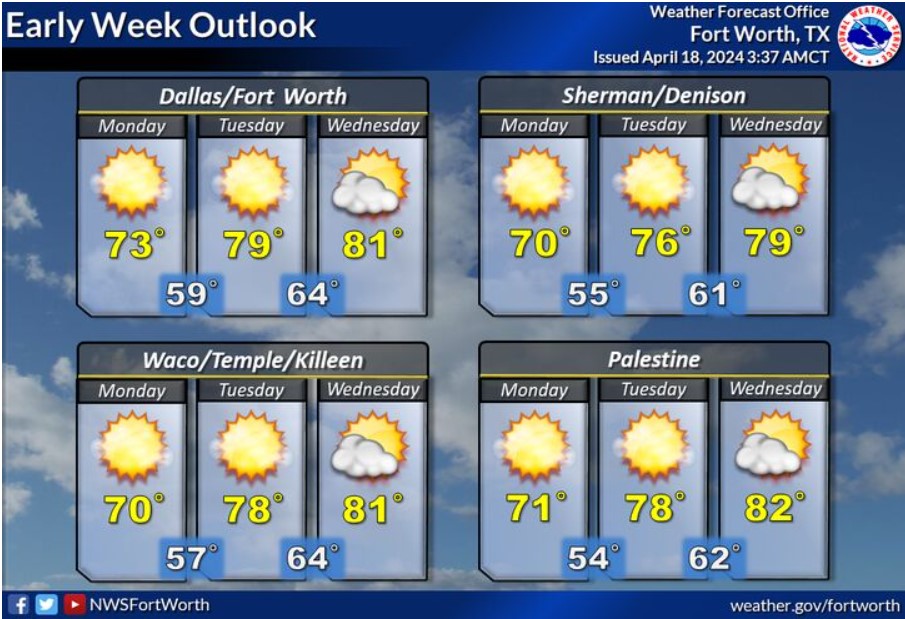
The first half of next week will be mostly clear and warmer, with highs ranging from the low 70s on Monday to the upper 70s and lower 80s by Wednesday. Lows will be in the 50s and 60s.
Today and Tonight
Scattered thunderstorms will accompany a cold front this afternoon and evening. A few storms may become severe with large hail and damaging winds.
Friday through Wednesday
Additional storm chances will arrive this weekend with the passage of
an upper-level disturbance. A few storms may become vital, with
small hail and heavy rain occurring locally.
SPOTTER INFORMATION STATEMENT
Limited spotter activation is possible this afternoon and evening.
South Central and Southwest Arkansas, North Central and Northwest Louisiana, Southeast Oklahoma, and East and Northeast Texas
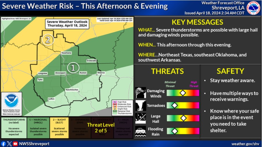
Strong to severe thunderstorms are possible across portions of the ArkLaTex this afternoon through this evening.
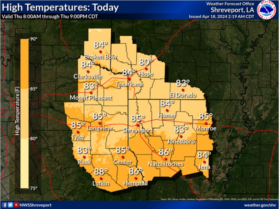
Expect a warm and humid afternoon across the region, with highs in the mid-80s.
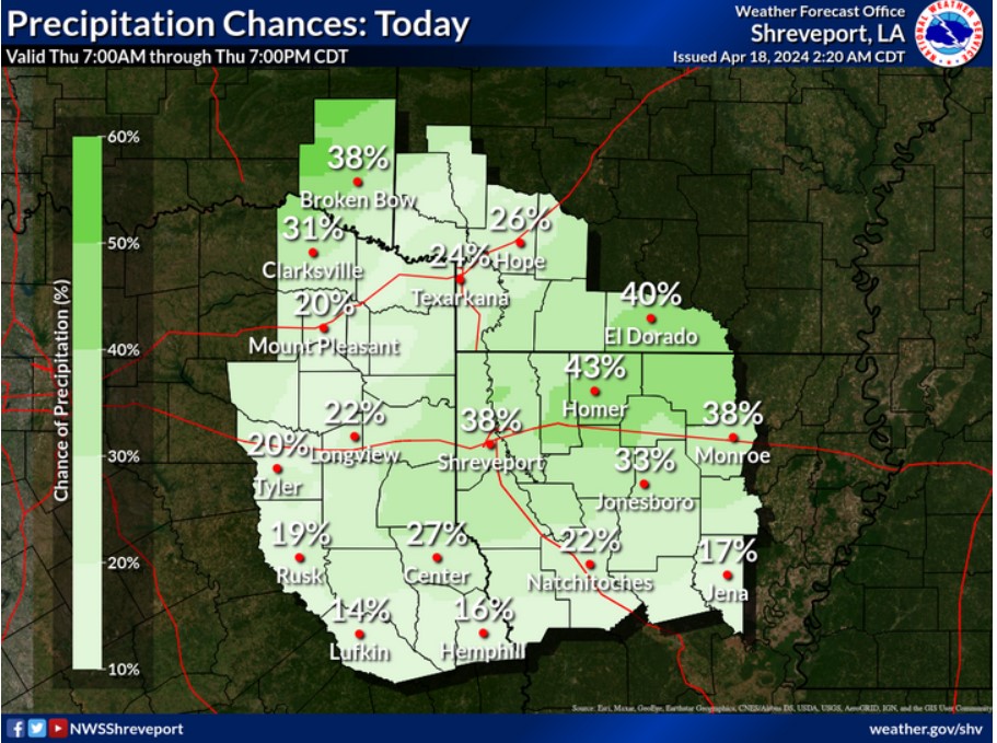
Scattered showers and thunderstorms are possible today ahead of an approaching frontal boundary.
Today and tonight
A round of thunderstorms will be possible this afternoon and evening across northeast Texas, southeast Oklahoma, and southwest Arkansas ahead of a cold front. Some storms may be severe, with damaging winds and large hail being the main threats.
Friday through Wednesday
Periods of locally heavy rainfall may be possible this weekend from Friday evening through Sunday.
SPOTTER INFORMATION STATEMENT
NWS may need spotter activation this afternoon and evening.