


North and Central Texas
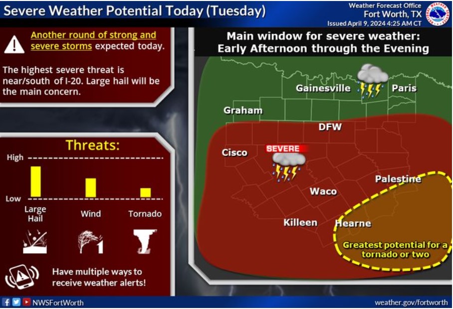
Intense storms are possible today, with the highest severe chances near and south of the I-20 corridor. Large hail will be the main concern, along with a threat of a couple of tornadoes across the far southern zones. There is also an increased threat of flooding. Make sure to have multiple ways to receive weather alerts and stay weather-aware!
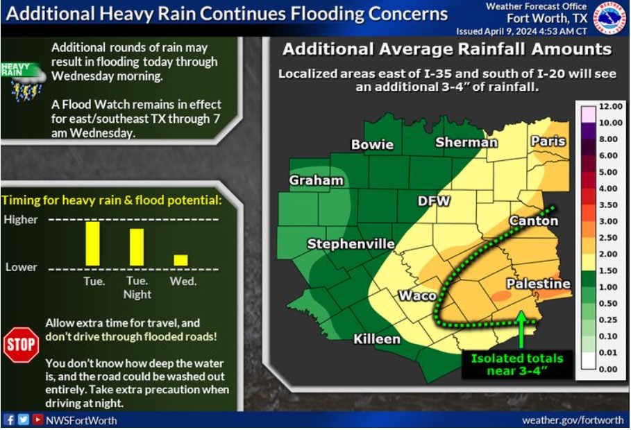
Additional rounds of heavy rainfall will continue flooding concerns today through Wednesday morning. A Flood Watch remains effective for East/Southeast Texas portions through 7:00 am Wednesday. Average additional rainfall totals will range from 1.5-3,” with isolated areas south of I-20 and east of I-35 picking up a further 3-4″ of rainfall. Allow extra time for travel, and don’t drive through flooded roads. Take extra precautions when driving at night.
Today and Tonight
Thunderstorms chances continue today across most of North and Central Texas. The highest severe threat this afternoon and tonight will be near and south of I-20. Large hail will be the primary concern, but there is an isolated threat for tornadoes across the southeast into the Brazos Valley region. Flooding will also be possible, mainly where any training storms may occur.
Wednesday through Monday
A few thunderstorms are possible across North Texas on Wednesday. Some intense storms may be capable of producing hail and gusty winds. Flooding due to locally heavy rainfall will also be a threat through Wednesday.
SPOTTER INFORMATION STATEMENT
Spotter activation may be needed this afternoon and evening.
South Central and Southwest Arkansas, North Central and Northwest Louisiana, Southeast Oklahoma, and East and Northeast Texas

There’s a risk for severe thunderstorms across most of the Four-State Area through tonight and into early Tuesday, and again during the day Tuesday and into early Wednesday. Giant hail greater than two inches in diameter, damaging winds, and tornadoes will be possible.
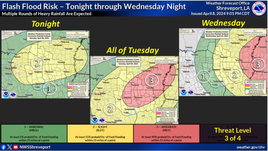
Multiple rounds of excessive heavy rainfall will result in a persistent threat of flash flooding across the entire Four-State Area tonight through Wednesday. On Tuesday, the most significant risk, a Moderate Risk, Level 3 of 4, will be across much of Southwest Arkansas, Northern Louisiana, and East Texas.
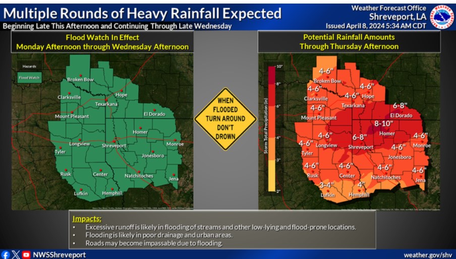
Expect multiple rounds of heavy rainfall through at least Wednesday morning. Widespread rainfall totals of three to six inches are expected, with scattered pockets of six to eight inches. Isolated higher amounts are possible. This will likely result in a widespread threat of flooding. Therefore, a Flood Watch has been issued for the entire Four State Area from Monday afternoon through Wednesday morning.
Today and Tonight
Showers and thunderstorms will continue to impact the entire Four-State Region Today through tonight. Excessive, heavy rainfall could result in additional flooding concerns, with low-lying and poor drainage areas becoming especially susceptible. Strong to severe thunderstorms will also be possible through tonight, especially across the southern half of Northeast Texas into Northern Louisiana, where large hail, damaging wind gusts, and an isolated tornado threat will exist.
Wednesday through Monday
The heavy rainfall should begin to taper off across much of the region during the day on Wednesday, but there will continue to be a severe thunderstorm threat, at least during the morning hours on Wednesday across portions of the region. Showers and thunderstorms should end across the entire Four State Region Wednesday Night.
Additional rises from recent rainfall will continue to impact the area waterways, with crests likely not reached until the end of the work week, the upcoming weekend, or next week.
SPOTTER INFORMATION STATEMENT
Spotter activation will be likely today through tonight.