


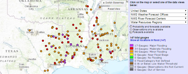
Rainfall amounts of 18–20 inches over the last four days have led to record flooding and evacuations in eastern Texas. Seven USGS crews are measuring high flood flows and verifying stream gage operations on the Sulphur, Cypress, and Sabine River basins. Preliminary data show record flood peaks were measured at five locations on the lower portion of the Sabine River, downstream of the Toledo Bend Reservoir. In anticipation of intense flooding in the City of Orange, Texas, USGS crews will be making specific discharge measurements and installing a rapid-deployment stream gage to support emergency management personnel. Floodwater and debris are impacting one USGS stream game, and crews will repair the equipment once it is safe to do so. All other stream measurements are fully operational and have not been impacted by the flood at this time.
USGS crews will keep tracking the movement of the floodwaters as rains continue and the water moves downstream. This information is critical for resource managers and emergency responders to help protect life and property. The USGS has coordinated efforts with the Army Corps of Engineers, the National Weather Service, Sabine River Authority and several other local and state partners.
There are about 550 USGS-operated stream gages in Texas that measure water levels, streamflow, and rainfall. When flooding occurs, USGS crews make numerous discharge measurements to verify the data USGS provides to federal, state and local agencies, as well as to the public.
For more than 125 years, the USGS has monitored flow in selected streams and rivers across the United States. The information is routinely used for water supply and management, monitoring floods and droughts, bridge and road design, determination of flood risk and for many recreational activities.
Access current flood and high flow conditions across the country by visiting the USGS WaterWatch website. Receive instant, customized updates about water conditions in your area via text message or email by signing up for USGS WaterAlert. See where floodwaters go by following a stream trace at Streamer. View water data on your mobile device. Learn how a USGS stream gage works.
USGS provides science for a changing world. Visit USGS.gov, and follow us on Twitter @USGS and our other social media channels.