


North and Central Texas.
Today and Tonight
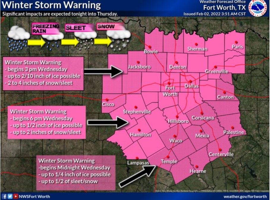
A mix of winter precipitation will begin across the northwest portions of North Texas late this afternoon, spreading southeast
overnight. Accumulating ice, sleet, and snow will significantly impact travel across the region tonight.
Falling temperatures and a strong north wind will have wind chills in the single digits and teens tonight.
Thursday through Tuesday
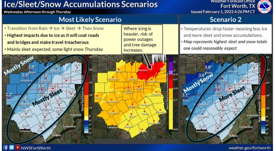
On Thursday, the period of freezing rain, sleet, or snow will continue across North and Central Texas. Additional ice, sleet, and snow accumulations will make travel difficult or impossible. All precipitation will exit the region Thursday evening.
Expect dangerously cold temperatures with wind chill values as low as minus Thursday night and Friday night.
SPOTTER INFORMATION STATEMENT
The NWS does not expect spotter activation at this time, but reports of winter precipitation accumulations are appreciated.

Southwest Arkansas, Southeast Oklahoma, and Northeast Texas
Today and Tonight
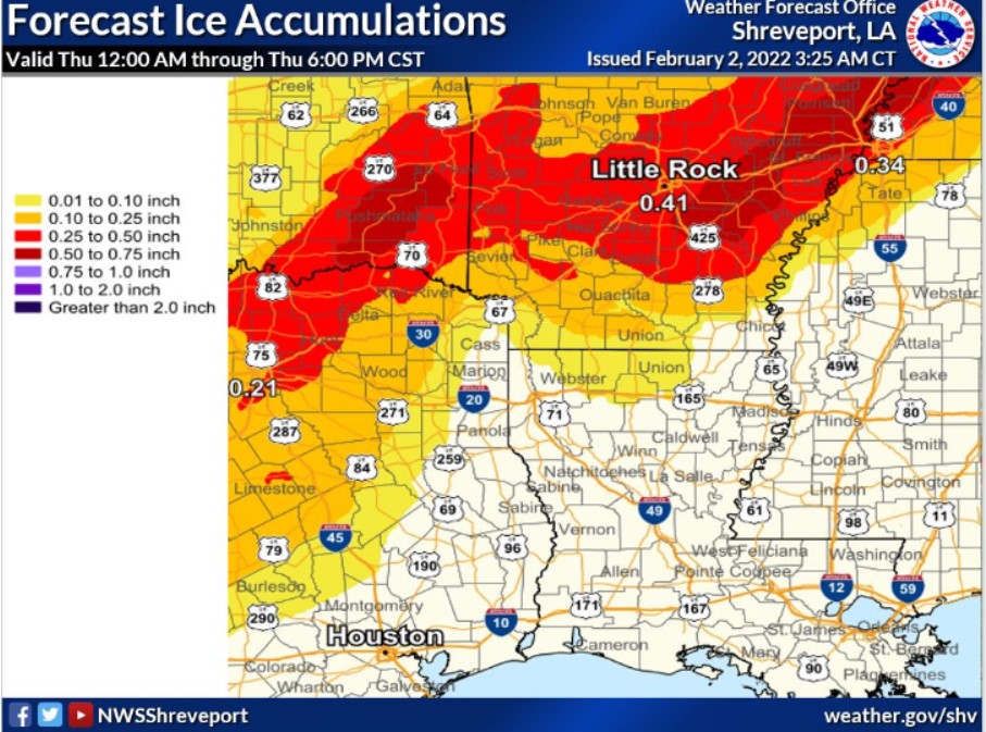
Given increased moisture and limited mixing, patchy fog may be possible across a good portion of the region this morning. Some of this fog may be dense at times. Much colder air will move into the area beginning tonight. Given persistent rain, a wintry mix of precipitation should start falling by the overnight hours tonight in our far Northwest zones. A winter storm warning is issued to account for this wintry mix, as accumulations and impacts should be at their most challenging in these areas. Expect driving conditions to deteriorate once this transition occurs quickly.
Thursday through Tuesday
Wintry precipitation will continue and expand east throughout the day on Thursday. Some accumulation of ice up to one-tenth of an inch will continue to make driving extremely hazardous. In addition, some light snow accumulations are possible during this timeframe. The winter storm warning will expire at 6:00 pm Thursday, but lingering precipitation will still be possible. Given already wet surfaces, roads will thaw and freeze into the weekend. It will continue making driving hazardous potentially into Saturday.
SPOTTER INFORMATION STATEMENT
The NWS will not need the activation of emergency management personnel, amateur radio operators, and storm spotters through tonight.