


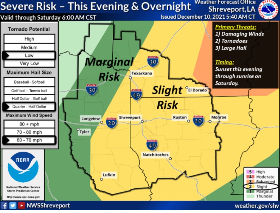
Southwest Arkansas, Northwest Louisiana, East, and Northeast Texas
Today and Tonight
Isolated to widely scattered thunderstorms will be possible across much of the area today. However, the NWS expects thunderstorms to
increase intensity and coverage this evening and tonight as a vital cold front approaches. Some storms could be severe. Also possible are damaging winds, large hail, and isolated tornadoes, especially in Louisiana and Southwest Arkansas. The cold front and the line of storms will move southeast across the area during the overnight hours and into Saturday morning.
You can expect gusty southerly winds of 15 to 20 mph with gusts between 25 and 30 mph this afternoon. Therefore, a Lake Wind Advisory
is in effect from noon until 6:00 pm CST this evening.
Saturday through Thursday
After a few dry days, thunderstorm chances will return to the area late Wednesday and into Thursday.
SPOTTER INFORMATION STATEMENT
Activation of emergency management personnel, amateur radio operators, and storm spotters may be needed this evening and into
Saturday morning.
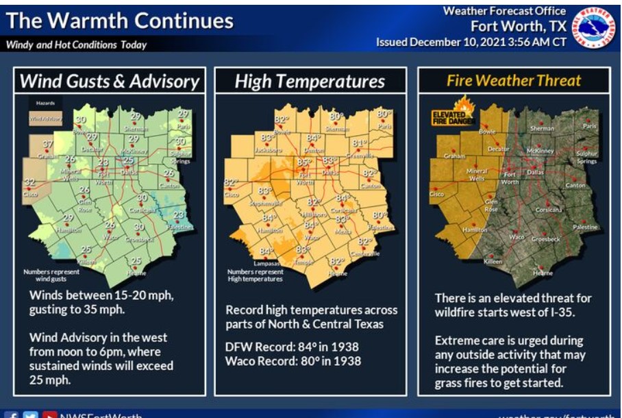
North and Central Texas
Today and Tonight
There will be an elevated threat for grassfires west of I-35 this afternoon. A few isolated thunderstorms are possible across the
Brazos Valley and Southeast Texas tonight. The severe weather threat is low, with the strongest storms producing small hail and gusty winds.
Saturday through Thursday
Low thunderstorm chances return to the region late next week, starting on Thursday continuing into next weekend.
SPOTTER INFORMATION STATEMENT
The NWS does not expect to activate spotters at this time.