


North and Central Texas
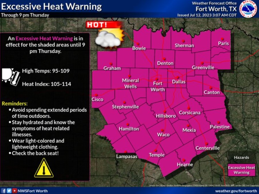
An Excessive Heat Warning is in effect through 9:00 pm Thursday as temperatures will climb to 95-109 degrees with heat index values near 105-114 degrees. Ensure heat safety by drinking plenty of water and avoiding time outdoors. Know the signs of heat-related illnesses!
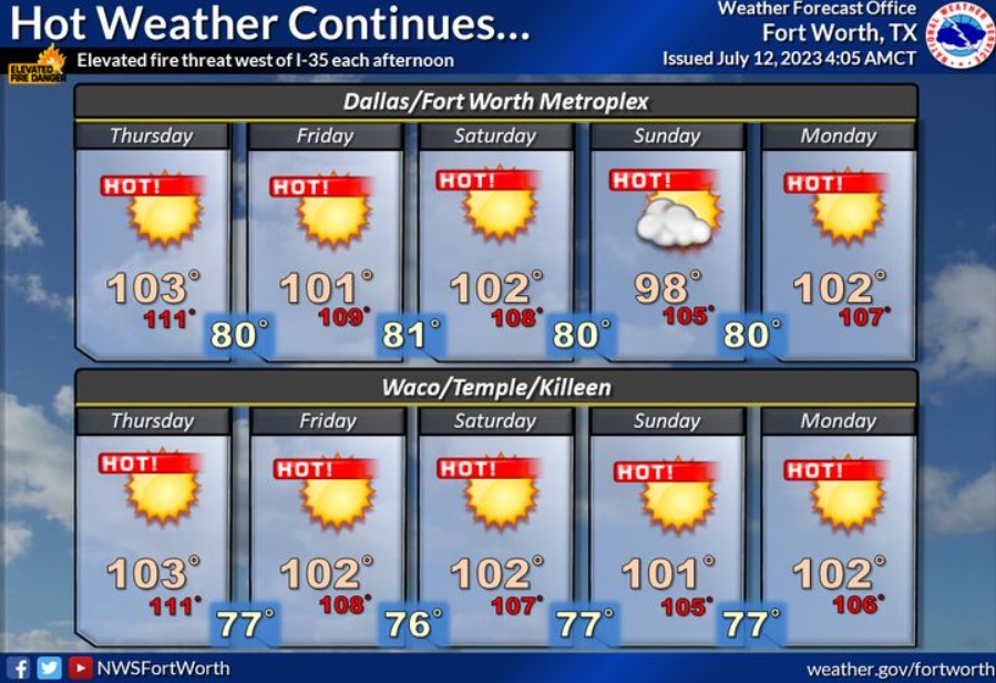
The heat continues the remainder of the week into early next week, with highs in the upper 90s to around 103. Expect heat index values up to 111. There is an elevated threat of wildfires west of the I-35 corridor each afternoon.

Practice Heat Safety Wherever You Are!
Today and Tonight
Excessive heat is expected across North and Central Texas today, with high temperatures from the upper 90s to around 109 and afternoon heat index values up to 114.
The Forest Service is elevating wildfire possibilities generally west of the I-35 corridor.
Thursday through Tuesday
Hot and humid weather will continue through early next week, with afternoon heat index values reaching between 105 and 113 degrees each day.
Low chances for thunderstorms return to North Texas Saturday night and Sunday.
The wildfire threat will remain elevated generally west of the I-35 corridor Thursday through Tuesday.
SPOTTER INFORMATION STATEMENT
Do not expect spotter activation at this time.
South Central and Southwest Arkansas, North Central and Northwest Louisiana, Southeast Oklahoma, and East and Northeast Texas
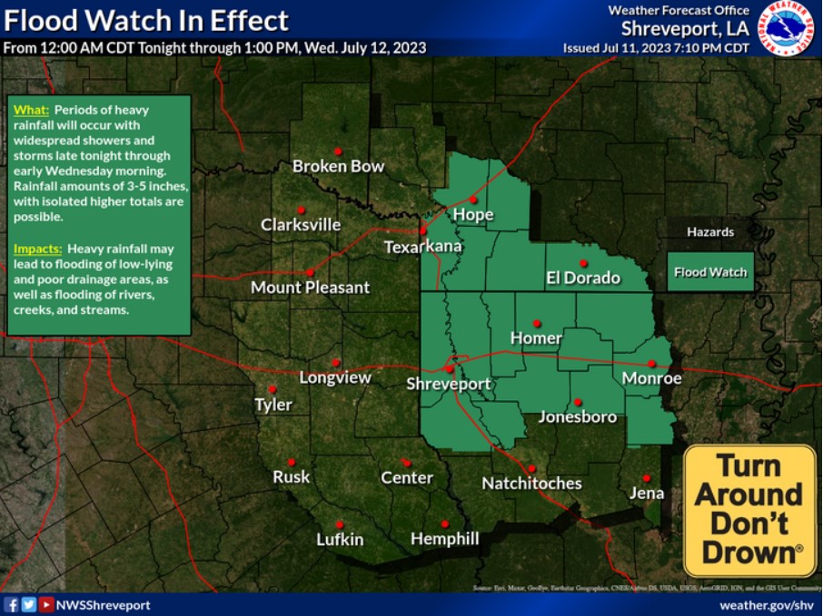
A Flood Watch has been issued for Northern Louisiana and portions of South Arkansas from Midnight tonight through 1:00 pm Wednesday (July 12). Showers and thunderstorms could produce rainfall totals of 3-5 inches, with isolated higher amounts possible.
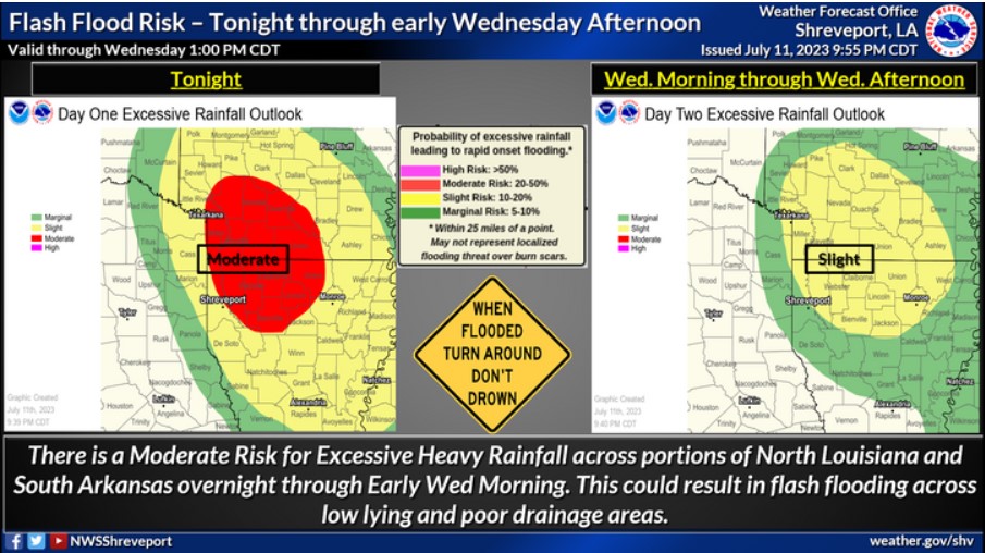
There will be a risk of flash flooding today through tonight across portions of far Southeast Oklahoma and Northeast Texas, as well as much of Southwest Arkansas and Northern and Northeast Louisiana. Storms will produce excessive heavy rainfall, which could result in localized flash flooding.
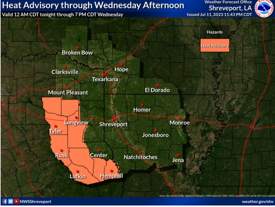
A Heat Advisory will remain in effect through Wednesday Afternoon across portions of East Texas. Expect heat indices between 105 to 109 degrees.
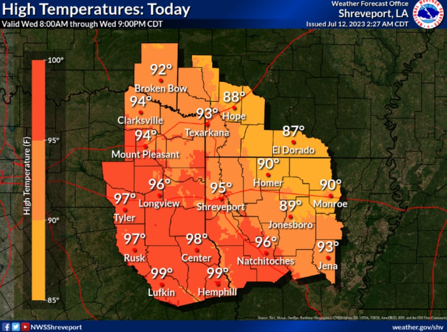
Highs this afternoon move to the mid to upper 90s.
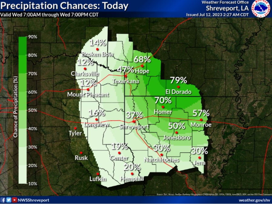
Expect a complex of thunderstorms to develop across portions of the region tonight, bringing locally heavy rainfall through the morning hours.
Today and Tonight
You can’t rule out some isolated to scattered thunderstorms across the region this morning. Some of these storms could produce strong wind gusts and hail. In addition, excessive, heavy rainfall could accompany
the thunderstorms. Thus an isolated flash flood threat cannot be ruled out.
Thursday through Tuesday
The heat is here to stay across the region for the remainder of the work week. Look for the likelihood of Heat Advisories through at least the rest of the work week and into the weekend’s first half. Thunderstorms chances may return to the region Sunday into Monday of next week. However, dry conditions and more hot and humid conditions will return by Tuesday.
SPOTTER INFORMATION STATEMENT
Do not expect spotter activation at this time.