


North and Central Texas
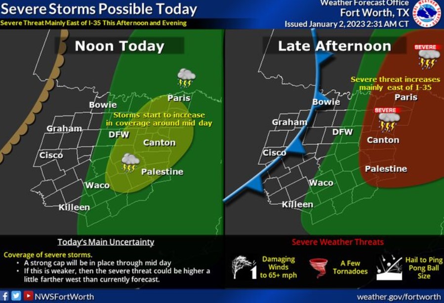
Expect thunderstorms to increase across parts of North Texas today as a storm system moves through the Plains. Scattered showers and a few storms will develop around midday but will grow in coverage through the afternoon, mainly east of I-35. Some storms during the afternoon will be severe and capable of producing damaging winds, tornadoes, and hail. These storms will move into East Texas during the evening hours.
Today and Tonight
Expect thunderstorms to develop later today, primarily over areas along and east of the Interstate 35 corridor. Some storms could be severe, with large hail, damaging winds, and a few tornadoes all possible.
The severe threat looks to maximize from mid-afternoon through the early evening hours, and storm chances generally increase the farther east you go.
Isolated thunderstorms may redevelop late this evening as a weak cold front moves through the region. These storms would also be
mainly along and east of I-35. A few of these may become strong with hail, gusty winds, and frequent lightning.
Tuesday through Sunday
Expect no hazardous weather at this time.
SPOTTER INFORMATION STATEMENT
The NWS may request the activation of spotters this afternoon and evening for areas along and east of the I-35 corridor.
South Central and Southwest Arkansas, North Central and Northwest Louisiana, Southeast Oklahoma, and East and Northeast Texas
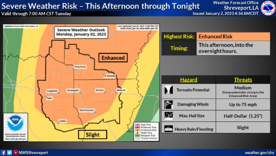
Expect strong to severe thunderstorms to develop across much of the Four State Region this afternoon through tonight. Damaging winds, isolated tornadoes, some of which could be strong, large hail, and locally heavy rainfall, which may result in flooding, will all be possible.
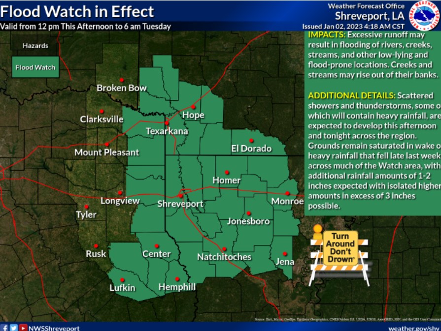
Multiple showers and thunderstorms are expected Monday through Tuesday morning across portions of East Texas, North Louisiana, and Southwest Arkansas. Locally heavy rainfall falling atop already saturated grounds may result in flooding, with rainfall amounts of 1-2 inches expected, with isolated higher amounts over three inches possible, especially over portions of North Louisiana.
Today and tonight
Expect severe weather to increase into the afternoon hours and remain overnight. All modes of severe weather will be possible over the next 24 hours, including tornadoes. The tornado threat will come in the traditional Supercell form and, eventually, the QLCS form. Given the strongly sheared environment, a few of these tornadoes could be substantial. Heavy rain and isolated flash flooding may also become a concern, but that is more likely in the portions of our area under a Flood Watch.
Tuesday through Sunday
Anticipate no hazardous weather.
SPOTTER INFORMATION STATEMENT
The NWS may request the activation of spotters this afternoon and evening for areas along and east of the I-35 corridor.