


North and Central Texas
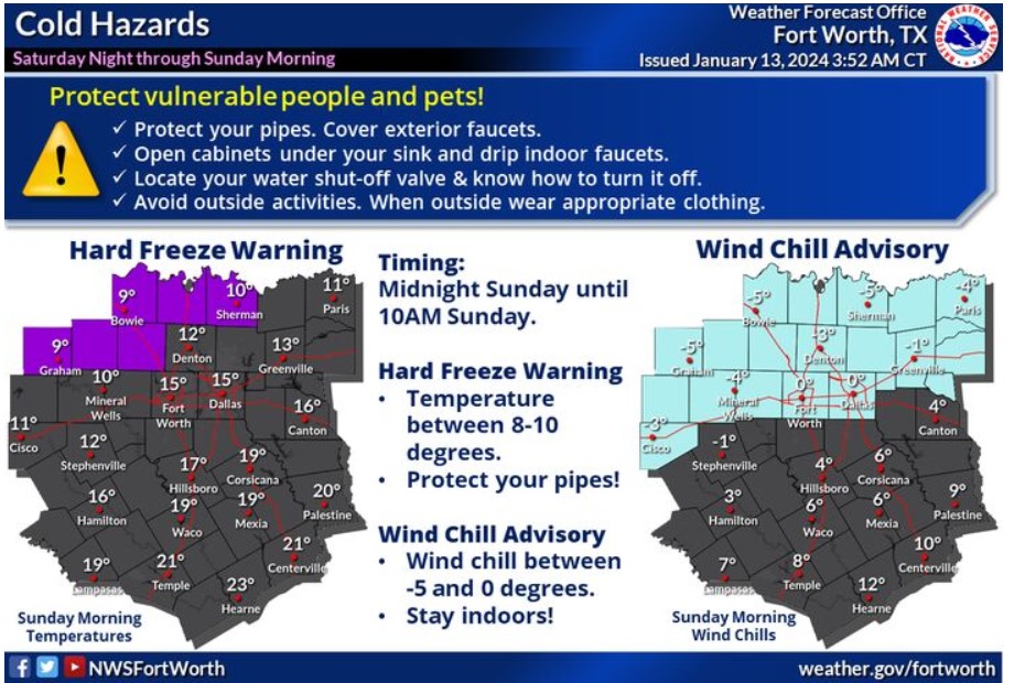
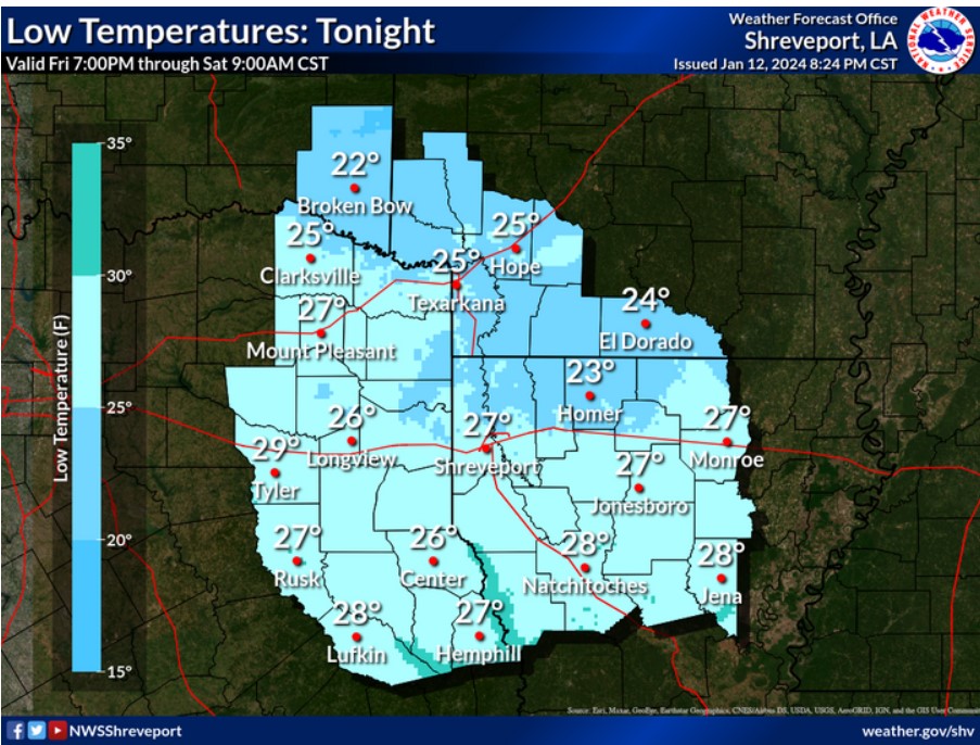
Temperatures will fall below freezing for North and Central Texas tonight and Sunday morning. Some locations across western North Texas will fall into the single digits. Most places along and north of I-20 will experience wind chills at or below zero from midnight through 10:00 am Sunday. Protect vulnerable people and plants from the cold! Protect your pipes and avoid outdoor activities.
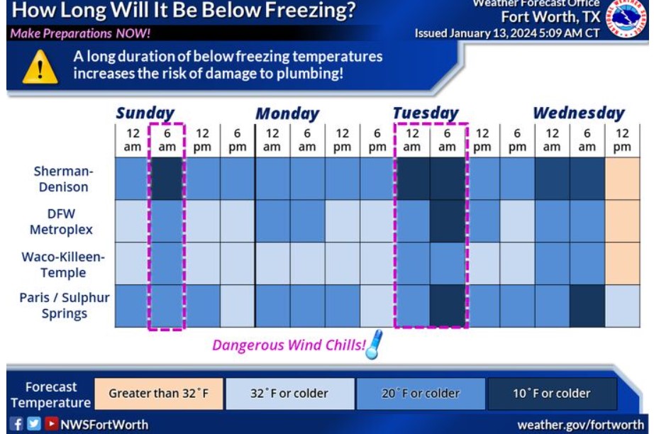
An arctic blast arrives today, with dangerously cold temperatures late this weekend through mid-next week. Temperatures will remain below freezing Saturday night through Wednesday morning for nearly all of North and Central Texas. Now is the time to complete freeze preparations. Make sure to protect exposed and vulnerable pipes by covering or wrapping them. During the cold weather, drip any indoor sinks. Now is an excellent time to locate your water shut-off valve if you have to turn off the water to your residence or business. Remember to protect and check on people and pets during the cold, too!
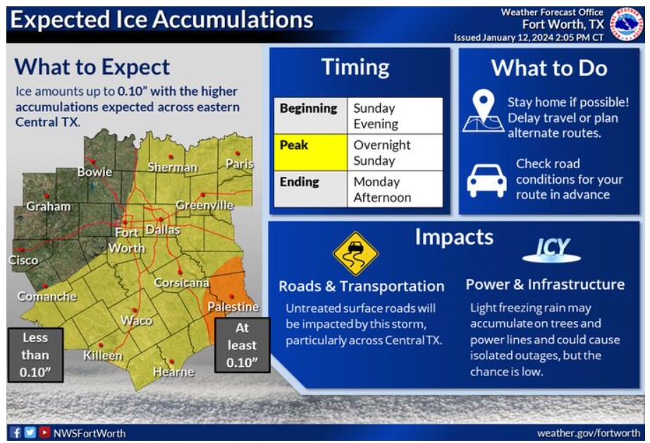
A mix of rain and freezing rain may begin as early as late Sunday afternoon, transitioning to a wintry mix by Sunday night. Expect ice accumulations of generally a few hundredths of an inch for most areas, but at least 0.10″ is possible in Eastern Central Texas. Untreated surface roads will be impacted, particularly across Central Texas. Stay home if possible, but if you must travel Sunday night or Monday, check road conditions for your route in advance.
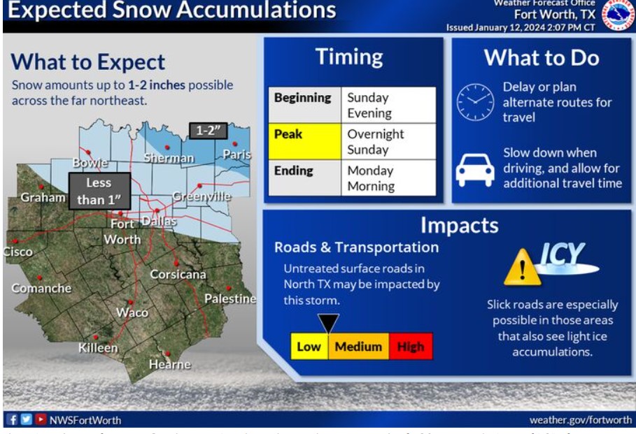
There is a chance for snow Sunday evening through Monday near/north of I-20. Accumulations of 1-2″ snow are possible across the far northeast, with less than 1″ expected elsewhere. Even though snow amounts are light, any snow that falls will stick due to the cold roads, bridges, and elevated surfaces. Therefore, expect an impact of untreated surface roads. Also, slick roads are especially possible in areas with light ice accumulations.
Today and Tonight
Frigid temperatures will arrive this evening. Wind chills will fall below zero at times tonight across portions of North Texas, with temperatures falling into the single digits in some areas.
Now is the time to ensure you protect your home against the cold. Protect any outdoor pipes and let indoor faucets drip during the prolonged sub-freezing temperatures.
Sunday through Friday
Frigid temperatures will continue through Wednesday morning. Wind chill values will sometimes fall below zero, with low temperatures in the teens and single digits Sunday night through Wednesday morning.
A wintry mix is expected Sunday afternoon through midday Monday. While accumulations will be light, expect impacts on untreated surface roads. Ice may accumulate on trees and power lines and could cause isolated outages, but the chance of this is low.
SPOTTER INFORMATION STATEMENT
Do not expect spotter activation at this time.
South Central and Southwest Arkansas, North Central and Northwest Louisiana, Southeast Oklahoma, and East and Northeast Texas
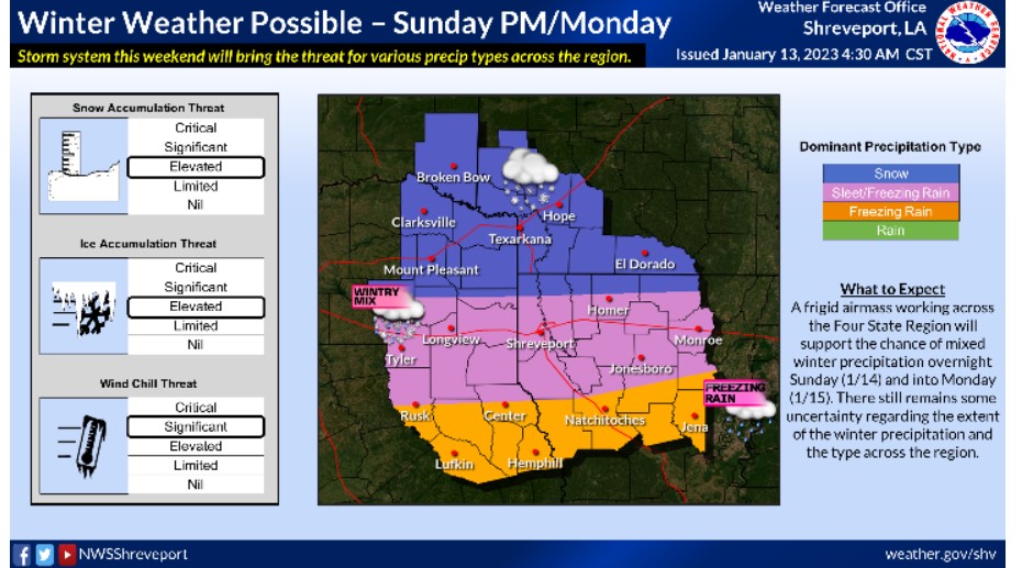
The weekend will see-saw from warmer to colder with the threat of mixed winter precipitation by late Sunday. Snow, sleet, and freezing rain will all be possible. Stay tuned to the forecast for the latest over the next few days.
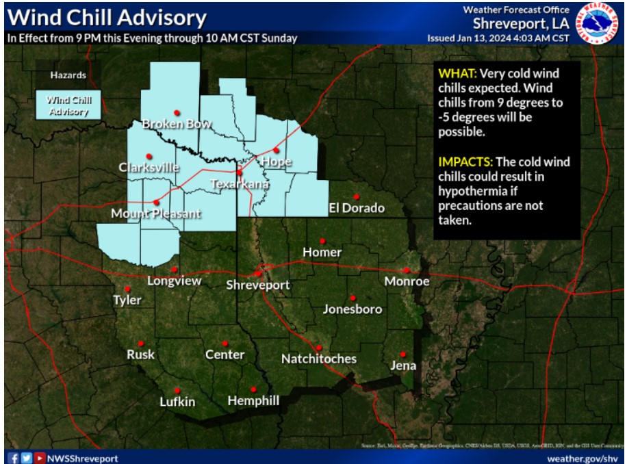
A Wind Chill Advisory will go into effect at 9:00 pm this evening and continue through 10:00 am Sunday. Expect wind chill values from 9 degrees to -5 degrees. Use precaution if you must be outdoors.
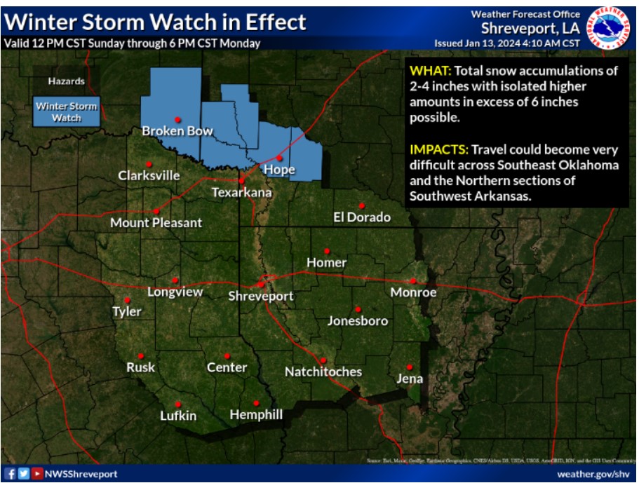
A Winter Storm Watch is in effect Sunday afternoon through Monday for McCurtain County, Oklahoma, and the Northern sections of Southwest Arkansas. Snowfall accumulations of 2-4 inches, with isolated high amounts over 6 inches, are possible across the Watch area.
Partly cloudy skies and warmer 50s for Saturday afternoon to finish outdoor preparations ahead of our weekend’s Arctic air mass “wrapping up” (pun intended).