


North and Central Texas
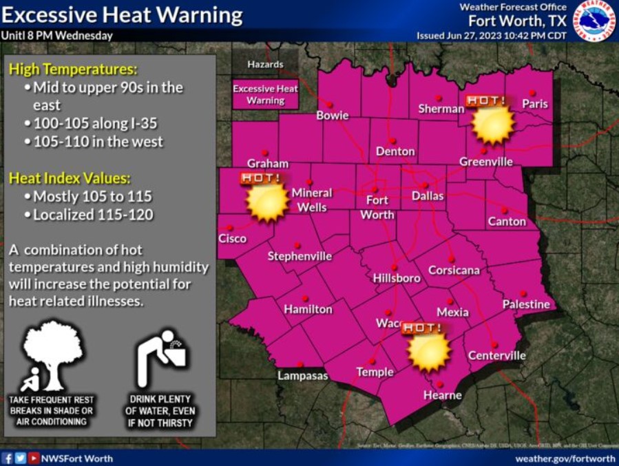
An Excessive Heat Warning remains in effect until 8:00 pm Wednesday. The westernmost counties will experience the highest temperatures of 105 to 110, while the central and east counties will experience the highest heat indices, generally 110-115. Remember to take frequent breaks in an air-conditioned building and stay hydrated when planning outdoor activities. Also, keep your pets indoors if possible, and do not walk them on hot pavement.
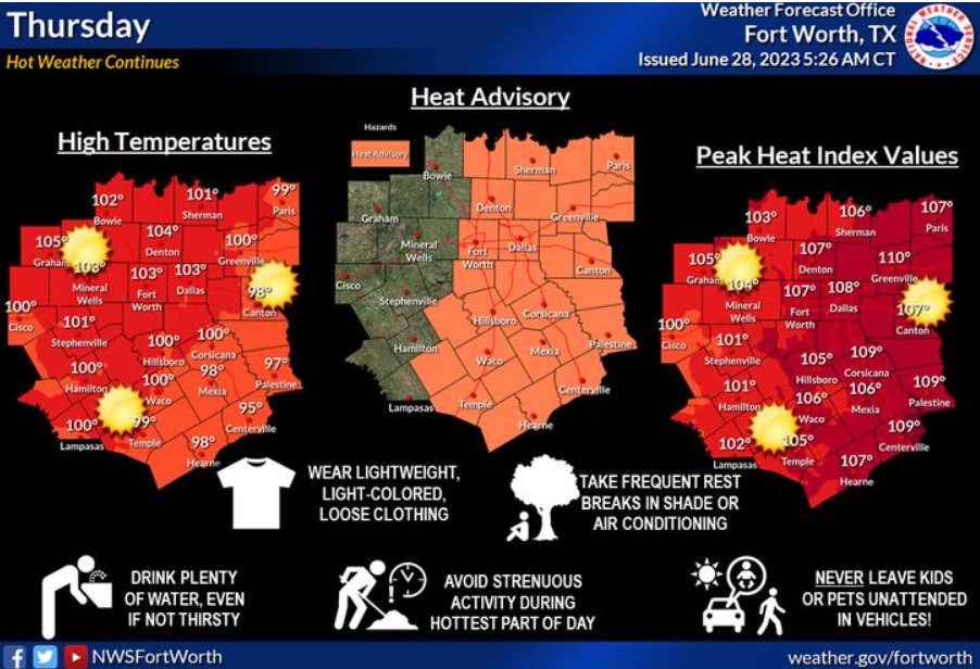
The Excessive Heat Warning will expire at 8:00 pm, but a Heat Advisory will continue throughout the region into Thursday. Expect triple-digit high temperatures, and heat indices will climb into the 105 to 110-degree range within the advisory area Thursday afternoon.
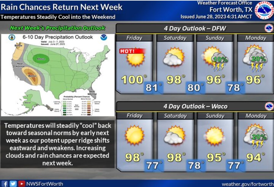
The heat will gradually ease as we head into the latter part of the upcoming weekend and next week. The solid upper ridge currently overhead will shift eastward and weaken. As it does, temperatures will fall closer to seasonal normals for this time of year. In addition, scattered afternoon showers and storms will return by Monday and continue through the week.
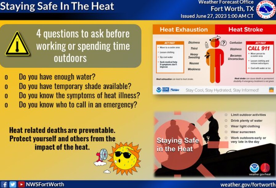
With this persisting heat, practice heat safety wherever you are! Know the signs of heat illness, and check on the more vulnerable populations. Drink plenty of water, avoid extended time outdoors during the day’s heat, and look before you lock!
Today and Tonight
Well-above-normal temperatures will continue today. Make sure to take the necessary precautions to avoid heat-related illnesses.
Thursday through Tuesday
Low thunderstorm chances will return to the region Saturday through Tuesday. Hot and humid weather will continue through the end of the week.
SPOTTER INFORMATION STATEMENT
Do not expect spotter activation at this time.
South Central and Southwest Arkansas, North Central and Northwest Louisiana, Southeast Oklahoma, and East and Northeast Texas
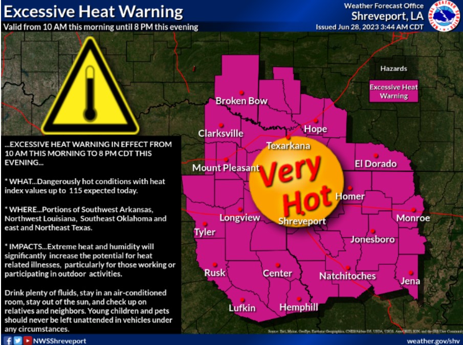
Hazardous heat is forecasted today, with ambient temperatures near 100 degrees and Heat Indices as high as 115 degrees this afternoon. Take precautions if you must work outdoors today.
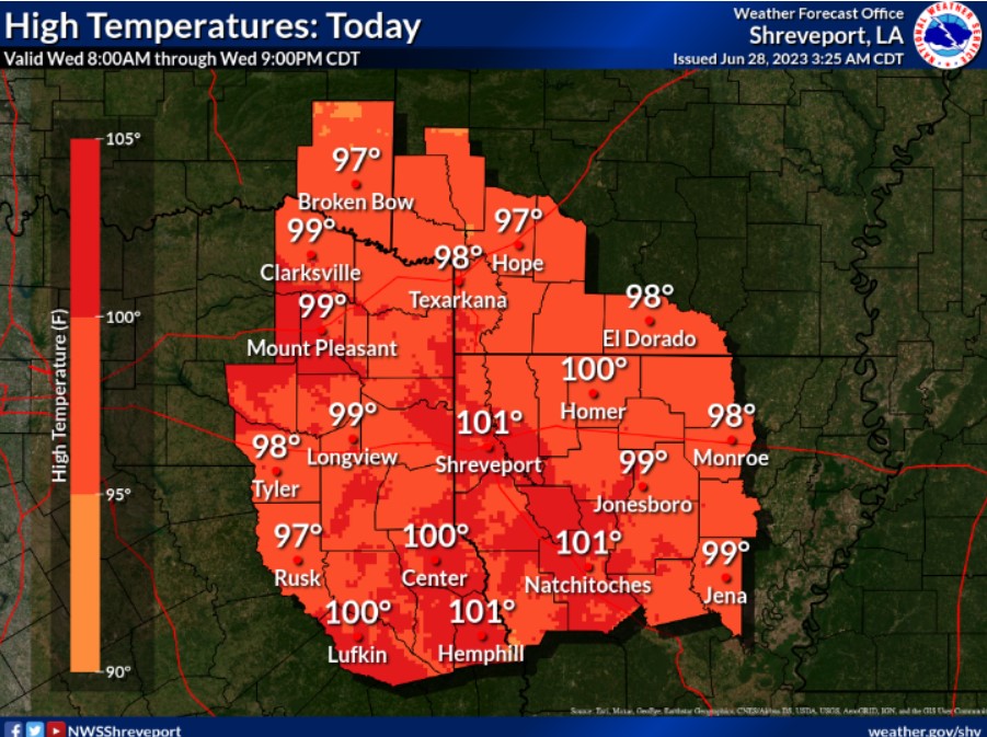
The hottest temperatures of the summer season thus far are forecast for today. Look for high temperatures to range from the upper 90s to near 102 degrees.
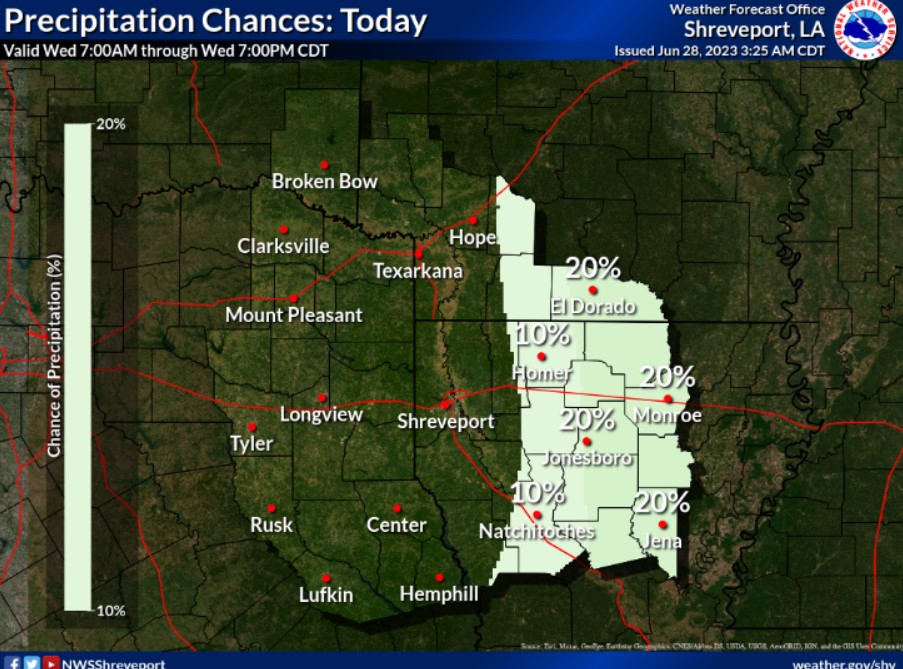
Isolated showers and thunderstorms will be possible today, mainly across portions of North Central and Northeast Louisiana and South Central Arkansas.
Today and Tonight
Dangerous heat is forecast today across the entire Four-State Region, with ambient temperatures near 100 degrees. When you combine temperatures with the humidity, look for afternoon Heat Indices to climb to as high as 115 degrees. In addition, a solid isolated thunderstorm will be possible, mainly this afternoon into this evening, across portions of North Central and Northeast Louisiana into South Central Arkansas. These storms, if they develop, could produce strong wind gusts.
Thursday through Tuesday
The intense heat will be with us through at least the weekend’s first half. A Heat Advisory is currently in effect for Thursday, extending into the weekend’s first half. Thunderstorms chances return to portions of the Four-State Region on Sunday, but especially in the early and middle parts of next week.
SPOTTER INFORMATION STATEMENT
Do not expect spotter activation at this time.