


North and Central Texas

Showers and thunderstorms will continue east of I-35 this morning, with additional development expected into the afternoon. Coverage should remain around 20-30% throughout the day. A few storms may become strong to severe with hail and gusty winds. A slow-moving cold front will go through the region today, with high temperatures in the 70s to mid-80s.

Occasional chances for strong or severe thunderstorms will exist from Wednesday evening through Friday across much of the area, with large hail and gusty winds being the primary hazards. Expect the most significant extreme weather potential to be late Wednesday evening and night across North Texas. Storms will end during the day Friday while a strong cold front arrives from the north.

A strong cold front will arrive late Friday, bringing much cooler weather to the region heading into Saturday and breezy north winds. Some patchy frost is possible in North Texas on Sunday mornings, with low temperatures in the 30s. Sunday afternoon will be warmer and pleasant, with highs returning to the 60s.
Today and Tonight
There is a chance of thunderstorms across Central Texas and eastern North Texas early this morning, and mainly across Northeast Texas later today along an approaching cold front. A few vital to severe storms are possible and will be capable of producing hail and gusty winds.
Wednesday through Monday
Thunderstorm chances return Wednesday evening and will continue off and on through Friday. A few intense or severe storms with primarily a hail threat are possible during this period.
SPOTTER INFORMATION STATEMENT
Do not expect spotter activation at this time.
South Central and Southwest Arkansas, North Central and Northwest Louisiana, Southeast Oklahoma, and East and Northeast Texas

We are monitoring the potential for strong to severe thunderstorms across portions of the area on Thursday and Friday. It remains a fluid situation, and computers will likely make changes, but now is the time to prepare.

Low temperatures tonight will range from the upper 50s to middle 60s across the region, with showers and thunderstorms expected to increase toward daybreak ahead of an approaching cold front.
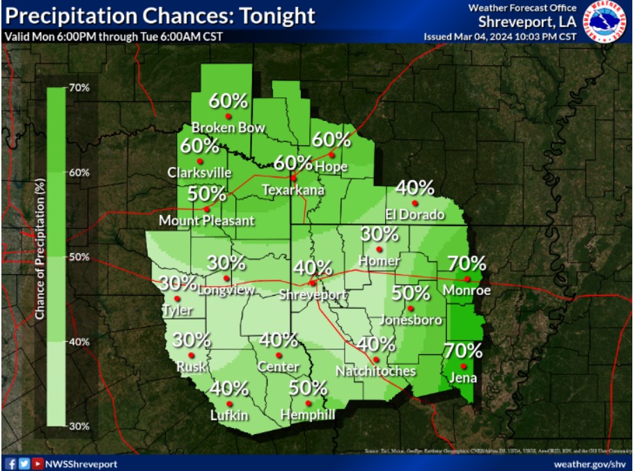
Lingering showers and thunderstorms will be possible across portions of the area tonight, with the best chances for our far eastern and northern zones.
This afternoon and tonight
Some intense storms may be possible across the Four-State Region, with small hail and strong wind gusts being the main threats.
Tuesday through Sunday
Expect warmer and drier conditions, with periods of scattered showers and thunderstorms, possible each day through much of the workweek.
SPOTTER INFORMATION STATEMENT
Do not expect spotter activation at this time.