


North and Central Texas
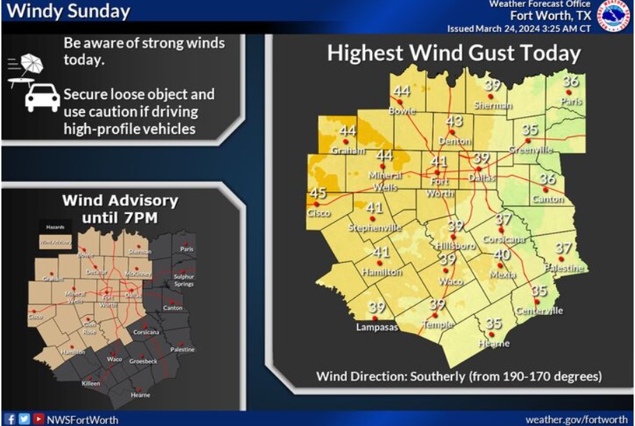
Expect strong winds today. Expect sustained winds between 15-25 mph with gusts up to 35-45 mph. There is a low (10%) chance parts of Western North Texas could receive gusts to 50 mph between noon and 5 pm. Please secure outdoor items and use caution when operating high-profile vehicles, particularly on east-west-oriented roads.
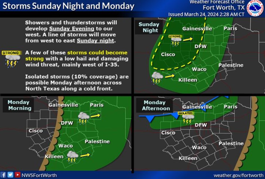
Rain and storm chances return to North and Central Texas tonight. There is a window for strong to severe storms this evening as storms push into western North and Central Texas. The overall severe threat is low and near zero for locations east of I-35. The storms will move into East Texas Monday morning. There is a 10% chance of isolated storms Monday afternoon across North Texas.
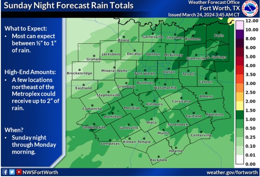
Most can expect to receive between 1/2″ and 1″ of rain tonight and early tomorrow morning. Locations northeast of the Metroplex could receive up to 2″ of rain.
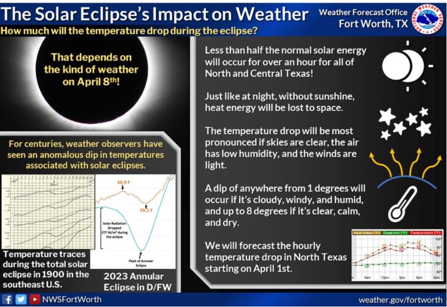
We all know the weather will impact the eclipse viewing, but how will the eclipse affect the weather? We could see a notable drop in temperatures depending on the cloud cover, wind speeds, and humidity on Monday, April 8.
Today and Tonight
Wind 20-30 mph with 40-45 mph gusts are expected for locations near and west of I-35 today. The wind may blow around unsecured loose objects. Driving on area roadways may become difficult for high-profile vehicles.
A line of thunderstorms will move through North and Central Texas tonight and early tomorrow morning from west to east. An isolated hail and damaging wind threat will exist west of I-35 tonight.
Monday through Saturday
Isolated thunderstorms are possible on Wednesday afternoon.
SPOTTER INFORMATION STATEMENT
Do not expect spotter activation at this time.
South Central and Southwest Arkansas, North Central and Northwest Louisiana, Southeast Oklahoma, and East and Northeast Texas
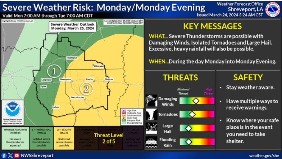
There is a Slight Risk for severe thunderstorms across Louisiana, much of Southern Arkansas, and extreme Northeast Texas during the day Monday through Monday Evening. The greatest threats will be damaging winds, isolated tornadoes, and large hail. Excessive heavy rainfall will also be a threat across portions of the Four-State Region.
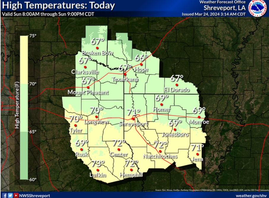
It’s warmer today, with afternoon high temperatures ranging from the middle to upper 60s north to the lower and middle 70s south.
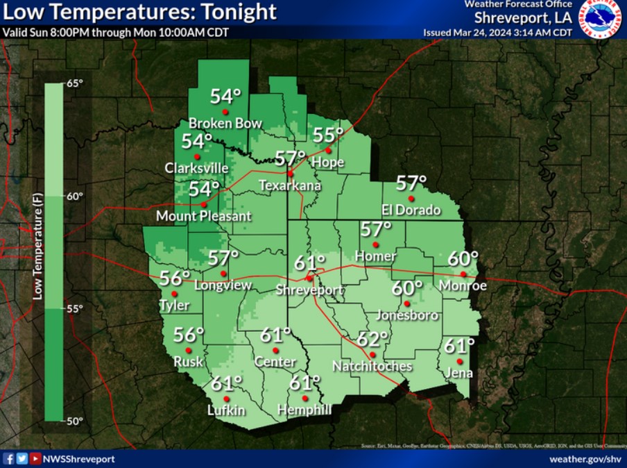
It is warmer tonight, with low temperatures ranging from the middle 50s northwest to the lower 60s south.