


North and Central Texas
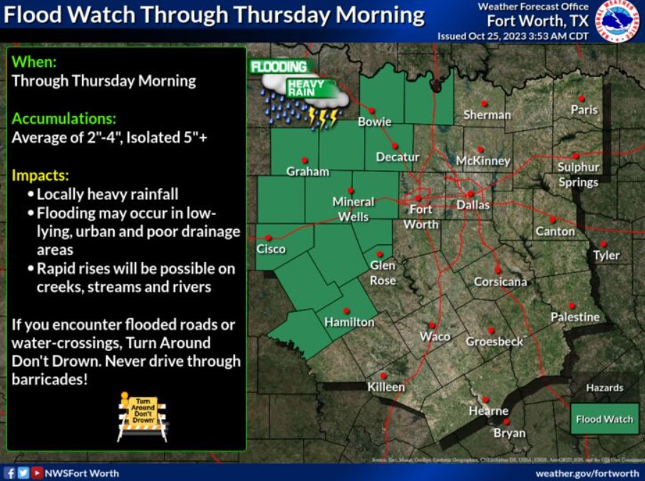
A Flood Watch will be in effect through Thursday morning. Widespread rainfall averages of 2-4″ can be expected with a lower chance (10%) of 5 inches or more of rain. Make sure to remain weather-aware this afternoon and through the night!
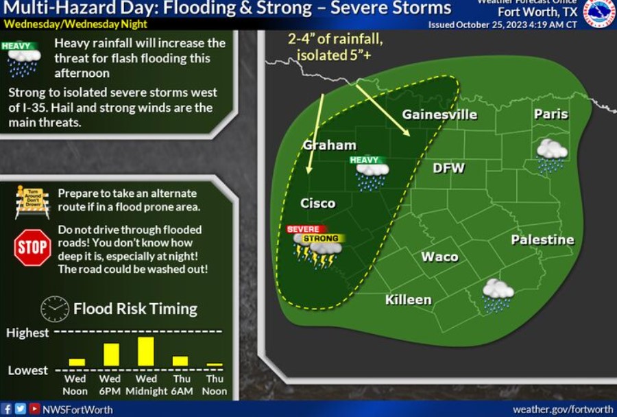
The threat of flash flooding will increase today, especially west of I-35. Heavy rainfall and slow-moving thunderstorms will increase the risk of flooding, especially in areas that experienced rainfall yesterday. Widespread 2-4″ of rain is expected, with a 10% chance of 5+ inches of rain in the dark green shaded region. In addition, there will be a threat of strong to isolated severe storms capable of hail and strong winds.
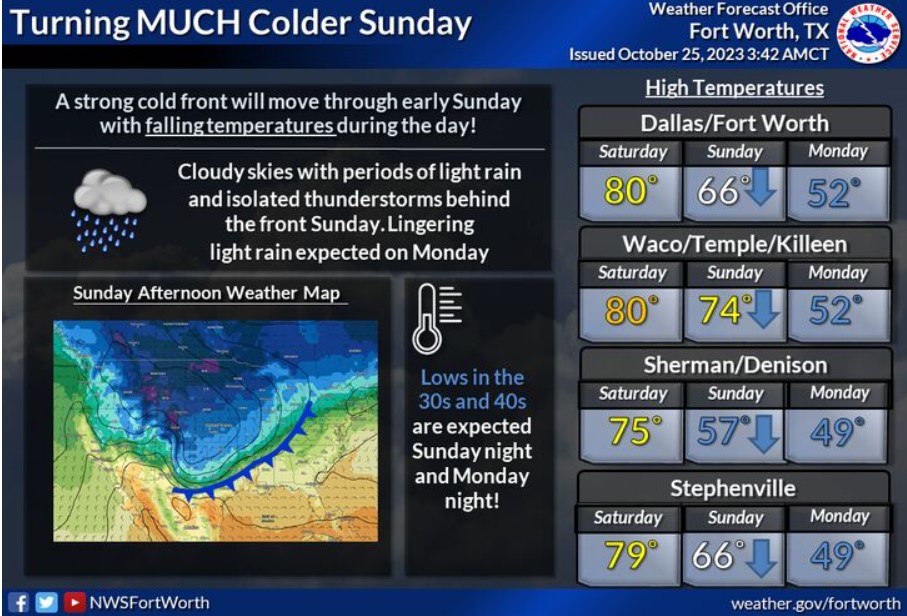
A strong cold front will move through early Sunday, with falling temperatures occurring during the day. Temperatures will be in the 30s and 40s for lows Sunday night and Monday night, with highs in the low 50s Monday. Adding to the chill will be a chance of rain behind the front on both Sunday and Monday.
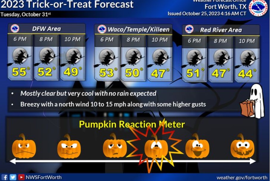
Halloween is less than a week away, and you may wonder what it will be like when you head out for Tricks or Treats. The good news is that the rain will have exited the region, and the sky will be mostly clear. The bad news is that temperatures will cool down to the 50s around sunset and into the middle and upper 40s by 10:00 pm. A breezy north wind between 10 and 15 mph will be chilling, so wear warm clothes if you are outside enjoying the festivities.
Today and Tonight
Scattered to numerous thunderstorms are possible this afternoon and tonight. A few strong to severe storms may develop with a potential for hail and damaging winds. Heavy rainfall may result in some localized flash flooding, especially west of the I-35 corridor.
Thursday through Tuesday
Isolated to scattered thunderstorms are possible across the region Thursday through Sunday. The severe weather threat is low, but a few intense storms with small hail and gusty winds will be possible. Rainfall totals of 2 to 4 inches with locally higher amounts over 6 inches are possible, mainly west of I-35.
SPOTTER INFORMATION STATEMENT
Minimal spotter activation is possible this afternoon and
evening, mainly west of I-35.
South Central and Southwest Arkansas, North Central and Northwest Louisiana, Southeast Oklahoma, and East and Northeast Texas
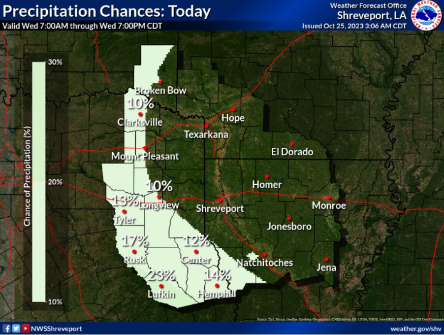
Rain chances today will be isolated to widely scattered and mainly confined to portions of Deep East Texas.
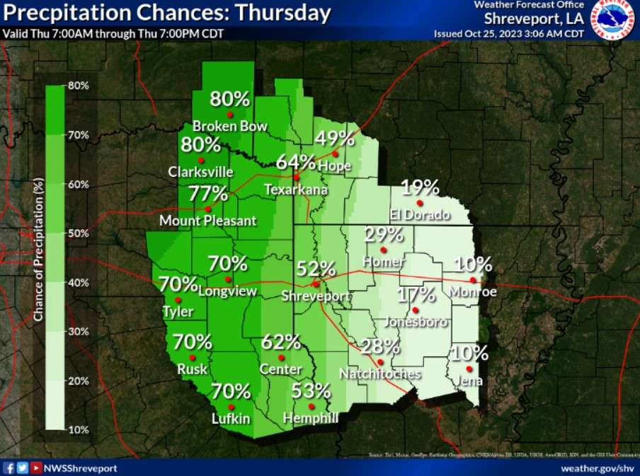
Rain chances will increase across the entire Four-State Region for your Thursday, with the best rain chances forecast across Northeast Texas, Southeast Oklahoma, Southwest Arkansas, and far Northwest Louisiana.