


North and Central Texas
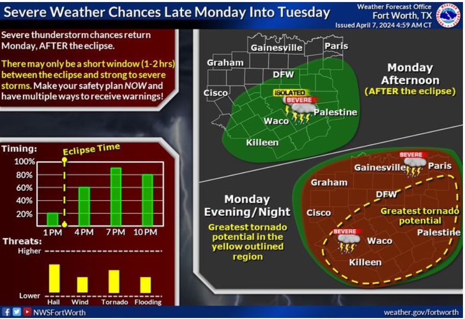
Severe thunderstorm chances return Monday after the eclipse. Some areas may only have a short one to two-hour window between the eclipse and strong to severe storms. Make your safety plan now and have multiple ways to receive warnings! The primary threat is large hail, but tornadoes, damaging winds, and flooding are all possible.
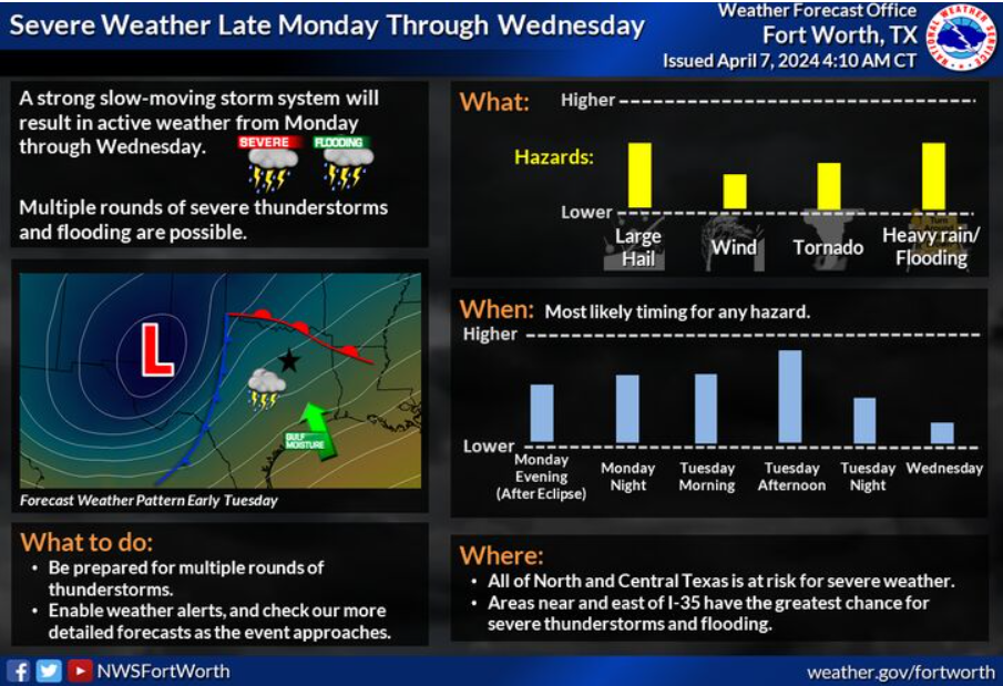
Showers and thunderstorms are expected to develop late Monday afternoon and evening after the eclipse. Additional storms are expected late Tuesday into Wednesday. Some of these storms have the potential to become vital to severe, with all hazards possible, including flooding. Monitor the forecast and ensure you have multiple ways to receive weather alerts.
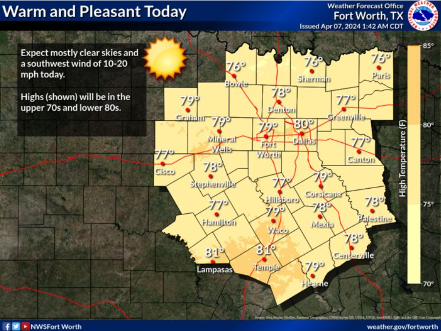
Today, expect mostly clear skies and a southwest wind of 10-20 mph. Highs will be in the upper 70s and lower 80s.
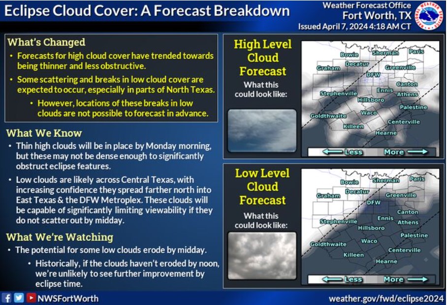
Optimal eclipse viewing conditions are unlikely due to anticipated cloud cover, but 10-20% of the area will likely experience enough cloud breaks for more decent viewing. We are confident that high clouds will be in place, but they may be thin enough not significantly to obstruct the sun. However, more dense low clouds are likely across Central Texas, and with increasing confidence, they will spread farther north into East Texas and the DFW Metroplex. While some scattering of low clouds is likely, many areas will still have an obstructed view as these clouds linger into the afternoon.
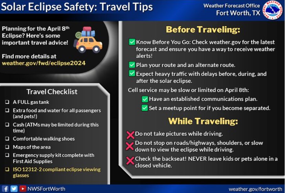
Are you traveling for the upcoming total solar eclipse on April 8? Here are some tips to help you stay safe during your travel plans.
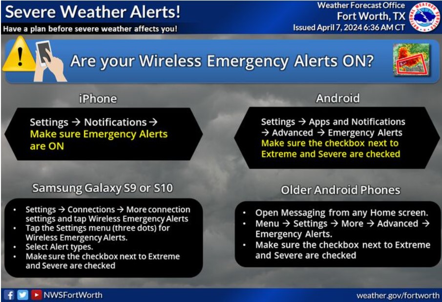
The National Weather Service forecasts severe weather starting late Monday afternoon after the eclipse and into Wednesday. Now is the time to prepare, especially if you’re traveling! Know which office issues forecasts and warnings for where you’re headed, and ensure you know where to shelter if a warning is issued for your location. Make sure you also have multiple ways to receive warnings, including having Wireless Emergency Alerts enabled on your phone!
South Central and Southwest Arkansas, North Central and Northwest Louisiana, Southeast Oklahoma, and East and Northeast Texas
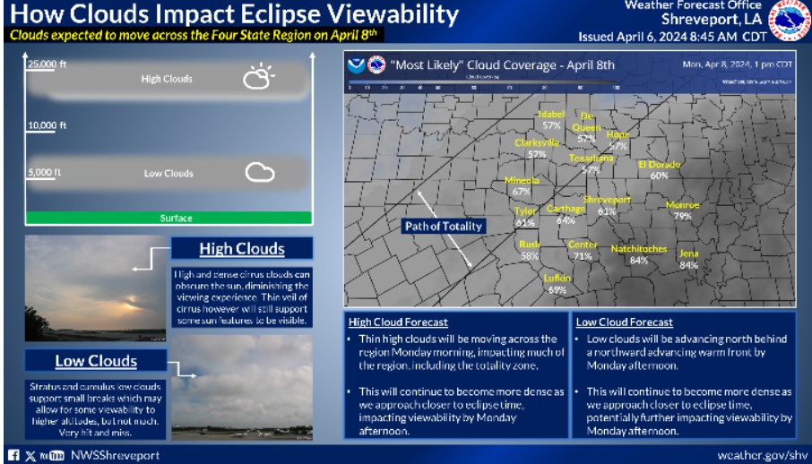
The latest forecast generally represents a low probability, less than 40% chance, of partially favorable viewing conditions across most Northeast Texas, Southeast Oklahoma, and far Southwest Arkansas. It extends into Northwest Louisiana. At the same time, strong to severe storms will be possible late Monday into Monday night. Unfortunately, this is across the entire local path of totality for the eclipse. Although storms may favor the evening, this could support additional clouds during the afternoon eclipse viewing time, thus decreasing the chance of a visible eclipse.
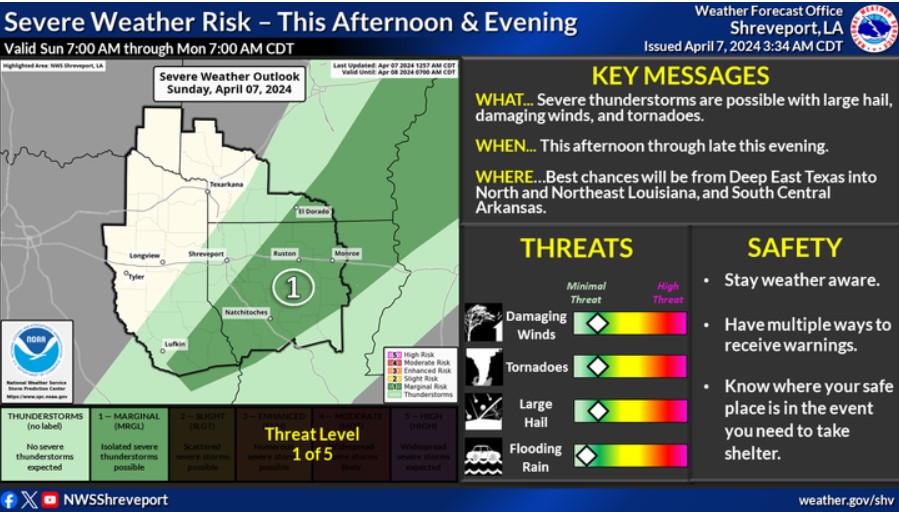
There is a risk for severe thunderstorms this afternoon through late this evening across portions of Deep East Texas, Northern and Northeastern Louisiana, and South Central Arkansas. Damaging winds, large hail, and tornadoes will be possible.
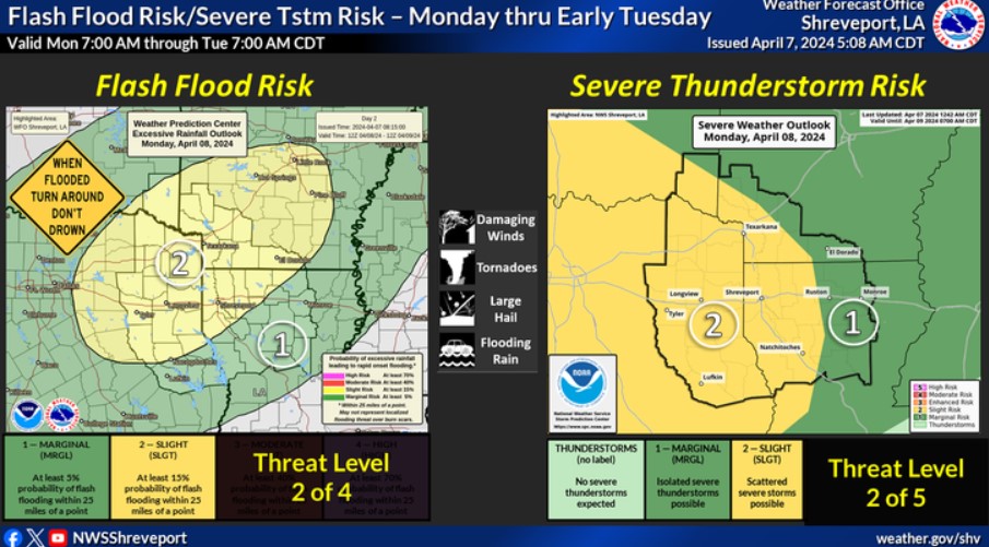
Strong to severe thunderstorms and excessive heavy rainfall, possibly resulting in at least isolated flash flooding, will be possible late in the day Monday through Monday Night across portions of the Four-State Region.
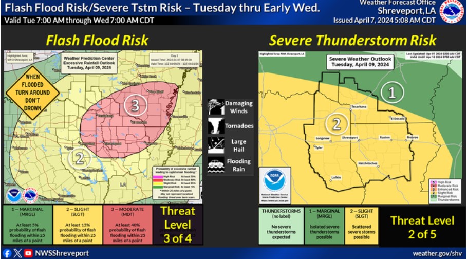
The flood and severe weather threat will continue into Tuesday and early Wednesday, with strong to severe thunderstorms and at least flash flooding possible across most of the Four-State Region.

Expect multiple rounds of heavy rainfall from Monday afternoon through at least Wednesday morning. Widespread rainfall totals of three to six inches are expected, with scattered pockets of six to eight inches. Isolated higher amounts are possible. This will likely result in a widespread threat of flooding. Therefore, a Flood Watch has been issued for the entire Four-State Area from Monday afternoon through Wednesday morning.