


North and Central Texas
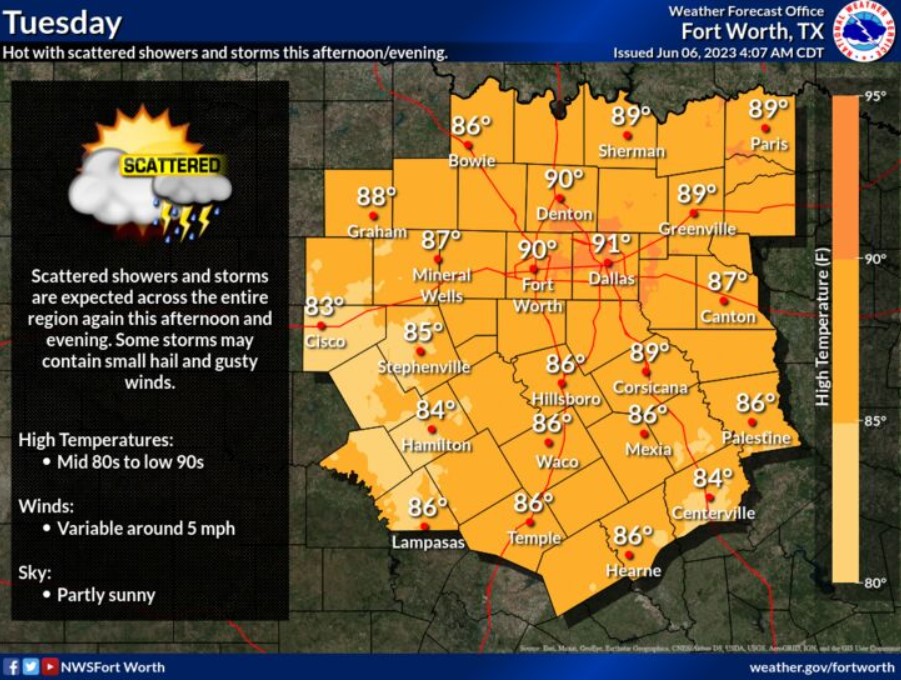
Scattered showers and storms are expected across the region again this afternoon and evening. While the threat of severe weather is low, some thunderstorms may contain gusty winds and small hail. High temperatures will warm into the mid-80s to low 90s with variable winds around five mph.
Today and Tonight
There is a slight chance of thunderstorms across most of North and Central today and tonight. The threat of severe weather is low, but a few storms may produce small hail and gusty winds.
Wednesday through Monday
Low thunderstorm chances will continue Wednesday through Monday. The forecast does not anticipate severe weather.
SPOTTER INFORMATION STATEMENT
Do not expect spotter activation at this time.
South Central and Southwest Arkansas, North Central and Northwest Louisiana, Southeast Oklahoma, and East and Northeast Texas

Afternoon and evening thunderstorms are again expected across the region, with the best chances across deep East Texssd and North Loouisiana.
Today and tonight
Showers and thunderstorms are again possible this afternoon and into the evening hours before diminishing later in the evening and overnight hours. There could be some intense thunderstorms capable of producing small hail and some damaging winds. In addition, heavy rainfall could cause isolated Flash Flooding.
Wednesday through Monday
The upper-level pattern over the region will continue to keep an unsettled weather theme through the week. Isolated strong thunderstorms may be possible each day, with gusty winds and brief heavy rainfall being the main threats with some storms.
SPOTTER INFORMATION STATEMENT
Do not expect spotter activation at this time.