


North and Central Texas
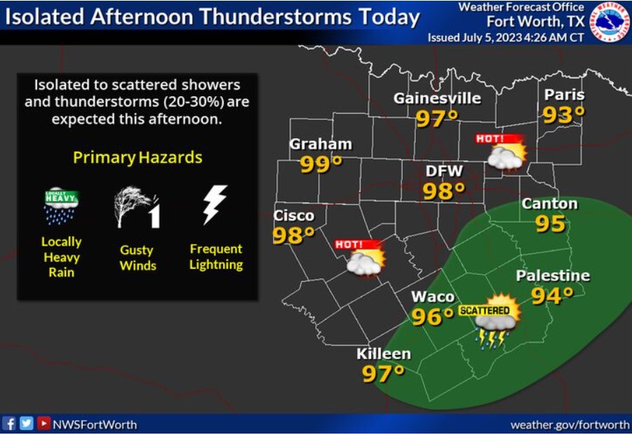
This afternoon, scattered thunderstorms are possible, mainly in Central and East Texas. Even if not storming at your location, nearby storms could produce gusty outflow winds and frequent lightning. Highs will be in the mid and upper 90s.
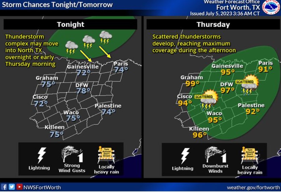
A thunderstorm complex from Oklahoma may move into North Texas late tonight or early Thursday morning. Additional showers and storms will develop during Thursday’s daytime, with threats for gusty winds, heavy rain, and frequent lightning.

Thunderstorms during midweek may produce gusty downburst winds. It can catch unsuspecting boaters by producing strong winds over open lakes. Skies may still be sunny, so pay close attention to the weather if you’re out and about!
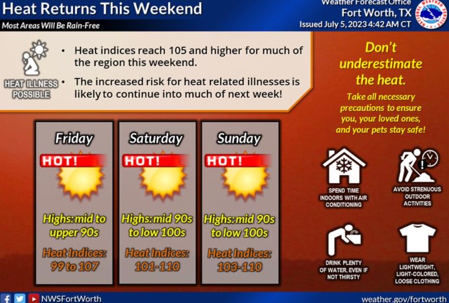
High pressure will expand overhead this weekend, returning to oppressively hot conditions. Expect temperatures in the mid-90s to around 105 each afternoon, with heat indices approaching or exceeding 110 in some areas.
Today and Tonight
Isolated storm chances exist this afternoon for portions of Central and East Texas. Storms can produce strong wind gusts, heavy rain, and frequent lightning.
Thursday through Tuesday
Thunderstorm chances will continue Thursday for much of North and Central Texas. Any storm that develops will have the potential to produce lightning, gusty winds, and heavy rain.
Heat index values above 105 degrees will likely return this weekend and early next week for much of the area, posing an increased threat for heat-related illnesses.
SPOTTER INFORMATION STATEMENT
Do not expect spotter activation at this time.
South Central and Southwest Arkansas, North Central and Northwest Louisiana, Southeast Oklahoma, and East and Northeast Texas
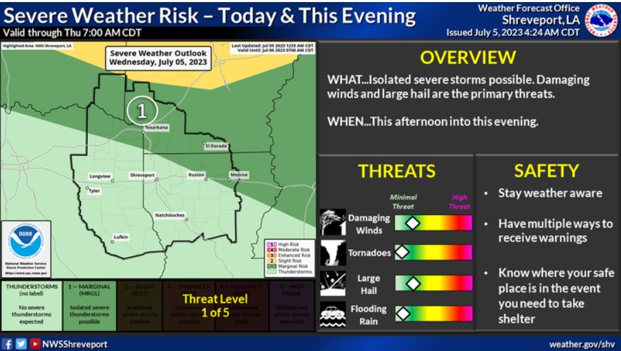
There’s a risk for severe storms today and tonight across Southeast Oklahoma, Southwest Arkansas, and portions of Northeast Texas and North/Northeast Louisiana. Damaging winds and large hail will be the primary threats.
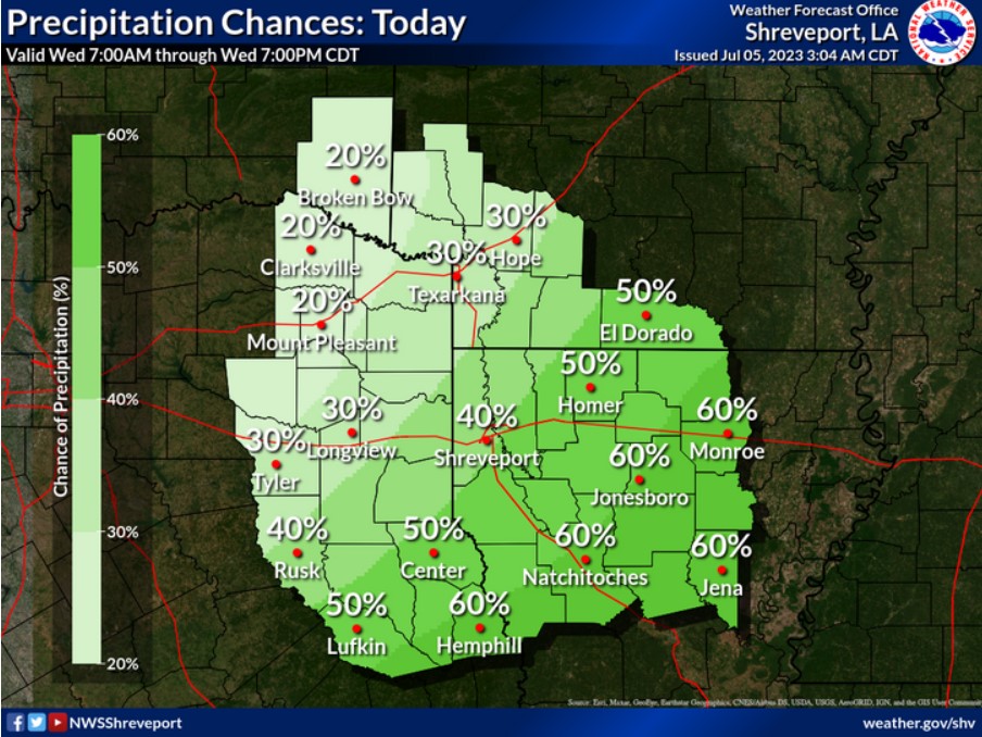
Scattered showers and thunderstorms are expected across much of the area south of the Interstate 30 corridor today.
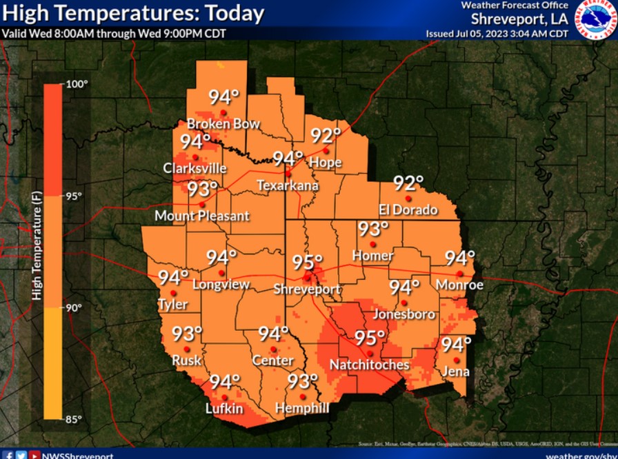
Expect hot and humid conditions today as temperatures climb into the lower to mid-90s.
Today and Tonight
Showers and thunderstorms will expand in coverage across the area through the afternoon. A Marginal Risk (Level 1/5) remains in place for zones along and north of the I-20 corridor and north central Louisiana. Damaging winds and hail look to be the primary associated hazards.
Wednesday through Monday
Thunderstorm chances continue on a near-daily basis throughout this week, with the greatest severe weather chances being along the northern zones of the CWA, along and north of the I-30 corridor. Damaging winds and hail are the primary hazards, with a tornado or two not being out of the question.
Beyond Thursday, widespread organized severe weather is not in the forecast for ArkLaTex, but the National Weather Service will monitor the possibility in the coming days as confidence grows.
Temperatures look to climb back into the mid to upper 90s into the weekend.
SPOTTER INFORMATION STATEMENT
Do not expect spotter activation at this time.