


North and Central Texas
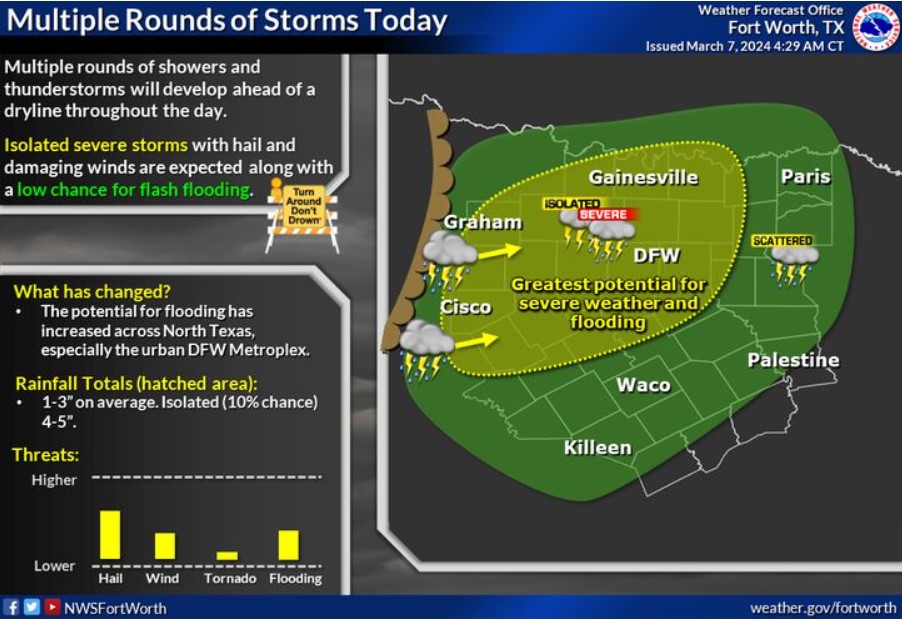
Multiple thunderstorms will develop ahead of a dryline today and slowly move east. Expect isolated severe storms capable of producing large hail and damaging wind gusts. Additionally, training thunderstorms will result in a low threat of flash flooding, especially across the urban DFW Metroplex. Rainfall totals will be between 1-3″ on average for much of North Texas, with isolated totals between 4-5″.
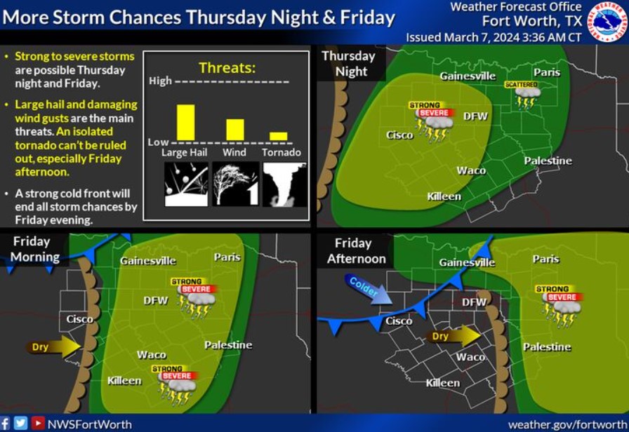
The National Weather Service forecasts additional storm chances for Thursday night into Friday ahead of a dryline and cold front. Some storms will become severe, with large hail and damaging wind gusts. You can not rule out an isolated tornado, especially on Friday afternoon before storms exit the area. Storm chances will end from west to east Friday afternoon, with colder air and breezy winds filtering in behind the cold front.
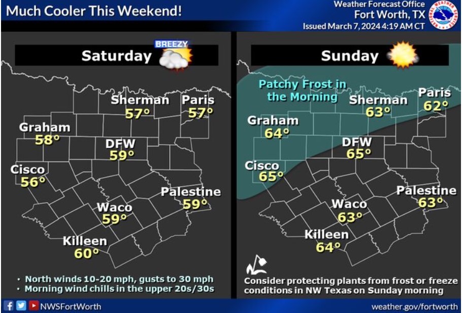
A strong cold front will arrive late Friday, bringing much cooler weather and breezy north winds to the region heading into Saturday. Expect lows in the 30s and 40s, with highs only reaching the 50s and mid-60s. There remains a low chance that areas near the Red River and in the northwest may observe freezing temperatures on Sunday morning, so protect tender plants from possible frost or freeze conditions.
Today and Tonight
Multiple thunderstorms are expected across North and Central Texas today and tonight. Some storms can become intense or severe, primarily due to hail and a secondary damaging wind threat. In addition, heavy rainfall could lead to flash flooding, which would most likely occur near or North of Interstate 20 this afternoon and evening.
Friday through Wednesday
Expect another round of strong or severe thunderstorms from Friday morning into early Friday afternoon, especially near and east of Interstate 35. Large hail and damaging winds would be the primary hazards associated with this activity. The arrival of a robust cold front later Friday afternoon will bring thunderstorm activity to an end.
SPOTTER INFORMATION STATEMENT
Do not expect spotter activation at this time.
South Central and Southwest Arkansas, North Central and Northwest Louisiana, Southeast Oklahoma, and East and Northeast Texas

Showers and thunderstorms are expected to intensify late tonight across Northeast Texas, Southeast Oklahoma, and Southwest Arkansas, along with an approaching upper-level disturbance.
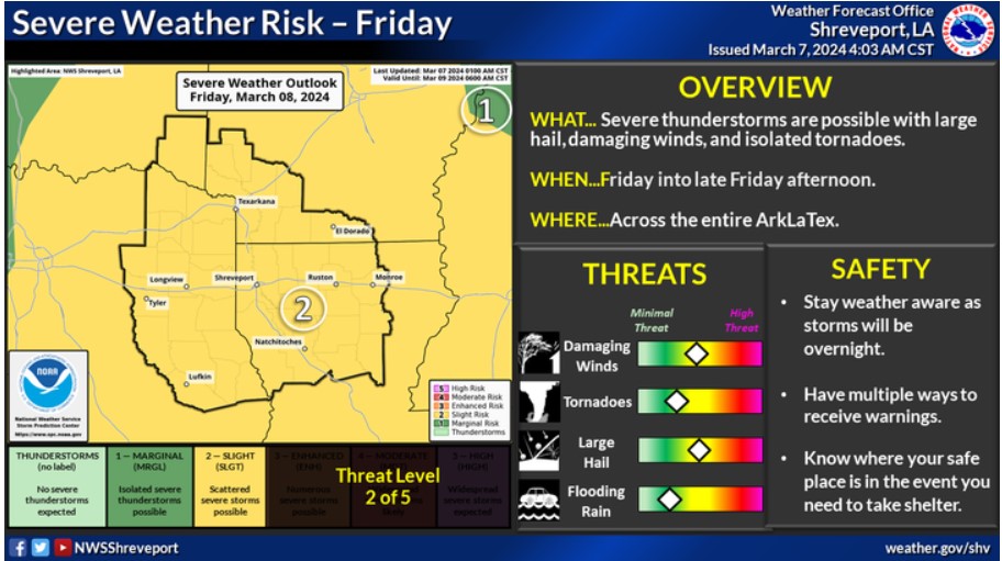
We are monitoring the potential for strong to severe thunderstorms across portions of the area on Friday. Stay tuned to the forecast for the latest updates.