


TODAY AND TONIGHT
North and Central Texas.
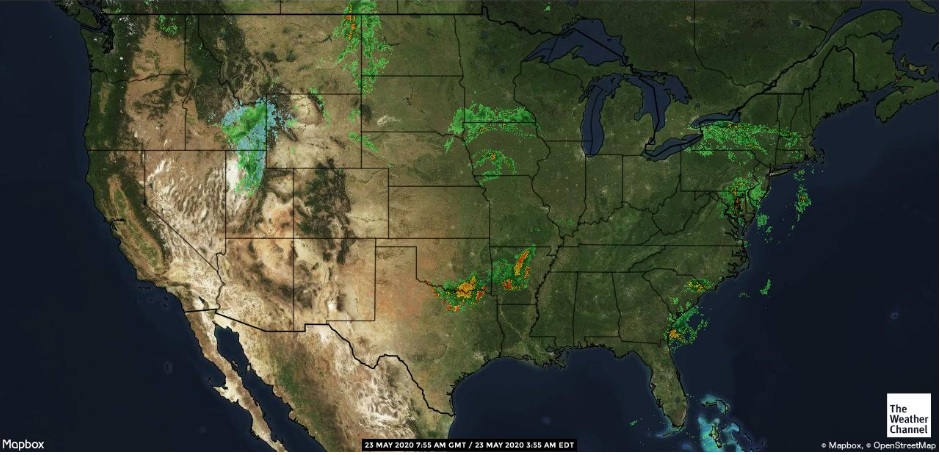
Strong to marginally severe storms will be possible early this morning in areas along and north of the I-20 corridor. Large hail and isolated flooding would be the primary hazards.
Another complex of thunderstorms may approach from the west this evening, moving deeper into North Texas during the overnight hours. Although the activity should steadily weaken, small hail and gusty winds may still accompany the stronger storms.
South Central Arkansas, Southwest Arkansas, North Central Louisiana, Northwest Louisiana, Southeast Oklahoma, East Texas, and Northeast Texas
Showers and thunderstorms will continue to be most widespread across the northern half of the four-state region this morning. They will become scattered in nature as we move into the afternoon hours. Large hail, damaging wind gusts, and locally heavy downpours will frequent any strong to severe thunderstorms today. The activity should quickly diminish this evening with mostly fair conditions expected overnight.
SUNDAY THROUGH FRIDAY
The four-state region will be transitioning into a reasonably wet period beginning during the second half of Sunday and continuing across much of the upcoming work week with a nearly stalled upper-level trough west of the region. It will result in periods of scattered to numerous showers and thunderstorms through much of the week.
Flash Flood Watches could become necessary for at least the western half of the four-state region as we move into the shortened workweek.
SPOTTER INFORMATION STATEMENT
This morning, the activation of Emergency Management Personnel, amateur radio operators, and storm spotters could be needed north of I-20 in Northeast Texas. Please relay any information about observed severe weather to the NWS while following all local, state, and CDC guidelines.