


North and Central Texas
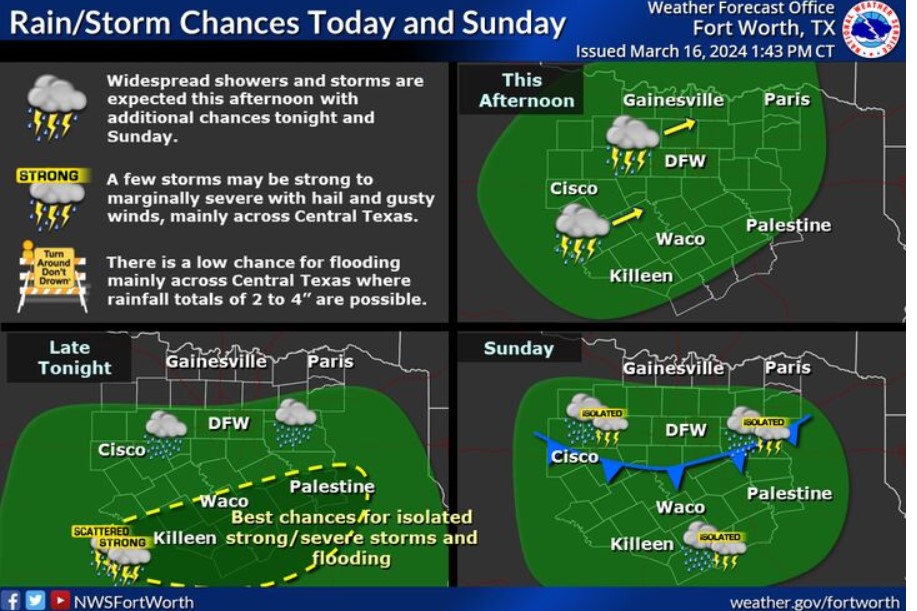
Additional thunderstorm chances will occur over the weekend and be associated with upper-level disturbances. Severe weather should mostly be confined well into Central Texas, the Texas Coast, and South Texas. There may still be intense storms with gusty winds and hail. A cold front arrives early Sunday, maintaining the near-season temperatures with brisk northerly winds of 10 to 20 mph. Highs will be in the 60s on both days, with a low Sunday morning in the 50s. In addition, patchy light fog is anticipated primarily across Central Texas on both days.
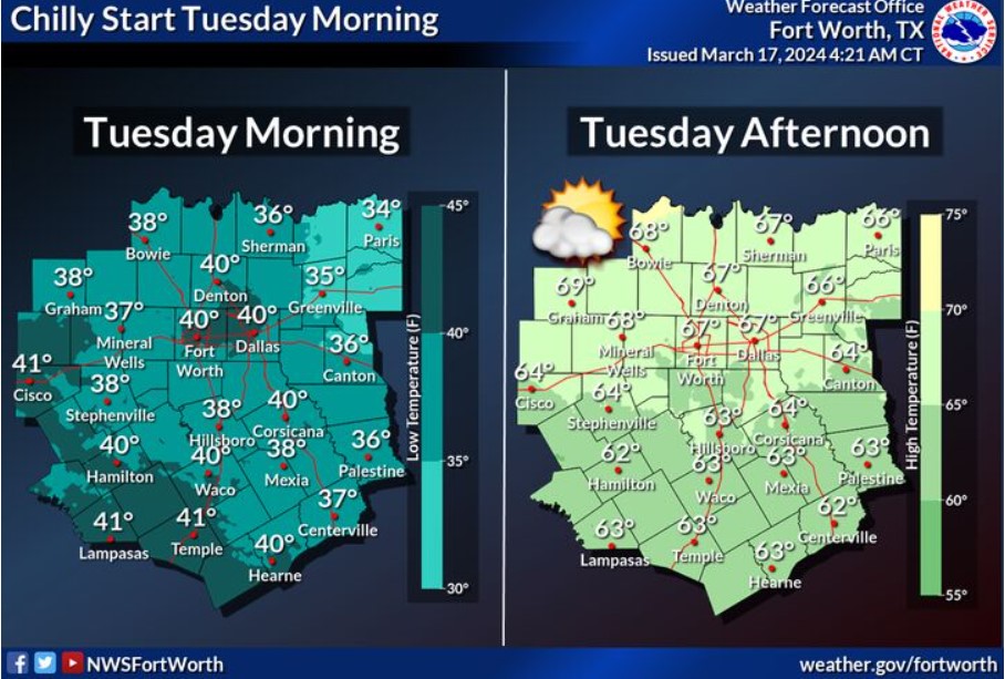
On Tuesday morning, expect the coolest temperatures of the week. Temperatures will range from the mid-30s in the northeast to the low 40s in the southwest. By the afternoon, temperatures should climb into the 60s areawide.
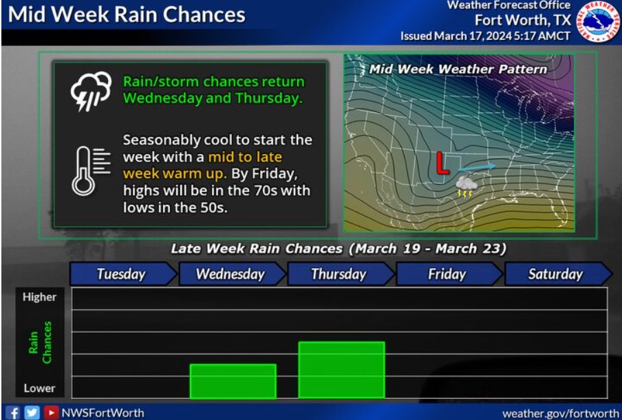
Seasonably cool temperatures will start next week, followed by a warm-up mid-to-late week. A chance of showers and storms will return Wednesday and continue into Thursday as the next system arrives.
Today and Tonight
Thunderstorms will continue moving across primarily Eastern Central Texas this morning, with a few intense storms expected, with hail and frequent lightning being the primary hazards. Locally heavy rain may also create brief, minor flooding issues. Do not expect flash flooding.
Monday through Saturday
Additional storm chances will arrive around Wednesday and Thursday. Intense storms appear possible, with hail and gusty downburst winds the primary threats.
SPOTTER INFORMATION STATEMENT
Do not expect spotter activation at this time. However, reports of
hail and wind are appreciated.
South Central and Southwest Arkansas, North Central and Northwest Louisiana, Southeast Oklahoma, and East and Northeast Texas
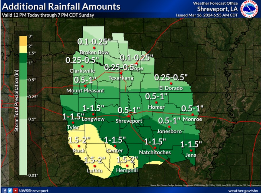
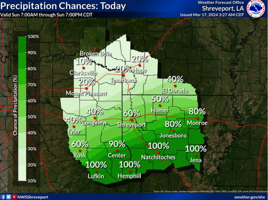
With showers and a few embedded thunderstorms increasing this afternoon and evening across the region, additional rainfall amounts of 1-2+ inches are expected generally along and south of the Interstate 20 corridor in East Texas and North Louisiana. Lighter rainfall amounts are expected farther north across extreme Northeast Texas, Southeast Oklahoma, and Southwest Arkansas.
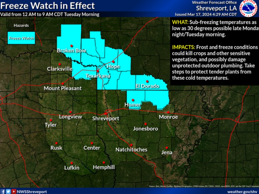
Sub-freezing temperatures will be possible overnight Monday into Tuesday across northern portions of the ArkLaTex, posing a potential threat to crops, vegetation, and exposed plumbing. A Freeze Watch will be effective from midnight to 9:00 am Tuesday.
Showers and thunderstorms will end from northwest to southeast this morning, clearing the area by early evening.
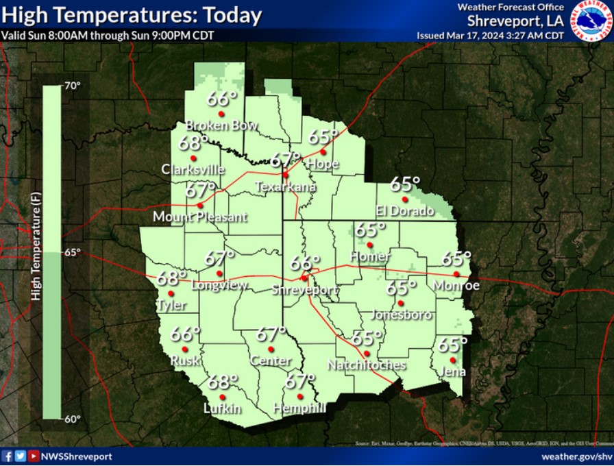
As the rain ends, high temperatures will generally be in the middle 60s under mostly cloudy skies this afternoon.
Today and tonight
Showers and a few embedded thunderstorms will spread east across much of East Texas and North Louisiana this morning before diminishing from west to east late this morning through the afternoon. Brief heavy rainfall will be possible in stronger storms, but do not expect any hazardous weather.
Monday through Saturday
Much cooler and drier conditions will return to the region Monday, with temperatures falling into the 30s Monday night. A mostly clear sky and light winds will result in good radiational cooling such that areas of frost will be possible Monday night and Tuesday morning. It would help if you took precautions to protect tender vegetation that these cold temperatures could harm. A warming trend will commence Tuesday and continue through Wednesday before showers and a few thunderstorms increase across the region Thursday ahead of an upper-level disturbance that will move through the area. However, the threat of severe thunderstorm development on Thursday is low. Warmer and drier conditions will return Friday through next weekend.
SPOTTER INFORMATION STATEMENT
Do not expect spotter activation at this time. However, reports of
hail and wind are appreciated.