


North and Central Texas
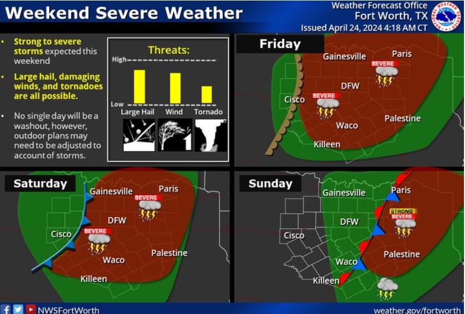 A weather pattern will persist into the weekend, with on-and-off storm chances each day. Some storms will be severe, with large hail, damaging winds, and a few tornadoes possible. You may need to adjust weekend plans accordingly, especially if they’ll be outdoors.
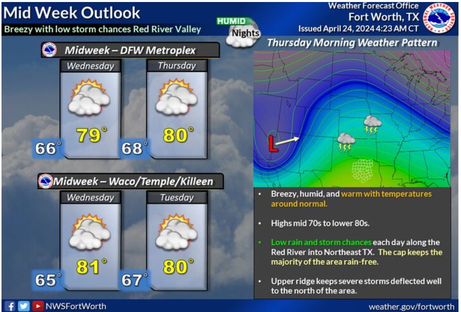 A warming trend is expected in the middle of this week, as an upper ridge over the area helps keep severe weather deflected well north and west of the region. Low rain chances will be possible from the Red River Valley into Northeast Texas. However, most areas will remain dry through Thursday, with mainly cloudy, breezy, humid, and warm conditions. Lows will be in the 60s, with highs from the mid-70s to the lower 80s. Expect more widespread chances across the region toward the end of the week.
Today and Tonight
A few storms will be possible along the Red River today. Do not expect severe weather. The main threat will be from lightning.
Thursday through Tuesday
Storm chances will continue through the rest of the week. At a minimum, expect frequent lightning from any storm. Severe weather chances will increase on Friday and continue through Sunday. All modes of severe weather will be possible.
SPOTTER INFORMATION STATEMENT
Do not expect spotter activation at this time.
South Central and Southwest Arkansas, North Central and Northwest Louisiana, Southeast Oklahoma, and East and Northeast Texas
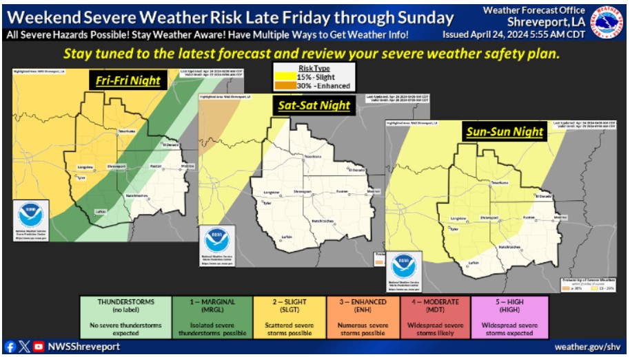 There is a risk for severe thunderstorms beginning Friday and continuing through the weekend. On Sunday, the severe risk expands to include nearly all of the region. Stay tuned to the latest forecast and review your severe weather safety plan as this potential comes into better focus over the next few days.
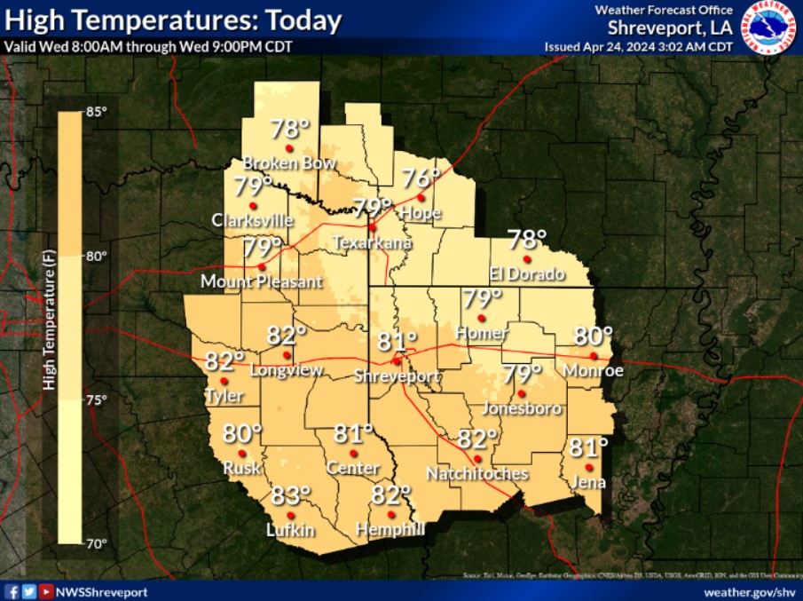 Despite abundant clouds and patchy fog to start the day, look for afternoon high temperatures from the mid and upper 70s to lower 80s with some breaks in the cloud cover by later today.
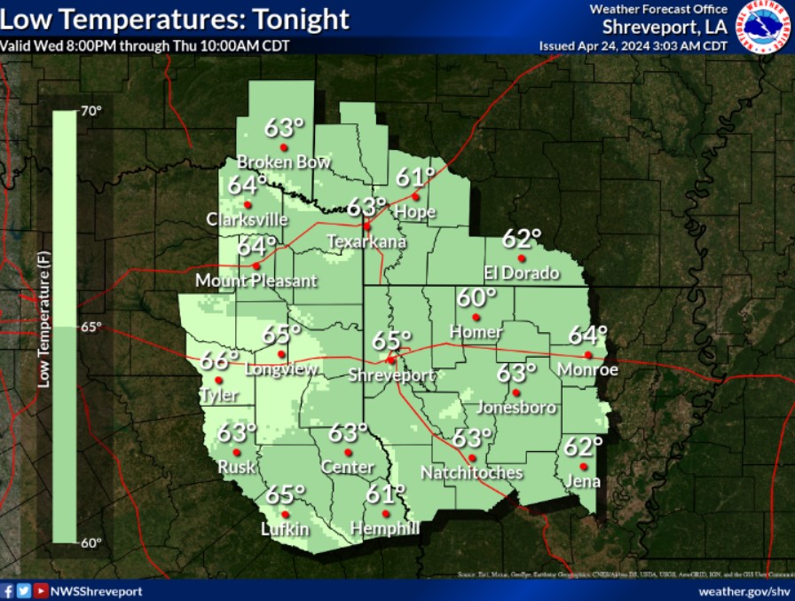 Expect overnight low temperatures from the lower to mid-60s with mostly cloudy to overcast skies and light winds.
Today and Tonight
A weak, cool front drifts toward our I-30 corridor and could help develop some isolated thunderstorms later this morning and until sunset down along I-20. The only real threat would be lightning. So if thunder roars, go indoors; season is upon us once again. Overnight should be quiet area-wide. Expect no other hazardous weather with this weak front.
Thursday through Tuesday
Severe thunderstorm activity will return to our Four-State area late Friday afternoon and evening. Some isolated activity may continue overnight and into early Saturday, with large hail the primary threat. This second push of the Westerlies will weaken as an upper-level ridge blocks from the eastern seaboard. Finally, a third frontal boundary late this weekend will be more decisive, boosting our chances for severe weather. More organized areas of thunderstorms with some severe activity will become likely Sunday afternoon, evening, and overnight into early next week.
Damaging winds will be possible with any bowing thunderstorm segments, along with some large hail. A brief and isolated tornado could occur if a squall line can advance into our area before the upper low lifts too far away early Monday. This third frontal boundary will also become stationary and wash out in place with scattered showers and thunderstorms continuing into midweek.
SPOTTER INFORMATION STATEMENT
Do not expect spotter activation until late Friday at the earliest and then for more widespread thunderstorms late Sunday and overnight.