


North and Central Texas
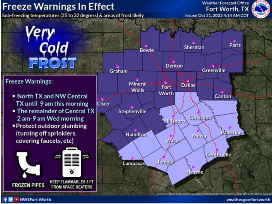
A Freeze Warning is in effect for North Texas and northwest parts of Central Texas through 9:00 am. The remainder of Central Texas is under a Freeze Warning early Wednesday morning. Protect any sensitive vegetation and outdoor plumbing, such as faucets and sprinkler systems, which could result in icy sidewalks and roads. In addition, make sure space heaters have adequate space for flammables. Lastly, make certain livestock and outdoor pets have shelter from the cold.
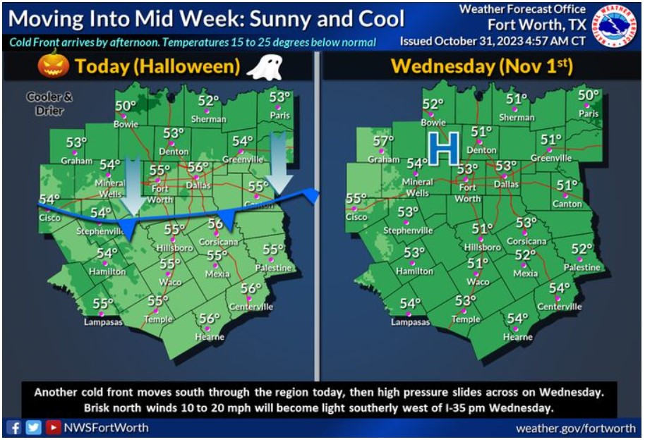
Sunny and breezy conditions are expected today after a chilly start in the 20s/30s and some frost early in the day. Northerly winds increase to 10 to 20 mph by afternoon after another cold front moves through. A high-pressure will slide east across the area Wednesday, with a North wind around ten mph becoming light and variable by midday. Southerly winds of 5 to 10 mph return to the Big Country Wednesday afternoon. It will remain very cool, with highs in the lower to mid-50s under sunny skies.
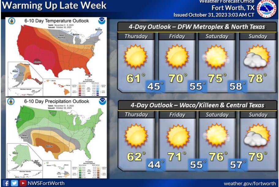
Cold weather will continue through midweek, with a warm-up expected late week through the weekend. Below-normal temperatures will finally return to normal on Friday, then increase to above-normal values this weekend through early next week. The latest 6 to 10-day outlook highlights the potential for above-normal temperatures and below-average precipitation for November 5-9.
With freezing temperatures and frost arriving several weeks before the average date in mid-November, here are some rules of thumb to remember to protect outdoor plumbing, livestock, pets, and others around you!
Tonight
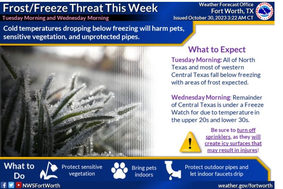
An early season freeze will occur tonight across North Texas and western Central Texas. Freezing temperatures and frost will damage sensitive crops and vegetation.
Tuesday through Sunday
Near to below-freezing temperatures are expected for all of North and Central Texas Wednesday morning. Freezing temperatures and frost will damage sensitive crops and vegetation. Although not the first of the
season, another freeze will occur across East Texas Thursday morning.
SPOTTER INFORMATION STATEMENT
Do not expect spotter activation at this time.
South Central and Southwest Arkansas, North Central and Northwest Louisiana, Southeast Oklahoma, and East and Northeast Texas
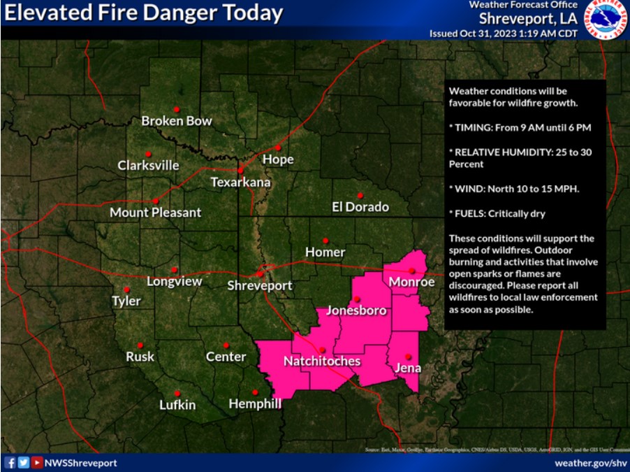
There is an elevated wildfire condition expected today across portions of North Louisiana.
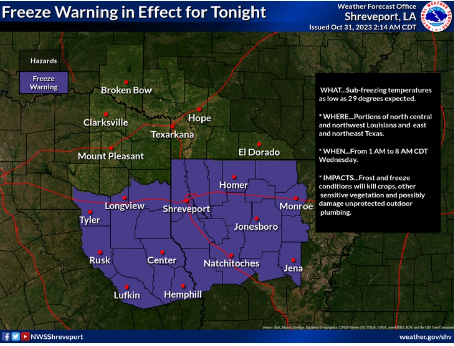
A Freeze Warning is now in effect for North Louisiana and East Texas for tonight. Temperatures will range from the mid-20s across Southeast Oklahoma to just below freezing across North Louisiana.
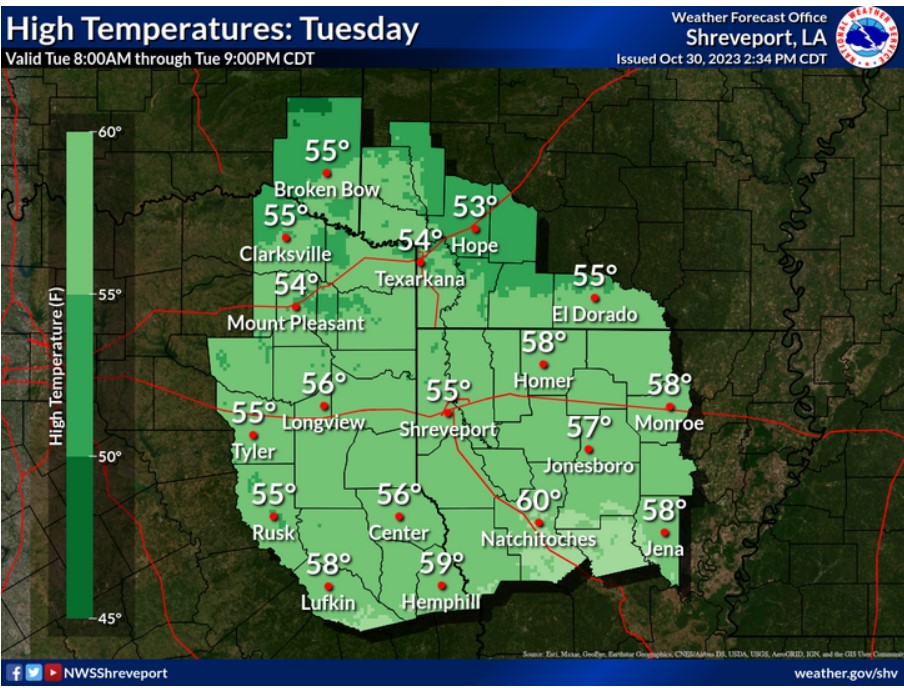
Dry and colder-than-normal conditions will remain in effect across the Four-State Region today, with temperature maximums only in the mid-to-upper 50s under sunny skies. Northerly winds will continue at ten mph.
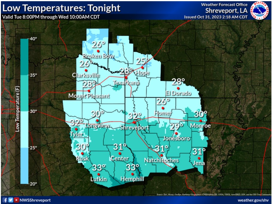
Freezing temperatures are forecast tonight nearly areawide.
Today and tonight
Please listen to NOAA Weather Radio or go to weather.gov online for more information about the following hazards.
Freeze Warning
Expect sub-freezing temperatures to climb above freezing by mid-morning. Temperatures will again fall below freezing into the mid to upper 20s overnight. It would be best to take precautions to protect sensitive vegetation, outdoor pets, and exposed pipes.
Wednesday through Monday
Expect cold temperatures in the upper 20s on Wednesday night into Thursday morning. Then expect a gradual warming trend on Thursday, with only a few locations possibly reaching freezing again on Thursday night into Friday morning.
SPOTTER INFORMATION STATEMENT
Do not expect spotter activation at this time.