


North and Central Texas
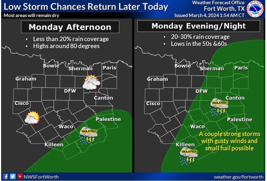
Chances for showers and thunderstorms will return to the area Monday afternoon through Monday night. The highest rain chances will be roughly along and east of I-35, and a few intense storms with gusty winds and small hail will be possible. Highs will be in the upper 70s to mid 80s with a south wind of 10 to 20 mph.

How much rain can you expect this week? Most of us will see rain, especially Wednesday night through Thursday night. Some areas will receive more than the indicated amounts, and some will receive less.
Today and Tonight
A chance for thunderstorms returns this afternoon, moving across Eastern Central Texas, then across Central Texas into Eastern North Texas tonight. A few intense storms are possible, producing hail and gusty winds.
Tuesday through Sunday
Thunderstorm chances return late Wednesday night and will continue intermittently through Friday. A few intense storms with gusty winds and hail will be possible Thursday afternoon into Thursday night. Locally heavy rainfall across the eastern half of the area is expected Thursday and Thursday night and may result in minor flooding.
SPOTTER INFORMATION STATEMENT
Do not expect spotter activation at this time.
South Central and Southwest Arkansas, North Central and Northwest Louisiana, Southeast Oklahoma, and East and Northeast Texas
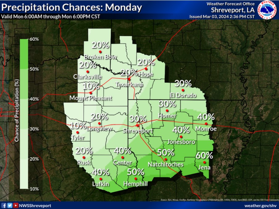
Showers and storms will return Tuesday morning, increasing into the afternoon hours. A few storms may be vital to severe, producing small hail and gusty winds.
Today and tonight
Some intense storms may be possible across the Four-State Region, with small hail and strong wind gusts being the main threats.
Tuesday through Sunday
Expect warmer and drier conditions, with periods of scattered showers and thunderstorms possible each day through much of the workweek.
SPOTTER INFORMATION STATEMENT
Do not expect spotter activation at this time.