


North and Central Texas
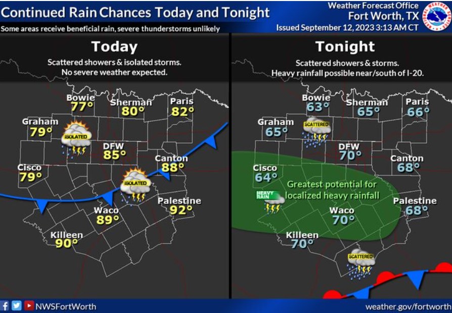
Rain chances will continue across the area today, although there will be a fair amount of dry time during the day. Highs will mostly be in the upper 70s and 80s, although a few locations in Central Texas will be able to reach 90. Higher rain chances will exist overnight into early Wednesday morning, with a threat for locally heavy rainfall near and south of the I-20 corridor.
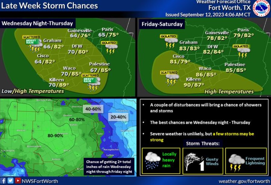
As additional upper-level disturbances move overhead, you can expect rain chances and below-normal temperatures mid to late week. The best rain chances now look to be Wednesday night through Thursday. Severe weather is unlikely, but a few storms may be substantial. Most will welcome rainfall and should lessen the severity of the ongoing drought. The bottom left portion of the graphic indicates the probability of receiving two or more inches of rain during the Wednesday night through Friday.
Today and Tonight
There is a chance of storms across much of the region today and tonight. The best opportunities are generally along and west of the I-35 corridor. Severe weather is unlikely, but a few storms may produce gusty winds and small hail.
Wednesday through Monday
Storm chances will continue through the rest of the week. You should not expect severe weather but don’t rule out a few intense storms with gusty winds. Heavy rain, especially on Thursday, may increase the threat of flooding in low-lying, flood-prone areas.
South Central and Southwest Arkansas, North Central and Northwest Louisiana, Southeast Oklahoma, and East and Northeast Texas

Scattered showers, possibly a thunderstorm or two, are possible today, mainly along and north of Interstate 30 as a cold front moves across the region.
Tuesday through Sunday
Below-normal temperatures are expected from Tuesday through Thursday in the wake of a passing cold front. We will see additional showers and thunderstorms across the region Tuesday through Friday. Do not expect severe weather at this time.