


North and Central Texas
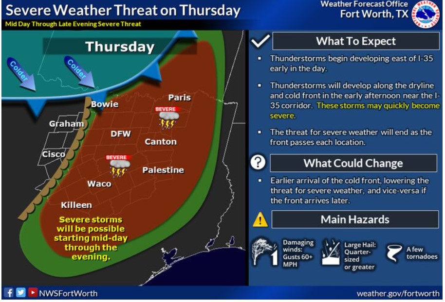
A storm system is expected to move through the Southern Plains on Thursday and will bring a threat of severe weather to North Texas. Showers and thunderstorms will begin developing east of I-35 early in the day. The severe threat will increase in the early afternoon near, and east of I-35 as thunderstorms develop along the dryline and cold front. The danger of severe weather will diminish as the front passes each location. However, large hail, damaging winds, and a few tornadoes will be possible.
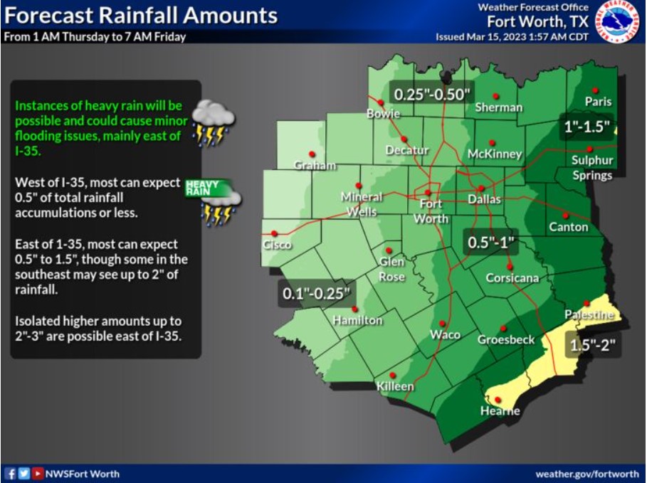
Here is how much total rain accumulations you can expect between Thursday and Friday. Areas west of I-35 can reasonably expect 0.5″ of rain or less, while east of I-35 can expect 0.5″ to 1.5.” Some in the southwest could see up to 2″ total. Isolated amounts of 2-3″ are possible east of I-35. Instances of heavy rain may lead to localized flooding issues.
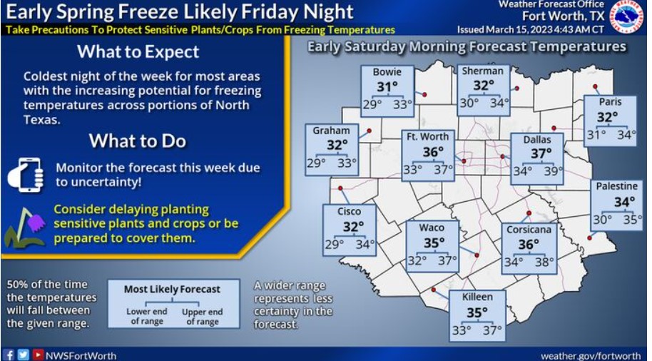
A period of below-normal temperatures is expected across much of the central U.S. later this week into next weekend. Freezing temperatures will be possible west and north of the Metroplex late Friday night into early Saturday morning. Keep updated with the latest forecast information, particularly if you’re concerned with outdoor planting. Sensitive plants and vegetation may need to be covered next weekend.
South Central and Southwest Arkansas, North Central and Northwest Louisiana, Southeast Oklahoma, and East and Northeast Texas
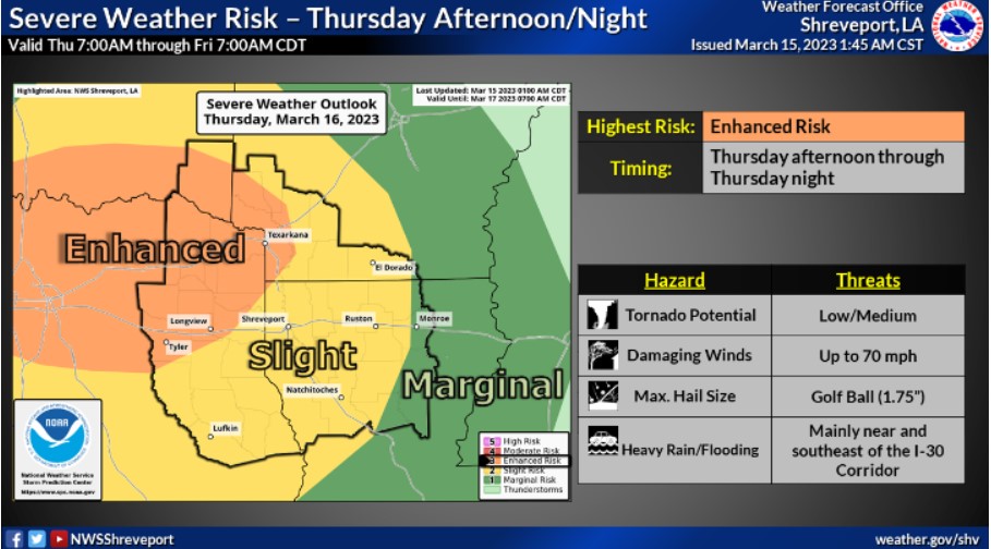
There will be a chance for severe thunderstorms late Thursday through Thursday Night across most of the Four State Region. Large hail, damaging wind gusts, and isolated tornadoes will be possible.
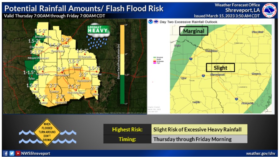
A flooding threat will occur across portions of the Four State Region Thursday through Thursday Night, especially across flood-prone and poor drainage areas. The heaviest rainfall should remain near and southeast of the Interstate 30 Corridor.