


North and Central Texas

All of North & Central Texas will experience hazardous cold early next week. Many areas may drop below 10 degrees Sunday night and Monday night. The National Weather Service’s medium-high confidence is more than 50% that areas along and north of I-20 stay below freezing all day Monday! Monitor the forecast this week and take precautions to protect the four “Ps:” People, Pets, Plants, and Pipes!
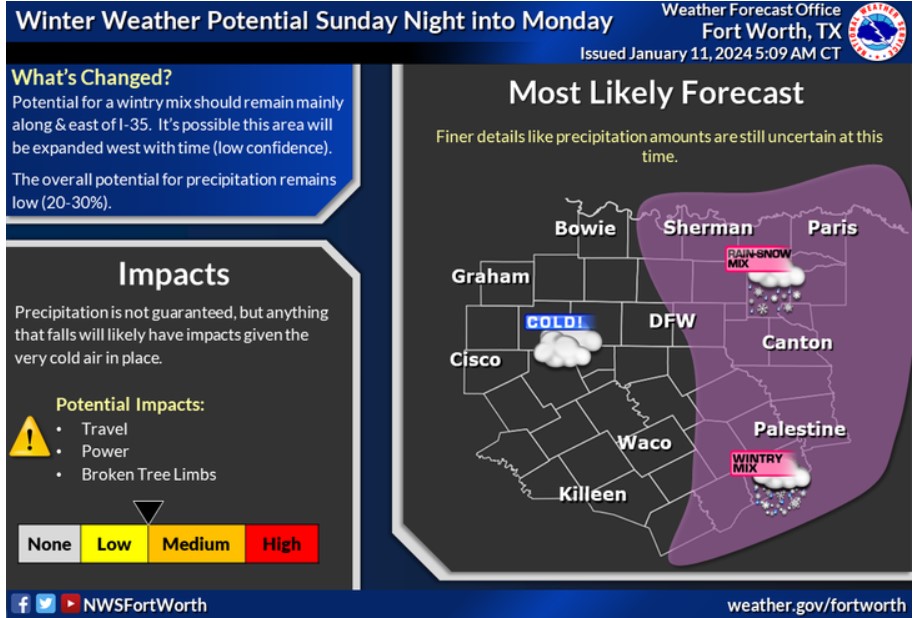
Expect frigid temperatures to arrive Sunday night. The National Weather Service is still watching our area’s potential for snow or ice. The forecast shows a low to medium chance for mainly snow, rain, and sleet roughly along and east of the I-35 corridor. Some minor impacts are possible if a wintry mix occurs, and these would be most likely across portions of Northeast and East Texas. Continue to monitor the forecast this week due to uncertainty!
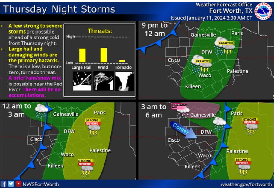
The first of two solid cold fronts will arrive Thursday night into Friday. A few strong to severe storms with hail and damaging winds are possible east of the I-35 corridor. There is a low, but non-zero, tornado threat for far eastern North and Central Texas. Most of the showers and storms will exit to the east by early Friday morning, but there will be a brief period in which a rain-snow mix may occur along the Red River. If this happens, there will be no accumulations.
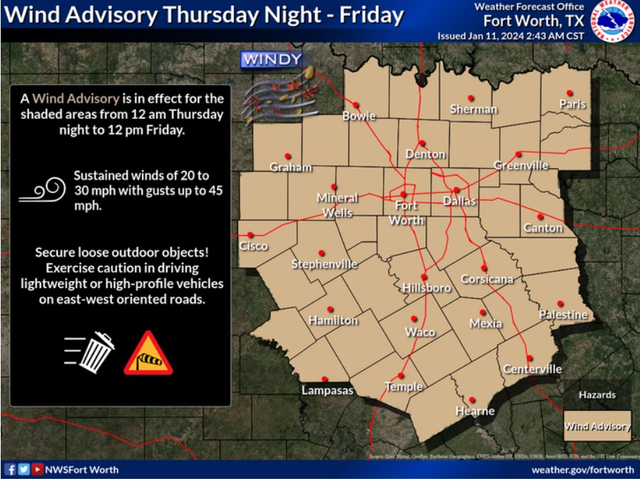
A Wind Advisory is in effect from midnight Thursday night through noon Friday. Expect Northwest winds near 20 to 30 mph and gusts up to 45 behind a strong cold front. Secure any loose outdoor objects, and exercise caution if driving lightweight or high-profile vehicles on east-west oriented roadways.
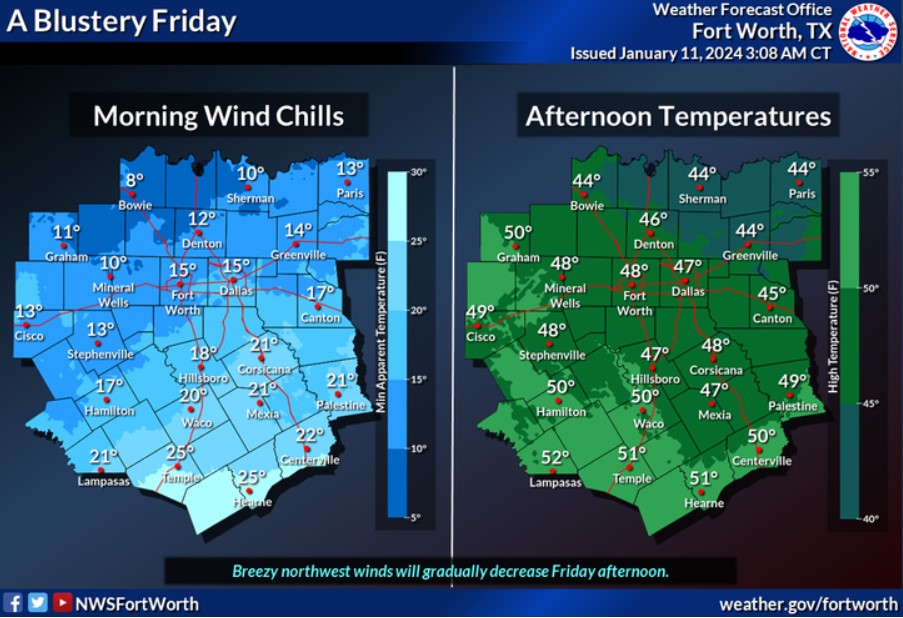
It will be much colder on Friday behind a strong cold front. Strong winds and freezing temperatures will result in wind chills in the teens to mid-20s Friday morning. A few spots along the Red River will see wind chills drop into the single digits. Breezy northwest winds will gradually decrease Friday afternoon, with high temperatures in the 40s to low 50s.
South Central and Southwest Arkansas, North Central and Northwest Louisiana, Southeast Oklahoma, and East and Northeast Texas

The chance of severe weather will return by Thursday evening into early Friday as the next central storm system aims at the region. Damaging winds, large hail, and tornadoes will all be possible.
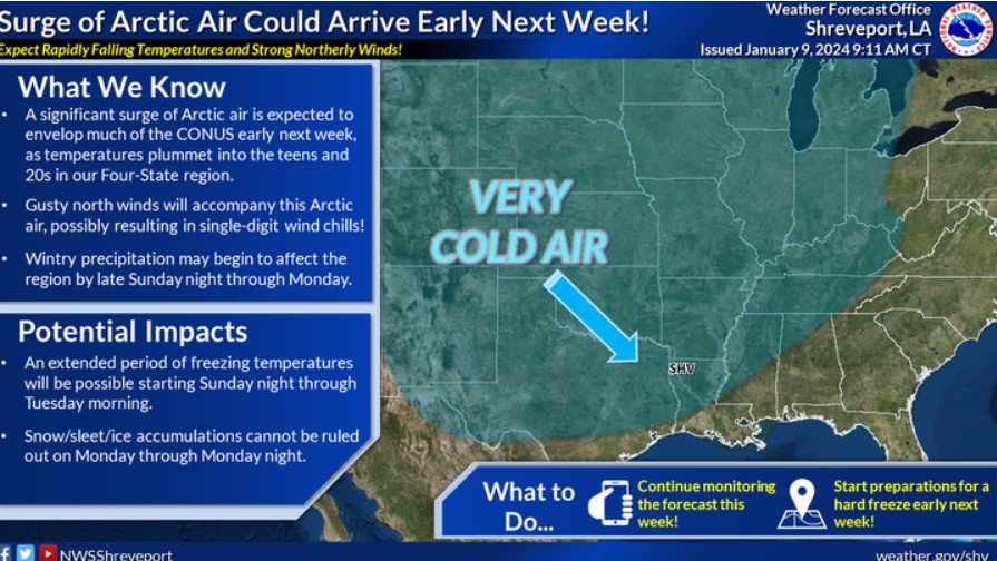
The likelihood of an Arctic air intrusion across much of the CONUS is increasing for early next week. It may result in an extended period of freezing temperatures across our region and some wintry precipitation starting late Sunday through Monday. More details will follow in the days ahead!

This afternoon, the upper 60s and near 70 degrees will be possible across the Four-State Region.
As a cold front moves through tonight, temperatures will be altered through the early morning hours, remaining with cool temps through the day.