


North and Central Texas
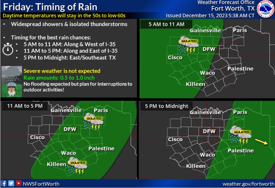
Widespread rain and isolated thunderstorms arrive in North and Central Texas early Friday through Friday night. Average rainfall totals will be near 0.5 to 1.5 inches. No flooding or severe weather is expected, but plan for interruptions to outdoor activities!
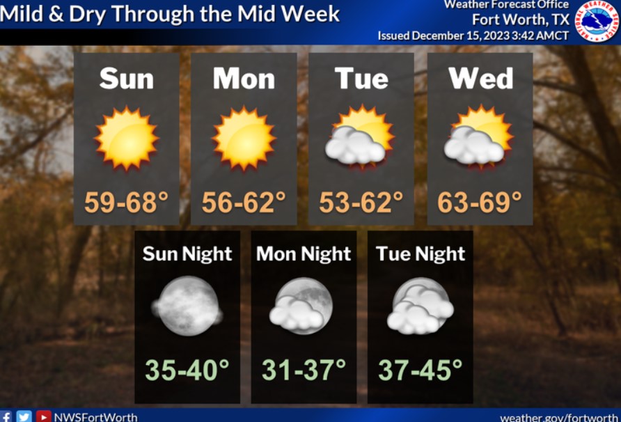
Dry and pleasant weather conditions will prevail through much of next week. Afternoon highs will be in the 50s and 60s, with overnight lows in the 30s and 40s. Expect no rain.

Are you dreaming of a White Christmas? Better ask Santa for something else this year! An unseasonably warm airmass will encompass much of the country leading up to Christmas Day. Sometimes, forecasts at this extended range need to be more accurate. Still, because there is no cold airmass forecast anywhere in the country, we have high confidence that no snow will occur around Christmas this year. Forecast highs and lows on Christmas Eve and Day should be in the mid-60s to mid-40s across North and Central Texas. However, because this is still 10-14 days away, there is uncertainty. With an 80% confidence, the highs will be anywhere from the mid-50s to low 70s, and lows will be in the mid-30s to mid-50s, which is above average.
Today and Tonight
Isolated to scattered thunderstorms are possible this morning through tonight, beginning out west and spreading east throughout the day. Lightning will be the primary hazard.
Saturday through Thursday
Expect no hazardous weather at this time.
SPOTTER INFORMATION STATEMENT
Do not expect spotter activation at this time.
South Central and Southwest Arkansas, North Central and Northwest Louisiana, Southeast Oklahoma, and East and Northeast Texas
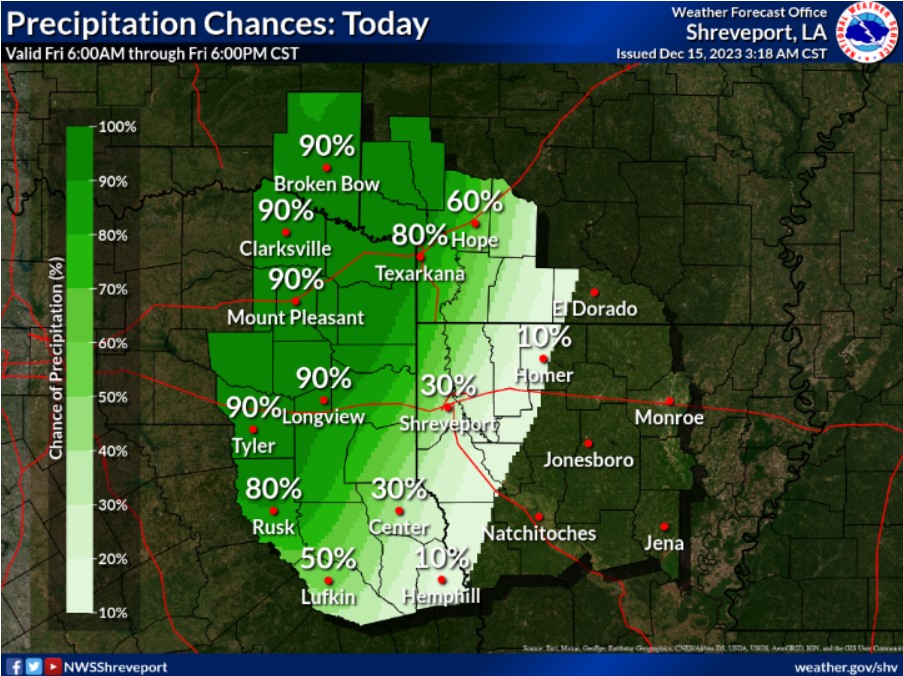
Clouds and rain arriving will keep the 50s along I-30, but a warmer range of 60s will extend down I-49. SE winds will also help to warm the air today. Rain showers and isolated thunderstorms will spread under an upper low and ahead of a weak cold front. With this Pacific system, we can expect rainfall totals of 1 to 2 inches.

Expect cooler low temperatures in the 40s for I-30 and a range of mid-40s to some lower 50s south of I-20 as rain continues overnight. The upper low will bring some needed rainfall overnight, improving conditions after daybreak.
Today and tonight
Increasing coverage of showers and possibly a few thunderstorms will begin this afternoon across our western areas and expand eastward through this evening and overnight as a cold front advances into the region. While there is no threat of severe weather, you can not rule out some embedded thunderstorms along with pockets of moderate to heavy rainfall. Rainfall amounts will generally average nearly an inch during this event, with isolated higher totals possible, but do not expect flooding impacts.
Saturday through Thursday
Showers and thunderstorms will gradually taper off from west to east during the day on Saturday as the cold front shifts east of the Four-State area by mid to late afternoon. Therefore, do not expect any hazardous weather at this time. Dry weather will return Sunday and prevail through much of next week.
SPOTTER INFORMATION STATEMENT
Do not expect spotter activation at this time.