


North and Central Texas
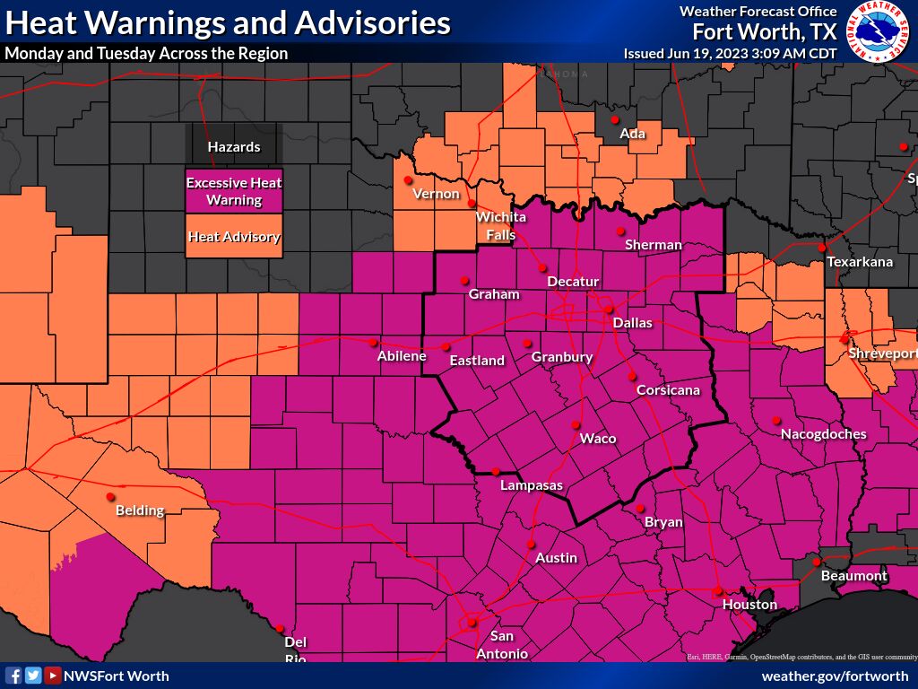 A Heat Advisory and Excessive Heat Warning remain in effect over the weekend. High temperatures will range from the 90s to the 100s, with heat indices anywhere from 105 to 115. Remember to stay hydrated, limit time outside during the hottest part of the day, and wear lightweight and light-colored clothing if outdoors.
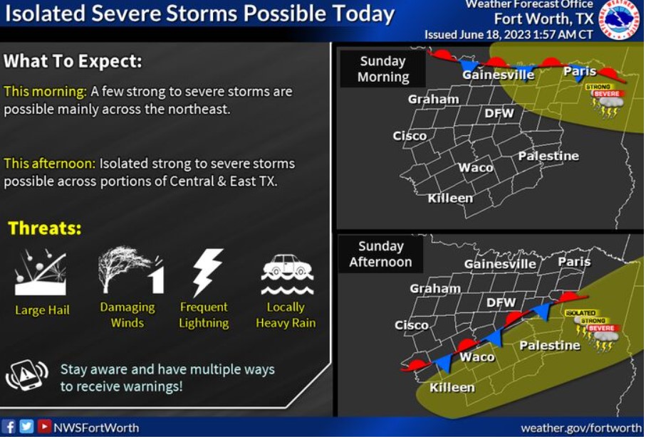
Isolated solid or severe storms are possible again today. This morning: areas across the North/Northeast will have the best potential. This afternoon: the storm’s chances shift to Central and East TX. The main threats would be large hail and damaging wind gusts.
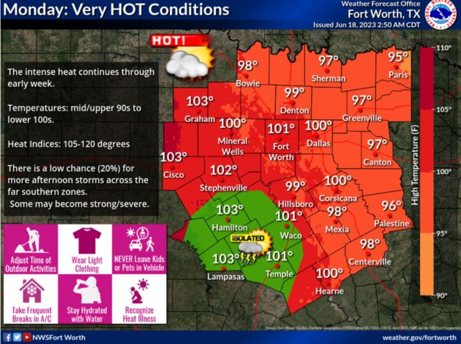
The intense heat continues through early this week. Heat-related illness is possible for those with strenuous outdoor activities or no A/C. Stay hydrated. There’s a low chance for isolated storms across the far south Central TX.
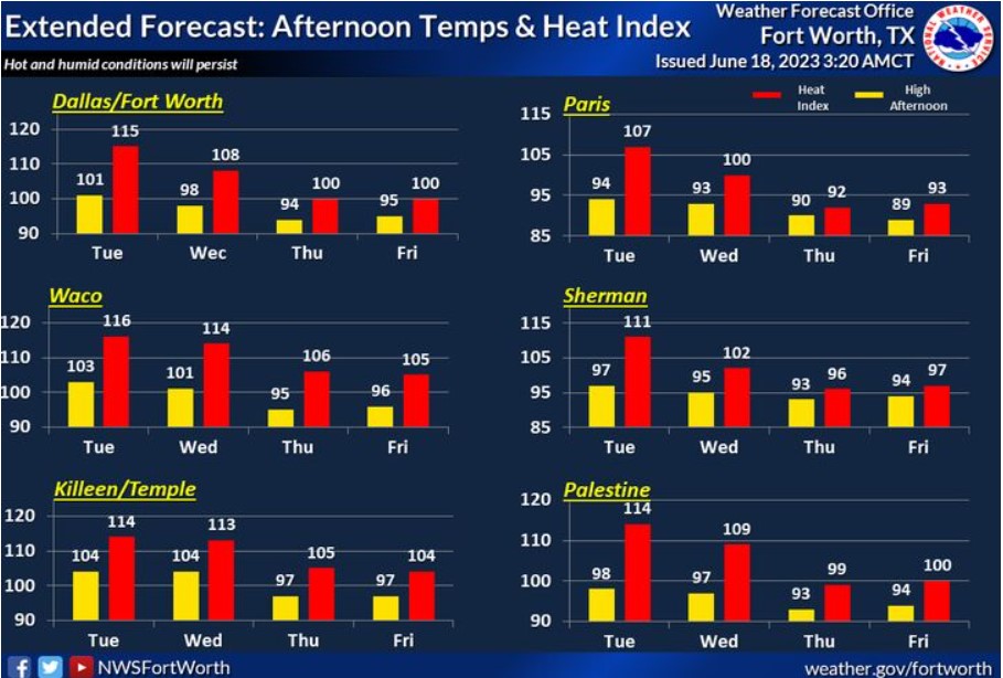
The heat continues through the first half of next week, with temperatures peaking in the 90s to lower 100s with even higher heat indices! Take all necessary precautions to avoid heat-related illnesses. Drink plenty of water, take frequent breaks in the A/C, and avoid spending time outdoors during the hottest part of the day!
Today and Tonight
Expect scattered thunderstorms along the Red River and Eastern North Texas early Sunday morning. Some of the storms may contain hail.
Isolated thunderstorms are possible this afternoon across East and Central Texas. Large hail and damaging winds will be the main threats.
Monday through Saturday
Isolated thunderstorms are possible Monday afternoon across Western Central Texas. Large hail and damaging winds will be the main threats if storms develop.
Oppressive heat and humidity will continue into early next week and increase the threat of heat-related illnesses if you do not take precautions. Make sure to drink plenty of water, wear light-colored clothing, and take frequent breaks if spending time outdoors.
SPOTTER INFORMATION STATEMENT
Do not expect spotter activation at this time.
South Central and Southwest Arkansas, North Central and Northwest Louisiana, Southeast Oklahoma, and East and Northeast Texas
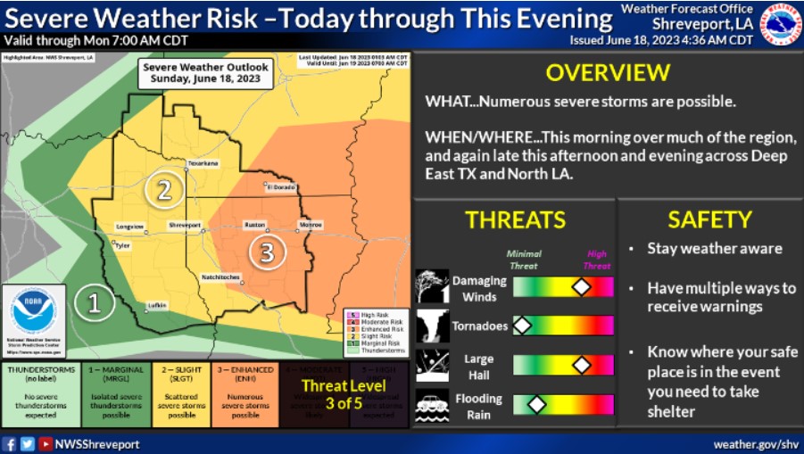
There is a risk for more severe thunderstorms over Northeast Texas, Southeast Oklahoma, Southwest Arkansas, and North Louisiana late this afternoon through this evening for portions of Deep East Texas and North Louisiana. Damaging winds and large hail will be the primary threats.
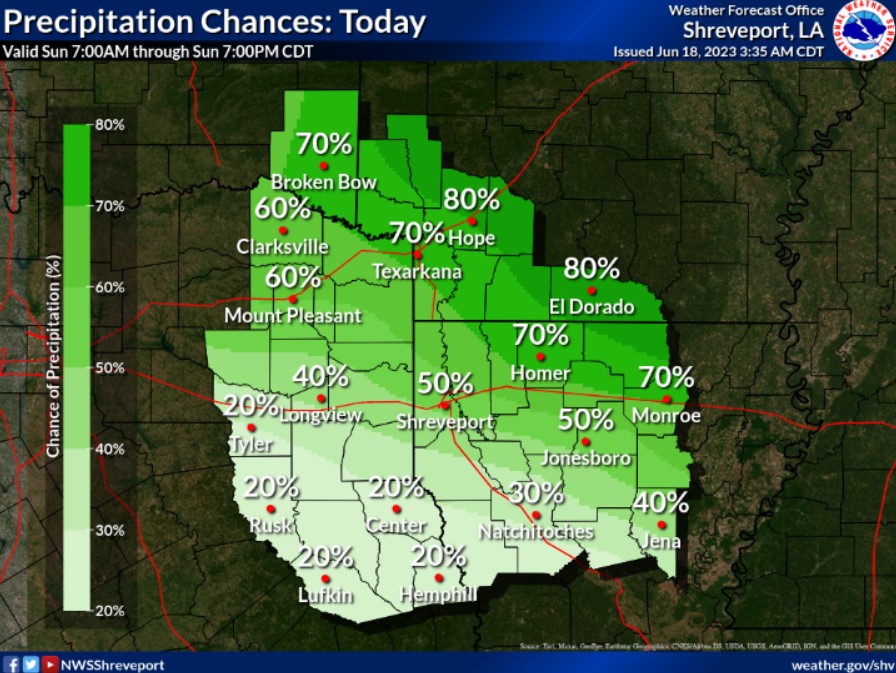
Scattered to numerous thunderstorms are expected to redevelop by the late afternoon across portions of Lower East Texas south of I-20 into North Louisiana.
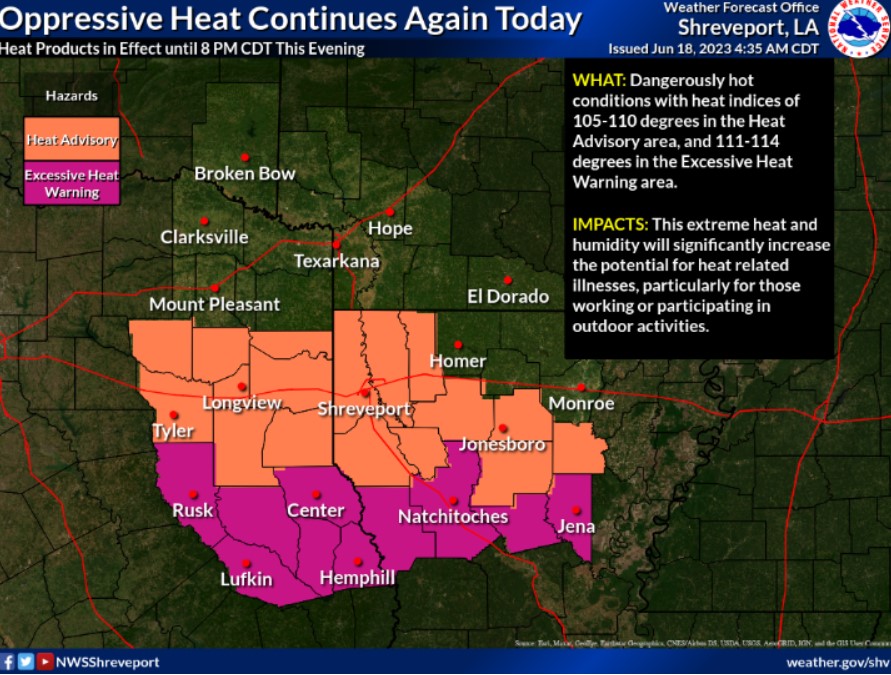
Temperatures this afternoon will again climb into the mid to upper 90s, and when combined with the high humidity, will result in heat indices ranging from 105-110 degrees across the Heat Advisory area and 111-114 degrees across the Excessive Heat Warning area. These heat products are in effect until 8 pm this evening.
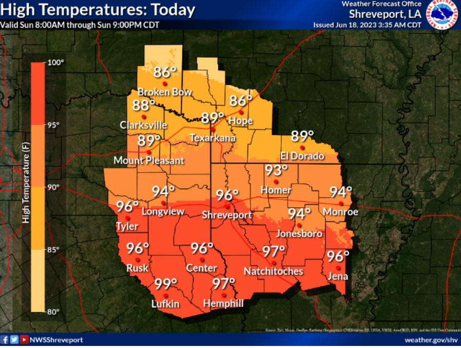
Another hot and humid day is expected today, with afternoon temperatures ranging from the mid to upper 80s across Northeast Texas, Southeast Oklahoma, and Southwest Arkansas to the middle and upper 90s across East Texas and North Louisiana.
Today and Tonight
Another round of strong to severe thunderstorms will be possible today and tonight, especially along and north of I-20. The primary threats will be damaging winds, large hail, and locally heavy rainfall.
Monday through Saturday
The last of the upper-level lows becomes stationary just to our East. Isolated coverage of mainly afternoon thunderstorms will linger over some of the regions. Afternoon high temperatures will climb into the mid to upper 90s and, when combined with the high humidity, will result in afternoon heat indices between 105 and 110 degrees across Deep East Texas and North Central Louisiana.
SPOTTER INFORMATION STATEMENT
Do not expect spotter activation at this time.