


North and Central Texas
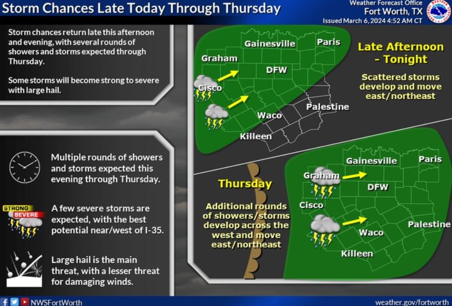
Weather returns late this afternoon as storms develop across the Big Country and move east/northeast this evening. Additional rounds of showers and thunderstorms will develop late tonight and throughout the day Thursday. A few strong to severe storms are expected throughout this period, with the best potential near and west of I-35. Hail will be the primary hazard, with damaging winds a lesser threat.
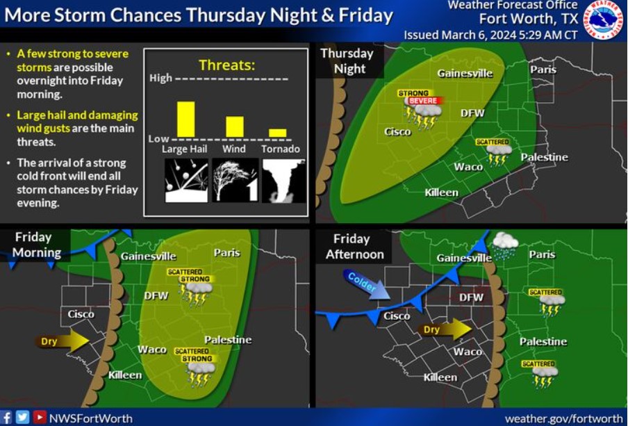
Additional storm chances are forecast Thursday night into Friday ahead of a dryline. Some storms could be intense or severe, primarily a hail threat, although isolated strong wind gusts are also possible. The arrival of a strong cold front on Friday afternoon and evening will bring all thunderstorm potential to an end.
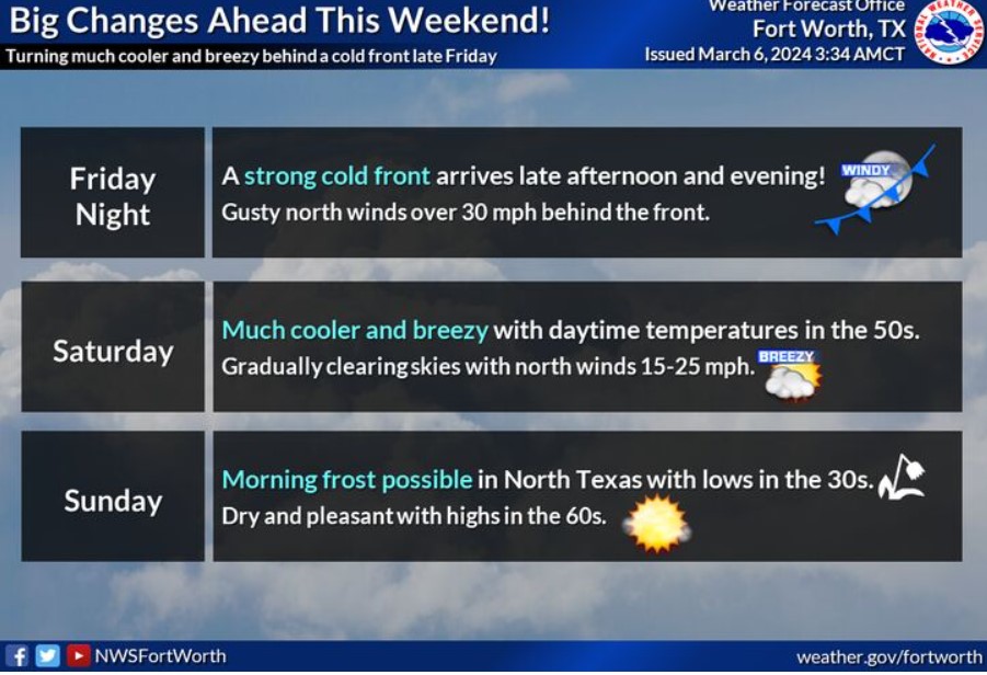
A strong cold front will arrive late Friday, bringing much cooler weather and breezy north winds to the region heading into Saturday. Expect lows in the 30s and 40s, with highs only reaching the 50s and lower 60s.
Today and Tonight
Expect thunderstorms to develop across the Western North and Central Texas late this afternoon, which will move eastward this evening. These storms will pose a threat for large hail while moving across North and Central Texas tonight.
Thursday through Tuesday
Scattered thunderstorms will continue off and on Thursday and Friday. During this time, a few intense or severe storms with primarily a hail threat
and a secondary damaging wind threat will be possible. Localized minor flooding is also possible. The arrival of a strong cold front will bring thunderstorm chances to an end by Friday evening.
SPOTTER INFORMATION STATEMENT
Do not expect spotter activation at this time.
South Central and Southwest Arkansas, North Central and Northwest Louisiana, Southeast Oklahoma, and East and Northeast Texas

We are monitoring the potential for strong to severe thunderstorms across portions of the area on Thursday. Primary concerns are damaging wind and hail. The tornado threat remains unclear at this time.

We are monitoring the potential for strong to severe thunderstorms across portions of the area on Friday. Stay tuned to the forecast for the latest updates.
Today and tonight.
This evening into the overnight hours, solid thunderstorms may develop along and in advance of a weak cold front moving toward the Middle Red River Valley of Northeast Texas, Southeast Oklahoma, Southwest Arkansas, and extreme Northwest Louisiana. If these storms develop, they could pose a hail and wind threat this evening into the overnight hours. Likewise, patchy fog may be near and south of the I-20 Corridor of Northeast Texas and Northern Louisiana this morning.
Thursday through Tuesday
Showers and thunderstorms will increase in coverage and intensity Thursday Night through Friday before ending from west to east across the region Friday Night. During the day Friday, severe thunderstorms will threaten much of the region with large hail, damaging thunderstorm wind gusts, and isolated tornadoes.
SPOTTER INFORMATION STATEMENT
Do not expect spotter activation at this time.