


North and Central Texas
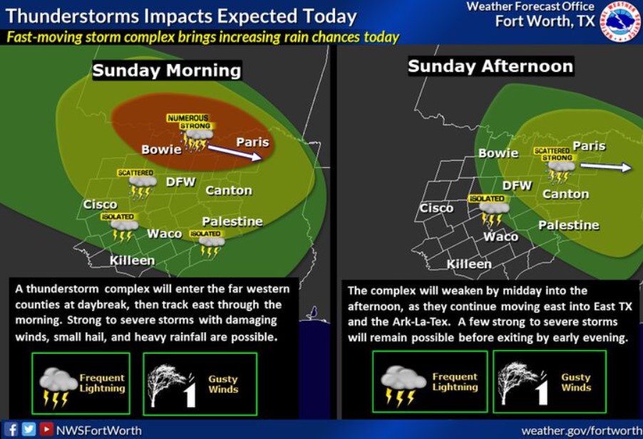
A storm complex will enter far western parts of North Texas around sunrise, then move progressively east through the morning hours and into eastern parts of North and Central Texas by early afternoon. This complex of storms may undergo both weakening, then re-intensifying phases as it produces an outflow boundary that interacts with a very warm, humid, and unstable atmosphere. This convective complex should remain primarily sub-severe with gusty outflow winds, frequent lightning, brief heavy rainfall, and possibly small hail. A severe storm or two with damaging winds over 60 mph is possible as the area remains under a Marginal Risk for severe weather throughout the day. Showers and storms will move east out of the forecast area late this afternoon. Better rain chances will be north of the I-20 corridor to the Red River Valley. At the same time, most of Central Texas sees a few isolated storms or, unfortunately, misses out completely on precipitation while remaining hot and humid.
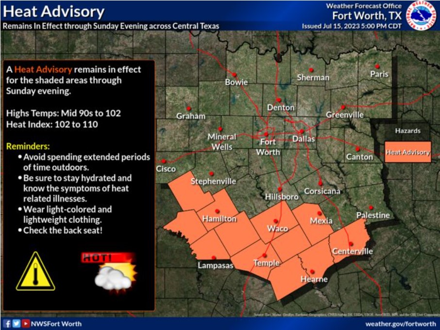
A Heat Advisory will remain in effect for much of Central Texas through 9:00 pm this evening. Within the advisory area, afternoon high temperatures will range from the mid-90s to 101 degrees, with heat indices up to 105 degrees at times. Remember to protect the young and elderly from the heat, give your pets plenty of water, and keep them off the hot pavement if taking them outside.
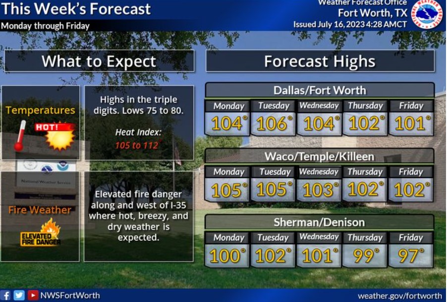
The summer heat will continue this week, with high temperatures in the triple digits across most of North and Central Texas. Heat index values will reach 105 to 110+ degrees each afternoon. The threat of wildfires will be elevated each day, particularly west of I-35, with rain chances remaining near zero.
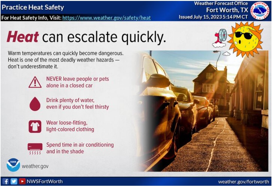
Keep your loved ones safe during the summer heat by practicing good heat safety routines. These include drinking plenty of water, wearing light-colored and loose-fitting clothing, spending time in an air-conditioned building and the shade, and never leaving people or pets in a closed car. You can find more about heat safety at https://www.weather.gov/safety/heat.
Today and Tonight
Expect a cluster of storms to move across North Texas today. Gusty winds and heavy rain will be the main threats to this activity.
Monday through Saturday
Hot and humid weather will continue through late next week with afternoon heat index values of 105 or higher each day.
The fire weather threat will remain elevated generally west of I-35 Monday through Thursday.
SPOTTER INFORMATION STATEMENT
Do not expect spotter activation.
South Central and Southwest Arkansas, North Central and Northwest Louisiana, Southeast Oklahoma, and East and Northeast Texas
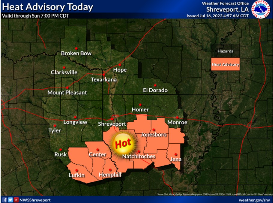
A Heat Advisory remains in effect today for parts of our area south of Interstate 20 across Deep East Texas into northern and central Louisiana. Heat index values will range from 105 to 109 degrees in these areas. Although our northern zones might not quite reach advisory thresholds, it will still be hot.
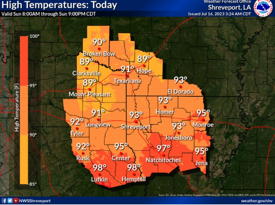
Expect high temperatures to range from nearly 90 degrees in far northern areas to the mid and upper 90s farther south as clouds increase today, along with showers and thunderstorms late this morning through the afternoon.
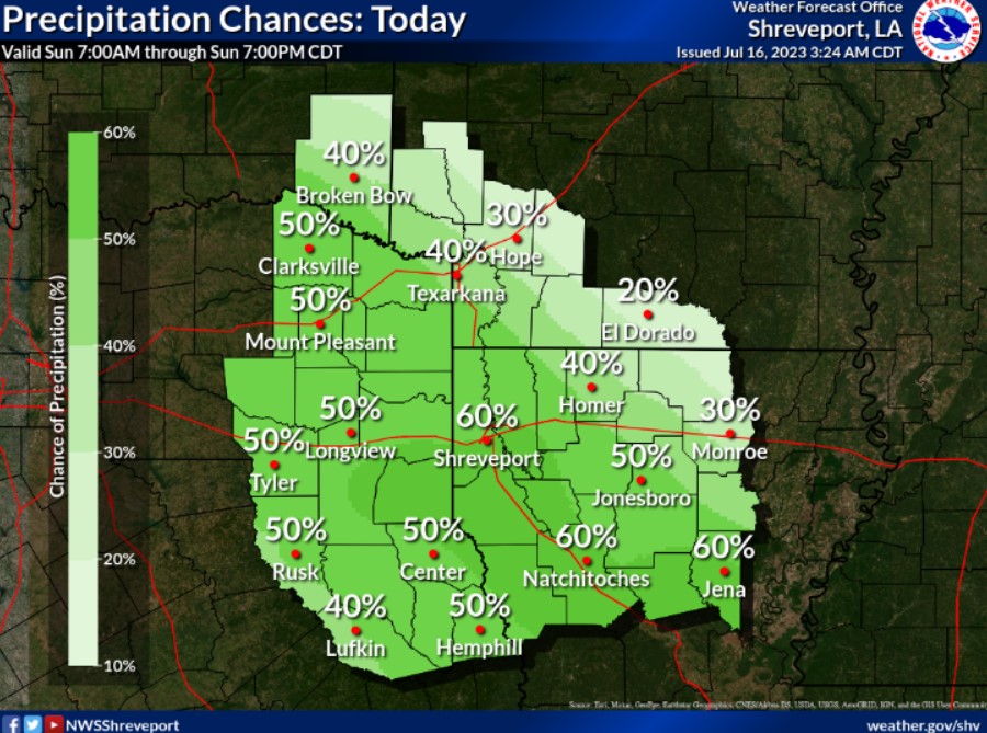
Showers and thunderstorms are expected to develop late this morning and increase through the afternoon as a disturbance shifts into the region and interacts with a weak frontal boundary.
Today and Tonight
While the Heat Advisory has been allowed to expire, the forecast has replaced the heat threat with a severe weather threat. A marginal risk is in effect for the entire region, with damaging winds being the primary severe weather threat. Locally heavy rainfall is also possible with these slower-moving storms.
Monday through Saturday
Upper-level ridging sets in by Monday, with extended heat headlines likely into next weekend. Most regions will reach at least Heat Advisory criteria, with Excessive Heat warnings possible. Thunderstorm chances will also return into next weekend as upper- level ridging begins to break down.
SPOTTER INFORMATION STATEMENT
Do not expect spotter activation.